Moel Siabod facts for kids
Quick facts for kids Moel Siabod |
|
|---|---|

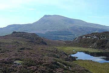
Moel Siabod from the Crimpiau
|
|
| Highest point | |
| Elevation | 872 m (2,861 ft) |
| Prominence | 600 m (2,000 ft) |
| Parent peak | Glyder Fawr |
| Listing | Hewitt, Marilyn, Nuttall |
| Naming | |
| English translation | shapely hill |
| Language of name | Welsh |
| Geography | |
| OS grid | SH705546 |
| Topo map | OS Landranger 115 |
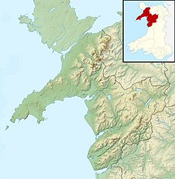
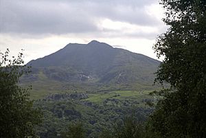
Moel Siabod is a cool mountain in Snowdonia, North Wales. It stands alone above the village of Dolwyddelan. At 872 meters (about 2,861 feet) tall, it is the highest peak in the Moelwynion mountain range.
The UK National Mountain Centre, Plas y Brenin, is right at the bottom of Moel Siabod. Imagine this: on a clear day from the top, you can supposedly see 13 of the 14 highest mountains in Wales without even turning your head!
The name Moel Siabod comes from the Welsh words. Some people thought it meant "shapely hill." But experts now think it might mean "bare hill" or even a "scarred mountain." This is because its head or top might have looked like it was covered in new snow, or perhaps it looked rough and rocky.
Contents
Getting to Moel Siabod
It's pretty easy to get to Moel Siabod from different directions. You can start your adventure from the north, near Capel Curig and Pont Cyfyng. Or, you can come from the south, starting from Dolwyddelan.
What the Mountain Looks Like
The very top of Moel Siabod has a long, rocky ridge that's about 800 meters (half a mile) long. This ridge runs from the summit towards the northeast.
The side of the mountain facing northwest is quite gentle. It has lots of different plants and many paths for walking. But the southeast side is much steeper! It drops down to a valley that sits about 500 meters (1,640 feet) above sea level. In this valley, you'll find a lake called Llyn-y-Foel. Its name means "lake of the mountain" in Welsh.
The Ground You'll Walk On
The main paths on Moel Siabod can be quite rocky. Sometimes, you might even need to use your hands to help you climb up the steeper parts!
Around Llyn-y-Foel, the ground can get very wet and muddy, especially on the north side. If you're walking to the lake from Pont Cyfyng, the path often turns into a small stream, so be ready for wet feet!
Paths to the Top
There are several ways to reach the top of Moel Siabod. Only one of these is shown on the regular Ordnance Survey maps. However, a special "Harvey SuperWalker" map for Snowdonia shows all the paths we'll talk about.
Starting from Dolwyddelan
A big part of this path goes through land managed by the Forestry Commission. You'll walk on dirt tracks through the forest. Look for a sign that points to "Moel Siabod" (turn left) or "Capel Curig" (turn right). The "Moel Siabod" path is a more direct way to the summit. This path follows a stream that comes from Llyn-y-Foel. Sometimes, you'll need to use your hands to get up the rocky parts!
Starting from Capel Curig
This is the most popular way to climb Moel Siabod. It starts from the Plas y Brenin National Mountaineering Centre in Capel Curig. This route is often used for guided trips because it's the easiest of the main paths. It's also the only one marked on the standard maps.
You'll cross an old bridge called "Pont-y-Bala." Then, you'll walk through forest land on dirt tracks and footpaths. Eventually, you'll come out onto open land and continue up the grassy northern side of the mountain.
Starting from Pont Cyfyng
In the village of Pont Cyfyng, look for a clear turning onto a very steep paved road. After about 100 meters (330 feet), a footpath leaves the road. This footpath splits into two. One path goes steeply up to the main ridge. The other path is gentler and goes through an old, abandoned slate mine. This path leads to Llyn-y-Foel, and from there, you can find several ways to the summit.
Paths from Llyn-y-foel to the Summit
Around Llyn-y-Foel, there are many small trails. The main way from the lake to the summit goes to the south of the lake. Then, it turns sharply right and climbs up a smaller ridge to the top. There's also a very steep path that goes directly up from the lake over rocks and loose stones to the ridge.
 | Janet Taylor Pickett |
 | Synthia Saint James |
 | Howardena Pindell |
 | Faith Ringgold |


