Mohave Valley, Arizona facts for kids
Quick facts for kids
Mohave Valley, Arizona
|
|
|---|---|
 |
|

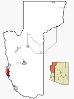
Location in Mohave County and the state of Arizona
|
|
| Country | United States |
| State | Arizona |
| County | Mohave |
| Area | |
| • Total | 14.04 sq mi (36.36 km2) |
| • Land | 14.02 sq mi (36.32 km2) |
| • Water | 0.02 sq mi (0.04 km2) |
| Elevation | 523 ft (159 m) |
| Population
(2020)
|
|
| • Total | 2,693 |
| • Density | 192.06/sq mi (74.15/km2) |
| Time zone | UTC-7 (MST) |
| ZIP codes |
86440, 86446
|
| Area code(s) | 928 |
| FIPS code | 04-47400 |
| GNIS feature ID | 1866989 |
Mohave Valley (also called Amat' 'Analy Uuhwely in the Mojave language) is a community in Mohave County, Arizona, United States. It is a special area the government counts people in, known as a census-designated place (CDP). In 2020, about 2,693 people lived here. Mohave Valley is close to other towns like Needles, California, Fort Mohave, and Bullhead City.
Contents
A Look Back in Time
The first European to visit Mohave Valley was Melchor Díaz in 1540. He wrote about meeting many native people. These people called themselves the Pipa Aha Macav, which means "People by the River".
The name "Mojave" (or "Mohave") comes from "Aha Macav". Both spellings are correct and sound the same. Mohave Valley uses the modern English spelling. However, the native tribe still uses the traditional Spanish spelling, "Mojave".
Where is Mohave Valley?
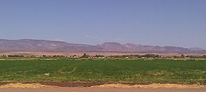
Mohave Valley is located in the western part of Mohave County. It sits in a valley that shares its name. The Colorado River flows through this valley.
The community is on the east side of Arizona State Route 95. This road goes north about 3 miles (5 km) to Fort Mohave. It continues 16 miles (26 km) north to Bullhead City. If you go south about 6 miles (10 km), you will reach Needles, California, across the Colorado River.
Mohave Valley is next to other communities. To the south is Arizona Village. To the west is Willow Valley. To the north, you'll find Mohave Ranch Estates.
The United States Census Bureau says that Mohave Valley covers about 14.0 square miles (36.3 square kilometers). Only a tiny part of this area, about 0.02 square miles (0.05 square kilometers), is water.
Who Lives Here?
|
||||||||||||||||||||||||
In the year 2000, there were 13,694 people living in Mohave Valley. There were 5,217 homes, with 3,850 of them being families. The population density was about 303 people per square mile (117 people per square kilometer).
About 29.6% of homes had children under 18 living there. Many homes, 59.4%, were married couples living together. About 19.0% of all homes were single people living alone. About 8.1% of these single people were 65 years old or older. The average family had about 2.94 people.
The people living in Mohave Valley were of different ages. About 24.6% were under 18 years old. About 27.4% were between 45 and 64 years old. And 16.5% were 65 years or older. The average age was 41 years.
Farming in the Valley
Farming is a big part of Mohave Valley's economy. The main crops grown here are cotton and alfalfa. These crops help support the local community.
Learning and Schools
Students in Mohave Valley attend schools in two main districts. There is the Mohave Valley Elementary School District for younger students. Older students go to the Colorado River Union High School District.
High school students usually attend River Valley High School. They also have other choices. They can go to the Academy of Building Industries Public Charter High School in Fort Mohave. Another option is the Aha Macav High School, which is on the Fort Mojave Indian Reservation.
See also
 In Spanish: Mohave Valley para niños
 | Laphonza Butler |
 | Daisy Bates |
 | Elizabeth Piper Ensley |


