Mono Hot Springs facts for kids
Quick facts for kids Mono Hot Springs |
|
|---|---|
 |
|
| Coordinates | 37°19′36″N 119°01′03″W / 37.32667°N 119.01750°W |
| Elevation | 6,562 feet (2,000 m) |
| Temperature | 112 °F (44.4 °C) |
Mono Hot Springs is a popular summer spot in Fresno County, central California. It's a place where you can find a resort and a campground, all built around amazing hot springs! You'll find it deep inside the Sierra National Forest, about 70 miles (113 km) northeast of Fresno. You get there by taking California State Route 168. It used to be called Lower Hot Springs or Lower Mineral Hot Springs.
Contents
History of Mono Hot Springs
The Mono Hot Springs area got its own post office in 1945. The Mono Hot Springs Resort is a rustic place with a general store and stone cabins. This resort was built in 1935. This was just a few years after Southern California Edison finished building the Kaiser Pass Road. They built this road for a big power project called the Big Creek Hydroelectric Project.
Geography and Location
Mono Hot Springs sits high up in the central Sierra Nevada mountains. Its elevation is about 6,562 feet (2,000 meters) above sea level. There are six different hot springs here. The warmest one reaches about 112°F (44°C).
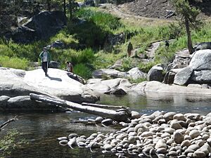
The public hot springs are on a hillside. They are across the South Fork of the San Joaquin River. You can find them opposite the campground and resort.
Getting to Mono Hot Springs
This area is located between two large reservoirs: Florence Lake and Lake Thomas A Edison. These lakes are part of the Big Creek Hydroelectric Project. You can reach Mono Hot Springs by driving on the Kaiser Pass Road. This road is managed by the forest service. It's about 17 miles (27 km) northeast from where it starts at Huntington Lake. The road goes over Kaiser Pass, which is 9,184 feet (2,800 meters high). After the pass, you will reach the hot springs and reservoirs.
Fun Activities at Mono Hot Springs
The Sierra National Forest has a campground right next to the springs and resort. It's called the Mono Hot Springs Campground and it's right on the river. There's also the Mono Creek Campground nearby to the north. This one is in a meadow along Mono Creek. Other campgrounds in the area include Ward Lake and Jackass Meadow Campgrounds.
Mono Hot Springs is a great starting point for many hiking trails. You can hike to local mountains or a volcanic plug. There are also many lakes to explore. From here, you can also reach the Ansel Adams Wilderness area to the north. The John Muir Wilderness area is to the east.
Nature Around Mono Hot Springs
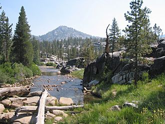
The landscape here is mostly made of large, rounded rock formations. These are huge Sierra granite rocks. They rise up above the plants and the river.
Plants of Mono Hot Springs
A special plant called the Mono Hot Springs Evening-primrose lives here. Its scientific name is Camissonia sierrae subsp. alticola. This plant is endemic, meaning it only grows in this area. It is also found in a few spots in Yosemite National Park. This plant is listed as rare or endangered. This listing is by the California Native Plant Society in their Inventory of Rare and Endangered Plants of California.
The main trees you'll see in the forest around here are Sierra lodgepole pines (Pinus contorta) and Ponderosa pines (Pinus ponderosa).
 | Janet Taylor Pickett |
 | Synthia Saint James |
 | Howardena Pindell |
 | Faith Ringgold |


