Central California facts for kids
Quick facts for kids
Central California
|
|
|---|---|
|
Region of California
|
|
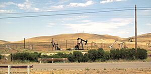
San Joaquin Valley, California
|
|
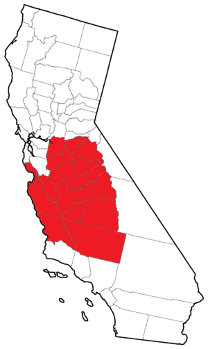
Map of counties that overlap Central California
|
|
| Country | United States |
| State | California |
| Region | Central California |
| Highest elevation | 14,505 ft (4,421 m) |
| Lowest elevation | -13 ft (−4.0 m) |
| Time zone | Pacific Standard Time |
| • Summer (DST) | Pacific Daylight Time |
| Area code(s) | 209, 559, 661, 805, 831 |
Central California is the middle part of the state of California in the United States. It's located between Southern California (where cities like Los Angeles are) and Northern California (home to San Francisco).
This region includes the northern part of the San Joaquin Valley. It also features parts of the Central Coast. You'll find hills from the California Coast Ranges and mountains from the central Sierra Nevada. Central California is west of the main Sierra Nevada mountains. East of these mountains is a different area called Eastern California.
Some of the biggest cities here are Fresno, Bakersfield, and Stockton. Other important cities include Modesto, Salinas, and Visalia. Over time, this area has faced more droughts and wildfires. This makes it harder to get enough water for everyone.
Exploring Central California's Geography
Central California can be defined in different ways. Some people divide the state into northern, central, and southern parts using imaginary lines. Others use county borders or river areas. Some definitions include more of the San Joaquin Valley and the larger Central Valley. Others might include less of the Central Coast.
Counties in Central California
Central California generally includes all or part of these 15 counties:
- Fresno
- Kings
- Madera
- Mariposa
- Merced
- Monterey
- San Benito
- Stanislaus
- Tulare
- Tuolumne
- Calaveras
- Kern
- San Joaquin
- San Luis Obispo
- Santa Cruz
Major Cities and Towns
Here are some of the main cities and towns in Central California. Many of these are important regional centers or county seats:
- Bakersfield
- Delano
- Fresno
- Hanford
- Hollister
- Lemoore
- Lodi
- Lompoc
- Madera
- Mariposa
- Merced
- Modesto
- Monterey
- Pismo Beach
- Paso Robles
- Porterville
- Salinas
- San Luis Obispo
- Santa Cruz
- Santa Maria
- Selma
- Sonora
- Stockton
- Riverbank
- Tulare
- Turlock
- Visalia
- Watsonville
Special Areas and Parks
Central California is home to many unique natural areas and parks. Some are fully within the region, while others are partly here.
Regions Fully in Central California
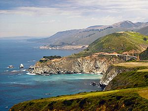
- Big Sur: A beautiful stretch of rugged coastline.
- Kings Canyon National Park: Known for its giant trees and deep canyons.
- Metropolitan Fresno: The urban area around Fresno.
- Monterey Bay: A large bay on the Pacific coast.
- Pinnacles National Park: Famous for its unique rock formations.
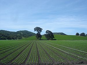
- Salinas Valley: A very important agricultural area.
- San Joaquin Valley: A large, fertile valley.
- Sequoia National Park: Home to the world's largest trees.
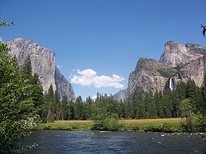
- Yosemite National Park: A famous park with waterfalls and granite cliffs.
Regions Partially in Central California
- California Coast Ranges: Mountain ranges along the coast.
- Central Coast: The coastal area of central California.
- Diablo Range: A mountain range in the Coast Ranges.
- Gold Country: An area known for the California Gold Rush.
- Santa Barbara County: A county partly extending into Central California.
- Santa Cruz County: A county on the coast.
- Sierra Nevada Mountains: A major mountain range.
- Tehachapi Mountains: A mountain range in Southern California that extends into Central California.
Learning and Education
Central California has many schools and universities. Two new universities have opened here in recent decades.
Universities and Colleges
- The University of California system has one campus in the region. University of California, Merced opened in 2005.
- The California State University system has four campuses:
- California State University, Monterey Bay opened in 1994.
- California State University, Stanislaus in Turlock opened in 1957.
- California State University, Fresno opened in 1911.
- The Monterey Institute of International Studies is a graduate school. It offers master's degrees in international policy, management, and languages. It is part of Middlebury College.
- San Joaquin College of Law is a private law school in Clovis.
- Fresno Pacific University is a private university in Fresno.
- The Naval Postgraduate School and Defense Language Institute are located in Monterey. These are special schools for military and government.
Community Colleges
Many community colleges offer two-year programs. Here are some in the region:
- Columbia College in Sonora
- Clovis Community College in Clovis
- Fresno City College in Fresno
- Hartnell College in Salinas
- Merced College in Merced
- Modesto Junior College in Modesto
- Monterey Peninsula College in Monterey
- Porterville College in Porterville
- Reedley College in Fresno
- College of the Sequoias in Visalia
- West Hills College Coalinga in Coalinga
- West Hills College Lemoore in Lemoore
- Madera Community College in Madera
- Oakhurst Community College Center in Oakhurst
Getting Around: Transport
Central California has a good network of roads, railways, and airports.
Main Highways
Most major highways here run north-south. They go around the mountains.
- Interstate 5 and State Route 99 are the main highways in the San Joaquin Valley.
- US 101 and State Route 1 are the main roads along the coast.
Here are some important highways in the region:
 State Route 1: Travels along the Central Coast, through Monterey and Big Sur.
 Interstate 5: Runs through the San Joaquin Valley.
 State Route 25: Connects Hollister and the Diablo Range, near Pinnacles National Park.
 State Route 33: Another route in the San Joaquin Valley.
 State Route 41: Goes through the San Joaquin Valley, Fresno, and towards Yosemite National Park.
 State Route 43: Found in the San Joaquin Valley.
 State Route 49: Runs through the historic Gold Country.
 State Route 63: In the San Joaquin Valley, passing Visalia.
 State Route 65: Another highway in the San Joaquin Valley.
 State Route 68: Connects Monterey and Salinas.
 State Route 99: A major highway in the San Joaquin Valley, passing Merced, Madera, Fresno, and Bakersfield.
 U.S. Route 101: Goes through the Salinas Valley and Salinas.
 State Route 108: From the San Joaquin Valley, through Modesto and Gold Country, to the Sierra Nevada.
 State Route 120: Connects the San Joaquin Valley, Gold Country, Sierra Nevada, and Yosemite National Park.
 State Route 132: In the San Joaquin Valley, through Modesto and Gold Country.
 State Route 137: Located in the San Joaquin Valley.
 State Route 140: From the San Joaquin Valley, through Merced, towards Yosemite National Park.
 State Route 145: In the San Joaquin Valley, near Madera.
 State Route 146: Leads to Pinnacles National Park.
 State Route 152: Another route in the San Joaquin Valley.
 State Route 156: In the Salinas Valley, connecting Salinas and Hollister.
 State Route 168: From Fresno towards the Sierra Nevada.
 State Route 180: In the San Joaquin Valley, through Fresno, and to Kings Canyon National Park.
 State Route 190: Connects the San Joaquin Valley and the Sierra Nevada.
 State Route 198: Goes through the Diablo Range, San Joaquin Valley, Hanford, Visalia, and to Sequoia National Park.
 State Route 201: Located in the San Joaquin Valley.
 State Route 233: Serves the area around Chowchilla.
 State Route 245: In the San Joaquin Valley, leading to Kings Canyon National Park.
Train Travel
You can travel by train in Central California.
- The Coast Starlight is a long-distance Amtrak train.
- The San Joaquins is a regional Amtrak route.
A new California High-Speed Rail system is being built. It will connect Merced and Bakersfield. Future plans include extending it to San Francisco and Los Angeles.
For moving goods, Union Pacific Railroad and BNSF Railway operate freight trains through the Central Valley.
Air Travel
Major and regional flights are available at:
- Fresno Yosemite International Airport
- Monterey Regional Airport
You can also find regional flights at Merced Regional Airport.
Many smaller airports are used for general aviation (private planes). Some used to be military bases:
- Castle Airport in Merced County
- Marina Municipal Airport in Monterey County
- Porterville Municipal Airport in Tulare County
- Salinas Municipal Airport in Monterey County
- Visalia Municipal Airport in Tulare County
There are also active military air bases. These include Naval Air Station Lemoore in Kings County and Fresno Air National Guard Base in Fresno County.
 | DeHart Hubbard |
 | Wilma Rudolph |
 | Jesse Owens |
 | Jackie Joyner-Kersee |
 | Major Taylor |


