
Moravian Indian Grants facts for kids

The Moravian Indian Grants were three special areas of land in Tuscarawas County, Ohio. The United States government gave these lands in the 1700s to a group of Christian Native Americans. Later, in the 1800s, these Native Americans moved west. The government then sold the land to other people.
Contents
Early Settlements in Ohio
In 1772, missionaries from the Moravian Church started new communities. These communities were in the Tuscarawas River valley, which is now Tuscarawas County, Ohio. They were for Christian converts from the Delaware and Mohican Native American peoples.
Three Moravian Villages
The first village, Schoenbrunn, was founded in May 1772. Gnadenhutten followed in October of the same year. Salem was established a bit later, in 1780.
Challenges During the Revolutionary War
During the American Revolutionary War, these peaceful villages faced a difficult situation. They were caught between British-allied Native American tribes to their west and American settlers to their east.
The Gnadenhutten Tragedy
On March 8, 1782, American militiamen came to Gnadenhutten. They gathered 96 Native American men, women, and children and sadly executed them. This terrible event is known as the Gnadenhutten massacre. Later, people in the East learned that these victims had not attacked settlers, as was first thought. Because of this, the United States Congress decided to offer help and payments to the victims' families.
Government Land Decisions
The Land Ordinance of 1785 was a law that set up a way to sell government land in what is now Ohio. Part of this law said:
The towns of Gnadenhutten, Schoenbrun, and Salem, along with the land and buildings around them, will be saved for the Christian Native Americans who used to live there. This land will be enough for them to farm.
However, the land surveys never reached the Tuscarawas Valley. So, this part of the law didn't actually happen at that time.
Changes to the Land Ordinance
In September 1788, Congress changed the law. It said that a town of 666 and 2/3 acres within a larger 4000-acre area around each of the three towns should be surveyed quickly. The ownership of this land would then be given to the Society of the United Brethren. This group would hold the land in trust to help spread their faith among Native Americans. Still, nothing happened right away.
The Act of 1796
The Act of June 1, 1796, created the United States Military District in the Tuscarawas Valley. This law also stated in section 5:
The Surveyor General must survey three separate areas of land, each 4,000 acres, at Shoenbrun, Gnadenhutten, and Salem. These are the areas previously set aside for the Society of the United Brethren to help spread the gospel among the Native Americans. The Surveyor General will then give the official land ownership papers to this society.
Returning the Land to the Government
On February 24, 1798, the official land ownership papers were given to the Society for the land tracts. But not many Native Americans chose to live there. The Moravians also spent a lot of money improving the land.
Buying Back the Land
In March 1823, Congress decided that they should buy the land back from the Native Americans. On August 4, 1823, at Gnadenhutten, Lewis Cass (representing the United States) and Lewis David de Schweinitz (representing the Moravians) agreed on a sale. Cass also made an agreement with several Native Americans in Detroit on November 8, 1823.
Congress accepted these agreements on May 26, 1824. They then ordered that the land tracts be divided into smaller lots and sold. F. Wampler, a Deputy Surveyor, surveyed these lots in 1825.
Selling the Lots
The lots were first sold at the courthouse in New Philadelphia, Ohio. Any lots that weren't sold there were later sold at the land office in Zanesville, Ohio. The Christian Native Americans received $400 each year from the sales. The Moravians received enough money to pay back their debts from the improvements they had made on the land.
Land Surveys
These land tracts were not surveyed using the usual rectangular system of the Public Land Survey System. They were surveyed independently from the surrounding United States Military District.
Images for kids
-
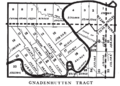
Gnadenhutten Tract
-
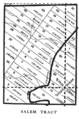
Salem Tract
-
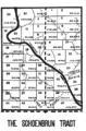
Schoenbrunn Tract


