Mount Auburn, Iowa facts for kids
Quick facts for kids
Mount Auburn, Iowa
|
|
|---|---|

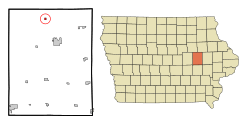
Location of Mount Auburn, Iowa
|
|
| Country | |
| State | |
| County | Benton |
| Area | |
| • Total | 0.25 sq mi (0.64 km2) |
| • Land | 0.25 sq mi (0.64 km2) |
| • Water | 0.00 sq mi (0.00 km2) |
| Elevation | 879 ft (268 m) |
| Population
(2020)
|
|
| • Total | 162 |
| • Density | 658.54/sq mi (254.21/km2) |
| Time zone | UTC-6 (Central (CST)) |
| • Summer (DST) | UTC-5 (CDT) |
| ZIP code |
52313
|
| Area code(s) | 319 |
| FIPS code | 19-54435 |
| GNIS feature ID | 0459272 |
Mount Auburn is a small city located in Benton County, Iowa, in the United States. In 2020, about 162 people lived there. It is part of the larger Cedar Rapids area.
Contents
History of Mount Auburn
Mount Auburn was officially planned and marked out in 1871. This happened when the Burlington, Cedar Rapids and Minnesota Railway line reached this area.
Geography of Mount Auburn
Mount Auburn is a small city. According to the United States Census Bureau, the city covers about 0.28 square miles (0.72 square kilometers). All of this area is land.
Population and People
| Historical populations | ||
|---|---|---|
| Year | Pop. | ±% |
| 1910 | 228 | — |
| 1920 | 249 | +9.2% |
| 1930 | 196 | −21.3% |
| 1940 | 223 | +13.8% |
| 1950 | 216 | −3.1% |
| 1960 | 186 | −13.9% |
| 1970 | 200 | +7.5% |
| 1980 | 188 | −6.0% |
| 1990 | 134 | −28.7% |
| 2000 | 160 | +19.4% |
| 2010 | 150 | −6.2% |
| 2020 | 162 | +8.0% |
| Source: and Iowa Data Center Source: |
||
Mount Auburn has seen its population change over the years. The city's population was 162 people in 2020. This is a small increase from 150 people in 2010.
Mount Auburn in 2020
In 2020, there were 162 people living in Mount Auburn. These people lived in 61 different homes. About 50 of these were families. The city had about 658 people per square mile.
Most of the people in Mount Auburn were White (93.8%). A small number were Native American (2.5%) or Asian (1.2%). Some people (2.5%) identified with two or more races. About 2.5% of the population was Hispanic or Latino.
Many homes (47.5%) had children under 18 living there. Most homes (65.6%) were married couples. The average age of people in Mount Auburn was 40.4 years. About 24.7% of residents were under 20 years old.
Mount Auburn in 2010
In 2010, there were 150 people living in Mount Auburn. They lived in 64 homes, and 44 of these were families. The city had about 536 people per square mile.
Most people (98.0%) were White. A small number (1.3%) were Native American. About 0.7% of people identified with two or more races.
About 31.3% of homes had children under 18. The average age in the city was 35 years. About 24% of residents were under 18.
Education in Mount Auburn
Students in Mount Auburn attend schools in the Union Community School District. This school district was formed in 1993. It was created when the La Porte City Community School District and the Dysart-Geneseo Community School District joined together.
See also
 In Spanish: Mount Auburn (Iowa) para niños

