Mount Clarence King facts for kids
Quick facts for kids Mount Clarence King |
|
|---|---|
| Highest point | |
| Elevation | 12,867+ ft (3922+ m) NAVD 88 |
| Prominence | 1,149 ft (350 m) |
| Parent peak | Mount Gould |
| Listing |
|
| Geography | |
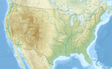
| Location | Fresno County, California, U.S. |
| Parent range | Sierra Nevada |
| Topo map | USGS Mount Clarence King |
| Climbing | |
| First ascent | 1896 by Bolton C. Brown |
| Easiest route | Technical, class 5.4 |
Mount Clarence King is a tall mountain located in the beautiful Kings Canyon National Park in California. It stands at over 12,867 feet (3,922 meters) high! This mountain is named after Clarence King, an important explorer and scientist. He helped map and study the land of California a long time ago.
Contents
Who Was Clarence King?
Clarence King was a very interesting person who loved exploring. He was part of the California Geological Survey, which was the first big project to study the geology of California. Think of it like a science team exploring and mapping the land.
King's Important Role
Later, Clarence King became the very first leader of the United States Geological Survey (USGS). This is a major government agency that studies the Earth, its resources, and natural hazards. So, the mountain is named after a true pioneer in understanding our planet.
Where is Mount Clarence King?
Mount Clarence King is part of the Sierra Nevada mountain range in California. The Sierra Nevada is a huge, long mountain range known for its stunning views and tall peaks.
Nearby Landmarks
The mountain is found along a smaller ridge called King Spur. It's located north of Mount Cotter and northeast of an area known as Gardiner Basin. To its west, you can find Sixty Lakes Basin and the famous John Muir Trail. The John Muir Trail is a long hiking path that goes through many beautiful parts of the Sierra Nevada.
First Climb to the Top
The first person known to climb Mount Clarence King was a talented artist named Bolton Brown. He was a painter and also made prints called lithographs.
An Early Achievement
Bolton Brown successfully reached the summit of Mount Clarence King in 1896. Climbing a tall mountain like this, especially back then, was a big adventure and a great achievement. It showed his skill and determination as an explorer.
 | Mary Eliza Mahoney |
 | Susie King Taylor |
 | Ida Gray |
 | Eliza Ann Grier |


