Mount Coe facts for kids
Quick facts for kids Mount Coe |
|
|---|---|

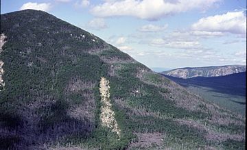
Fir waves on Mount Coe
|
|
| Highest point | |
| Elevation | 3,795 ft (1,157 m) |
| Prominence | 315 ft (96 m) |
| Listing | New England 100 Highest #90 |
| Geography | |
| Location | Piscataquis County, Maine |
| Topo map | USGS Doubletop Mountain |
| Climbing | |
| Easiest route | hiking trail |
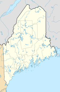
Mount Coe is a cool mountain in Maine, USA. It's found in Piscataquis County, inside a big nature area called Baxter State Park. Mount Coe is about 5.5 miles (8.8 kilometers) northwest of Mount Katahdin, which is another famous mountain. Nearby, you'll find South Brother mountain to the northeast and Mount O-J-I to the southwest.
Mount Coe is one of the tallest peaks in Maine, ranking 22nd in height. Its waters flow into the Penobscot River, which eventually reaches Penobscot Bay. Water from the east side of Mount Coe goes into a swampy area known as "The Klondike." From there, it flows into Wassataquoik Stream and then into the East Branch of the Penobscot River. Water from the northwest and southwest sides of the mountain flows into Nesowdnehunk Stream, which then joins the West Branch of the Penobscot River.
Exploring Mount Coe
Mount Coe is a popular spot for hikers. The main trail starts at a place called Slide Dam. This dam is on the east bank of Newsowdnehunk Stream. The starting point is about 1,190 feet (363 meters) high.
The Hiking Trail
The trail begins by heading east for about 1.2 miles (1.9 kilometers). Then, it turns right (south) and follows a path next to the Mount Coe slide. This slide is a rocky, open area on the mountain. The trail bends towards the east and then northeast. The last 0.5 miles (0.8 kilometers) of the trail go straight up this slide. On this part, hikers gain about 800 feet (244 meters) in elevation. It's a challenging but rewarding climb!
What is a Watershed?
A watershed is like a giant funnel. It's an area of land where all the water that falls on it, or drains off it, flows to a common point. This point could be a river, a lake, or even an ocean. For Mount Coe, all the rain and melting snow eventually make their way to the Penobscot River.
 | May Edward Chinn |
 | Rebecca Cole |
 | Alexa Canady |
 | Dorothy Lavinia Brown |


