South Brother facts for kids
Quick facts for kids South Brother |
|
|---|---|
| Highest point | |
| Elevation | 3,970 ft (1,210 m) |
| Prominence | 571 ft (174 m) |
| Listing | New England 100 Highest #69 |
| Geography | |
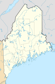
| Location | Piscataquis County, Maine, U.S. |
| Topo map | USGS Doubletop Mountain |
For the mountain in Australia, see Three Brothers, New South Wales. For the islands, see South Brother Island (disambiguation).
South Brother is a mountain located in Maine, a state in the U.S.. You can find it in Piscataquis County, inside Baxter State Park. South Brother is next to Mount Coe on one side and North Brother on the other. Together, these two mountains are often called "The Brothers."
Contents
About South Brother Mountain
South Brother is a tall mountain. It reaches about 3,970 feet (1,210 meters) high. This makes it one of the higher peaks in Maine. It's a great place for nature lovers and hikers.
Where is South Brother Located?
This mountain is in Baxter State Park. This park is a large wilderness area in Maine. It is known for its beautiful forests, lakes, and mountains. The park is home to many wild animals.
Part of "The Brothers"
South Brother is one of two mountains known as "The Brothers." The other mountain is North Brother. They stand close to each other. This makes them a notable landmark in the park.
Water Around the Mountain
Water from South Brother flows into different rivers. This area is called a watershed. A watershed is like a big bowl. All the rain and snow that falls there drains into one main river.
Rivers and Streams
South Brother is part of the Penobscot River watershed. The Penobscot River flows into Penobscot Bay.
- Water from the northeast and southeast sides of South Brother goes into a swampy area. This area is called "The Klondike."
- From "The Klondike," the water flows into Wassataquoik Stream.
- Then, it reaches the East Branch of the Penobscot River.
- Water from the west sides of South Brother flows into Roaring Brook.
- Next, it goes into Nesowadnehunk Stream.
- Finally, it joins the West Branch of the Penobscot River.
The Appalachian Trail
The Appalachian Trail is a very long hiking path. It is about 2,170 miles (3,500 kilometers) long. The trail starts in Georgia. It ends in Maine.
Trail's End Near South Brother
The northern end of the Appalachian Trail is Mount Katahdin. This famous mountain is about 5 miles (8 kilometers) southeast of "The Brothers." Many hikers finish their long journey here.
 | Sharif Bey |
 | Hale Woodruff |
 | Richmond Barthé |
 | Purvis Young |


