Mount Cooper (British Columbia) facts for kids
Quick facts for kids Mount Cooper |
|
|---|---|

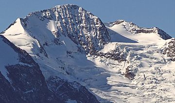
Mount Cooper, northeast aspect
|
|
| Highest point | |
| Elevation | 3,094 m (10,151 ft) |
| Prominence | 2,319 m (7,608 ft) |
| Parent peak | Nautilus Mountain (3130 m) |
| Listing |
|
| Geography | |
| Location | Goat Range Provincial Park British Columbia, Canada |
| Parent range | Goat Range Slocan Ranges Selkirk Mountains Columbia Mountains |
| Topo map | NTS 82K/3 |
| Climbing | |
| First ascent | August 10, 1962 |
Mount Cooper is a huge, icy mountain in southeast British Columbia, Canada. It stands 3,094 meters (about 10,151 feet) tall. This makes it a very prominent peak in the Selkirk Mountains.
You can find Mount Cooper about 36 kilometers (22 miles) northwest of Kaslo. It is located inside Goat Range Provincial Park. Mount Cooper is the highest peak in both the Goat Range and Slocan Ranges. These ranges are part of the larger Selkirk Mountains.
The first people to climb Mount Cooper reached the top on August 10, 1962. This climbing team was from the Spokane Mountaineers group. They climbed the mountain using the Spokane Glacier route. The mountain was named after Cooper Creek. This creek got its name from an old prospector and trapper from the 1880s. The name 'Mount Cooper' became official in 1960. Before that, people called it Cooper Mountain.
Weather at Mount Cooper
Mount Cooper has a subarctic climate. This means it has very cold, snowy winters. Its summers are usually mild. Temperatures can drop below −20 degrees Celsius (or −4 degrees Fahrenheit). With wind chill, it can feel even colder, sometimes below −30 degrees Celsius (−22 degrees Fahrenheit).
Water from the mountain and melting ice from the Spokane Glacier flow east. This water drains into Cooper Creek. Cooper Creek is a river that flows into the Duncan River.
 | Lonnie Johnson |
 | Granville Woods |
 | Lewis Howard Latimer |
 | James West |


