Mount Desor facts for kids
Quick facts for kids Mount Desor |
|
|---|---|
| Highest point | |
| Elevation | 1,394 ft (425 m) |
| Prominence | 792 ft (241 m) |
| Geography | |
| Location | Isle Royale National Park, Keweenaw County, Michigan, U.S. |
| Parent range | Superior Upland |
| Topo map | USGS Sugar Mountain |
| Climbing | |
| Easiest route | Trail hike |
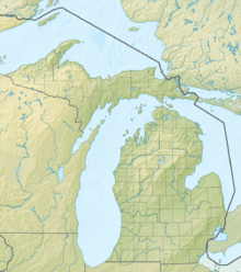
Mount Desor is the tallest mountain found within Isle Royale National Park. This park is located on Isle Royale, an island in Lake Superior. Mount Desor stands at about 1,394 feet (425 meters) tall. It is the third highest peak around Lake Superior.
Contents
Exploring Mount Desor's Summit
Where is Mount Desor Located?
Mount Desor is a special part of Isle Royale National Park. This park is a large island in the middle of Lake Superior. The mountain is found in Keweenaw County, Michigan, in the United States. Its height makes it a notable landmark on the island.
Hiking the Greenstone Ridge Trail
A long hiking path called the Greenstone Ridge Trail crosses over Mount Desor. This trail is about 45 miles (72 kilometers) long. It stretches across the entire length of Isle Royale. If you want to hike to the top of Mount Desor, it's about an 8.5-mile walk from the closest ferry landing.
What You Can See from the Top
The top of Mount Desor is covered with many trees. This means the views of the surrounding area are often limited. However, if you visit in the autumn after most of the leaves have fallen, you might get a special treat. You can sometimes see Lake Superior's Siskiwit Bay to the south. During other seasons, the thick woods block most of the distant views.
 | Bessie Coleman |
 | Spann Watson |
 | Jill E. Brown |
 | Sherman W. White |


