Mount Duke facts for kids
Quick facts for kids Mount Duke |
|
|---|---|

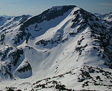
Mount Duke, northwest aspect
|
|
| Highest point | |
| Elevation | 2,379 m (7,805 ft) |
| Prominence | 389 m (1,276 ft) |
| Listing | Mountains of British Columbia |
| Geography | |
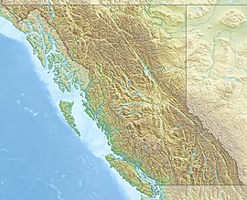
| Location | British Columbia, Canada |
| Parent range | Joffre Group Lillooet Ranges Coast Mountains |
| Topo map | NTS 92J/08 |
| Climbing | |
| First ascent | 1966 by M. Juri, T. Anderson |
| Easiest route | Scramble via northwest ridge |
Mount Duke is a tall mountain in British Columbia, Canada. It stands 2,379 meters (about 7,805 feet) high. You can find it about 30 kilometers (19 miles) east of Pemberton and 10 kilometers (6 miles) southwest of Duffy Lake.
Mount Duke is part of a mountain group called the Joffre Group. The tallest mountain in this group, Mount Matier, is about 4.4 kilometers (2.7 miles) to the west. The mountain was named after Archbishop William Mark Duke. A mountaineer named Reverend Damasus Payne suggested the name. It became official on April 21, 1966. Rain and melting snow from Mount Duke flow into two creeks: Caspar Creek and Twin One Creek.
Mount Duke's Climate
Mount Duke has a "subarctic climate." This means it has long, cold winters and short, cool summers. Most weather systems come from the Pacific Ocean and travel east. When they hit the Coast Mountains, they are forced to rise. This causes them to drop their moisture as rain or snow.
Because of this, the Coast Mountains get a lot of precipitation, especially snow in winter. Temperatures can drop below −20 °C (minus 4 °F). With the wind, it can feel even colder, below −30 °C (minus 22 °F). The best time to climb Mount Duke is usually from July through September, when the weather is most favorable.
 | Aurelia Browder |
 | Nannie Helen Burroughs |
 | Michelle Alexander |


