Mount Edgecumbe (Alaska) facts for kids
Quick facts for kids Mount Edgecumbe |
|
|---|---|

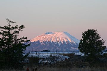
Mount Edgecumbe in December 2004
|
|
| Highest point | |
| Elevation | 3,201 ft (976 m) |
| Prominence | 3,201 ft (976 m) |
| Listing | Mountains of Alaska |
| Naming | |
| Native name | Error {{native name}}: an IETF language tag as parameter {{{1}}} is required (help) |
| Geography | |
| Topo map | USGS Sitka A-6 |
| Geology | |
| Age of rock | < 600,000 yr |
| Mountain type | Dacite stratovolcano |
| Last eruption | 2220 BCE ± 100 years |
| Climbing | |
| First ascent | 1805 by Urey Lisianski |
| Easiest route | Hike |

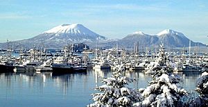
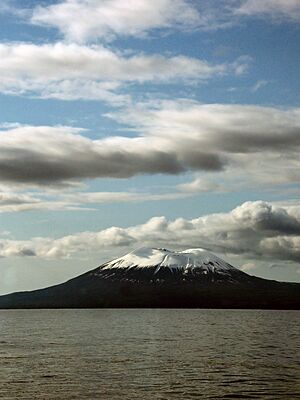
Mount Edgecumbe (called Lʼúx by the Tlingit people) is a volcano located on Kruzof Island in Alaska. It sits about 15 kilometers (9 miles) west of the city of Sitka. This volcano is considered "dormant," meaning it is not erupting right now but could in the future.
Mount Edgecumbe is the highest point in a volcanic area on Kruzof Island. This area also includes other peaks like Crater Ridge and Shell Mountain. The volcano has not had a major eruption in about 4,000 years. Scientists are watching it closely. Recent small earthquakes show that hot, melted rock (called magma) is moving deep underground. However, experts say an eruption is not likely to happen soon. The Alaska Volcano Observatory (AVO) calls Mount Edgecumbe "historically active."
Contents
What's in a Name?
The native Tlingit people consider Mount Edgecumbe a very special and sacred place. In their language, the mountain is called Lʼúx. This name means "to flash" or "blinking." The Tlingit people gave it this name because they first saw it when it was smoking or erupting.
A Spanish explorer named Juan de la Bodega saw the mountain in 1775. He named it Montaña de San Jacinto. Later, in 1778, Captain James Cook sailed past the mountain. He named it Mount Edgecumbe. He might have named it after a hill in England or a person named George, Earl of Edgcumbe. Explorer George Vancouver later used Cook's name, and it became the popular one.
Climbing the Mountain
The first person known to climb Mount Edgecumbe was Captain Urey Lisianski in July 1805. He was from the Russian Navy. In the 1930s, a path to the top of the mountain was built. This was done by the Civilian Conservation Corps. They were part of a government program to help people find jobs during the Great Depression.
The Mt. Edgecumbe Trail is about 11 kilometers (7 miles) long. It goes through forests and wet, boggy areas. The path then gets very steep. Near the top, it becomes a bare landscape of snow and red volcanic ash. There are signs to guide hikers toward the edge of the volcano's crater. A small cabin built by the Conservation Corps is about 4 kilometers (2.5 miles) up the trail. The trail can be muddy, and the last 3 kilometers (2 miles) are a tough climb. Hikers should also be aware that bears might be in the area. The trail is considered "moderate" in difficulty.
Past Eruptions
Mount Edgecumbe has erupted several times in the past. Here are some of its known eruptions:
- 7620 BC
- 3810 BC
- 2220 BC (give or take 100 years)
The April Fools' Joke
On April 1, 1974, a local person named Oliver "Porky" Bickar played a big April Fools' Day joke. He flew 70 old tires into the volcano's crater. Then, he set them on fire! The dark smoke rising from the crater made people in Sitka think the volcano was erupting.
Soon, everyone found out it was a joke. Around the rim of the volcano, "April Fool" was spray-painted in huge 15-meter (50-foot) letters. Porky had told the airport and the police about his prank. But he forgot to tell the Coast Guard! The Guardian newspaper said this was one of the ten best April Fools' hoaxes ever.
Recent Activity
Mount Edgecumbe was quiet for about 800 years. But in April 2022, scientists noticed hundreds of small earthquakes. Experts at the Alaska Volcano Observatory (AVO) studied these quakes. They found that the ground east of the mountain had been slowly rising since August 2018. This area is about 17 kilometers (10.5 miles) wide.
The ground has risen about 27 centimeters (10.6 inches) in total. This rising is likely caused by new magma moving deep underground, about 5 kilometers (3 miles) deep. However, this does not mean an eruption is about to happen. Magma moving under volcanoes does not always lead to an eruption. If the magma moves closer to the surface, there would be more changes and earthquakes. So, if an eruption were to happen, scientists would likely have plenty of warning.
To keep a better eye on Mount Edgecumbe, the AVO put a special device called a seismometer and a GPS sensor on Kruzof Island in May 2022. These tools help them find smaller earthquakes and measure how the ground is moving.
See also
 In Spanish: Monte Edgecumbe para niños
 | Toni Morrison |
 | Barack Obama |
 | Martin Luther King Jr. |
 | Ralph Bunche |


