Mount Pleasant, Pennsylvania facts for kids
Quick facts for kids
Mount Pleasant, Pennsylvania
|
|
|---|---|
|
Borough
|
|
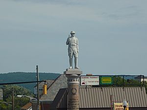
Doughboy Statue
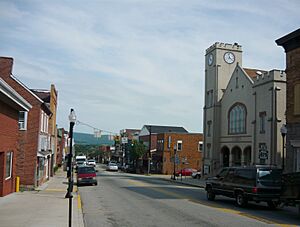
West Main Street and Diamond Street |
|
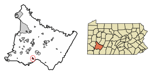
Location of Mount Pleasant in Westmoreland County, Pennsylvania.
|
|
| Country | United States |
| State | Pennsylvania |
| County | Westmoreland |
| Settled | 1797 |
| Incorporated | 1828 |
| Government | |
| • Type | Borough Council |
| Area | |
| • Total | 1.00 sq mi (2.59 km2) |
| • Land | 1.00 sq mi (2.59 km2) |
| • Water | 0.00 sq mi (0.00 km2) |
| Elevation | 1,171 ft (357 m) |
| Population
(2020)
|
|
| • Total | 4,245 |
| • Density | 4,240.76/sq mi (1,637.20/km2) |
| Time zone | UTC−5 (Eastern (EST)) |
| • Summer (DST) | UTC−4 (EDT) |
| ZIP Code |
15666
|
| FIPS code | 42-51880 |
| Website | www.mtpleasantboro.com |
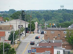
Mount Pleasant is a small town, also called a borough, in Westmoreland County, Pennsylvania, United States. It is located about 45 miles (72 km) southeast of Pittsburgh. In 2020, about 4,245 people lived there.
It's important not to confuse the Borough of Mount Pleasant with Mount Pleasant Township. The borough is the main town area, while the township is a separate, mostly rural area next to it.
In the past, Mount Pleasant was famous for making coke, which is a type of fuel made from coal. Other things made here included flour, lumber, iron, and glass.
Contents
History of Mount Pleasant
Mount Pleasant borough is located where two old Native American paths used to meet. When Europeans arrived, these paths became important roads. Today, they are known as Pennsylvania Routes 31 and 819.
This crossroads location attracted early settlers. They started businesses to help travelers passing through the area.
We don't know exactly when the first non-Native American person settled here. In 1755, a road built by the Braddock expedition went through the future town. This helped open the area for more people to settle. By the time of the American Revolutionary War, there were only a few houses.
In 1793, Michael Smith got a license to open an inn. An inn was like a hotel and restaurant for travelers. In 1797, Nathaniel Marshall sold land to Andrew McCready, who then planned out the design of the town.
The first iron-chain suspension bridge in the United States, called Jacob's Creek Bridge, was built south of the town in 1801. It was taken down in 1833.
Sadly, no buildings from before 1800 are still standing in the borough. The three oldest buildings that exist today were all built around 1812. These are the Shupe House, Hitchman House, and the Rupert Building, all located on Main Street.
Mount Pleasant officially became a borough on February 7, 1828.
Making glass was a big part of the local economy. Bryce Brothers started their glass business in 1850, and L. E. Smith Glass began in 1907. A new way to make steel, called the Bessemer process, was invented in 1859. This process needed a lot of coke (fuel). This invention had a huge impact on the area.
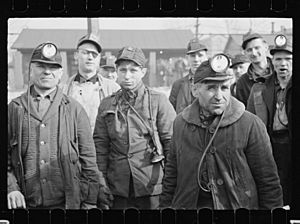
The town grew as more coal was mined to make coke. However, life was very hard for coal miners in the "patch towns." These were company-owned towns near the mines. There were often disagreements between the workers and the mine owners. One of the most serious events was the strike in Morewood in 1891. During this time, workers and authorities clashed.
Mount Pleasant faced a challenge in the 1850s when the main railroad lines did not pass through the community. But in 1871, the Mount Pleasant and Broadford Railroad opened, which later became part of the Baltimore and Ohio Railroad. Also, a branch of the Pennsylvania Railroad connected the borough to Scottdale. From 1906 to 1952, an interurban trolley system called West Penn Railways also served Mount Pleasant.
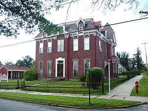
Three places in the Borough of Mount Pleasant are listed on the National Register of Historic Places. These are the Samuel Warden House (built in 1886), the former Mount Pleasant Armory (which has been taken down), and the Mount Pleasant Historic District. This district includes the oldest parts of the borough.
Geography and Climate
Mount Pleasant is located at 40°8′59″N 79°32′33″W / 40.14972°N 79.54250°W.
The United States Census Bureau says the borough covers about 1.1 square miles (3.0 km2) of land. There is no water area within the borough limits.
Mount Pleasant has a humid continental climate. This means it has four clear seasons throughout the year: spring, summer, autumn, and winter. The area also gets a fair amount of rain and snow.
| Climate data for Mount Pleasant (1991–2020 normals, extremes 1991–2011) | |||||||||||||
|---|---|---|---|---|---|---|---|---|---|---|---|---|---|
| Month | Jan | Feb | Mar | Apr | May | Jun | Jul | Aug | Sep | Oct | Nov | Dec | Year |
| Record high °F (°C) | 72 (22) |
75 (24) |
83 (28) |
87 (31) |
89 (32) |
92 (33) |
96 (36) |
96 (36) |
92 (33) |
86 (30) |
80 (27) |
73 (23) |
96 (36) |
| Mean maximum °F (°C) | 62.8 (17.1) |
64.2 (17.9) |
72.9 (22.7) |
82.4 (28.0) |
84.4 (29.1) |
88.4 (31.3) |
89.3 (31.8) |
89.8 (32.1) |
87.2 (30.7) |
79.6 (26.4) |
72.6 (22.6) |
65.1 (18.4) |
90.3 (32.4) |
| Mean daily maximum °F (°C) | 37.4 (3.0) |
40.6 (4.8) |
50.0 (10.0) |
62.2 (16.8) |
71.3 (21.8) |
78.5 (25.8) |
82.1 (27.8) |
81.2 (27.3) |
75.2 (24.0) |
63.7 (17.6) |
51.8 (11.0) |
42.0 (5.6) |
61.3 (16.3) |
| Daily mean °F (°C) | 29.0 (−1.7) |
30.8 (−0.7) |
38.9 (3.8) |
49.3 (9.6) |
59.2 (15.1) |
67.3 (19.6) |
71.1 (21.7) |
69.9 (21.1) |
63.1 (17.3) |
51.8 (11.0) |
41.5 (5.3) |
33.7 (0.9) |
50.5 (10.3) |
| Mean daily minimum °F (°C) | 20.7 (−6.3) |
21.0 (−6.1) |
27.7 (−2.4) |
36.3 (2.4) |
47.0 (8.3) |
56.1 (13.4) |
60.1 (15.6) |
58.6 (14.8) |
50.9 (10.5) |
40.0 (4.4) |
31.2 (−0.4) |
25.4 (−3.7) |
39.6 (4.2) |
| Mean minimum °F (°C) | −1.1 (−18.4) |
2.7 (−16.3) |
9.7 (−12.4) |
22.4 (−5.3) |
31.7 (−0.2) |
42.6 (5.9) |
48.0 (8.9) |
45.8 (7.7) |
36.3 (2.4) |
25.3 (−3.7) |
15.6 (−9.1) |
5.3 (−14.8) |
−3.1 (−19.5) |
| Record low °F (°C) | −14 (−26) |
−11 (−24) |
−3 (−19) |
14 (−10) |
27 (−3) |
35 (2) |
43 (6) |
41 (5) |
33 (1) |
20 (−7) |
6 (−14) |
−3 (−19) |
−14 (−26) |
| Average precipitation inches (mm) | 3.31 (84) |
2.24 (57) |
3.37 (86) |
3.64 (92) |
4.27 (108) |
4.86 (123) |
4.40 (112) |
3.96 (101) |
3.49 (89) |
3.18 (81) |
3.44 (87) |
3.78 (96) |
43.94 (1,116) |
| Average snowfall inches (cm) | 9.0 (23) |
7.5 (19) |
5.6 (14) |
0.3 (0.76) |
0.0 (0.0) |
0.0 (0.0) |
0.0 (0.0) |
0.0 (0.0) |
0.0 (0.0) |
0.1 (0.25) |
0.9 (2.3) |
6.4 (16) |
29.8 (76) |
| Average precipitation days (≥ 0.01 inch) | 15.6 | 11.9 | 13.0 | 14.0 | 13.8 | 12.3 | 12.2 | 10.6 | 10.8 | 9.9 | 12.0 | 14.1 | 150.2 |
| Average snowy days (≥ 0.1 in) | 6.5 | 5.3 | 2.5 | 0.4 | 0.0 | 0.0 | 0.0 | 0.0 | 0.0 | 0.1 | 1.2 | 4.9 | 20.9 |
| Source 1: NOAA | |||||||||||||
| Source 2: XMACIS2 (mean maxima and minima 1991–2020) | |||||||||||||
People of Mount Pleasant
| Historical population | |||
|---|---|---|---|
| Census | Pop. | %± | |
| 1840 | 554 | — | |
| 1850 | 534 | −3.6% | |
| 1860 | 497 | −6.9% | |
| 1870 | 717 | 44.3% | |
| 1880 | 1,197 | 66.9% | |
| 1890 | 3,652 | 205.1% | |
| 1900 | 4,745 | 29.9% | |
| 1910 | 5,812 | 22.5% | |
| 1920 | 5,862 | 0.9% | |
| 1930 | 5,869 | 0.1% | |
| 1940 | 5,824 | −0.8% | |
| 1950 | 5,883 | 1.0% | |
| 1960 | 6,107 | 3.8% | |
| 1970 | 5,895 | −3.5% | |
| 1980 | 5,354 | −9.2% | |
| 1990 | 4,787 | −10.6% | |
| 2000 | 4,728 | −1.2% | |
| 2010 | 4,454 | −5.8% | |
| 2020 | 4,245 | −4.7% | |
| Sources: | |||
In 2000, there were 4,728 people living in Mount Pleasant. Most people were White (97.10%). A smaller number were African American (1.67%) or other races.
Many residents in Mount Pleasant have Polish family backgrounds. This is shown by the presence of the Tadeusz Kościuszko Club.
The average age of people in the borough was 44 years old. About 19.1% of the population was under 18 years old. About 25.2% were 65 years or older.
The average yearly income for a household in the borough was $30,738. For families, the average income was $41,438. About 11.0% of the population lived below the poverty line. This means their income was below a certain level needed to meet basic needs.
Notable People
Many interesting people have connections to Mount Pleasant. Here are a few:
- Jack Gantos (born 1951), a well-known author of children's books.
- John W. Geary (1819–1873), a U.S. general during the Civil War. He also served as the 16th Governor of Pennsylvania.
- Lillian Resler Keister Harford (1851–1935), a church organizer and editor.
- Raymond V. Kirk (1901–1947), who was the president of Duquesne University.
- Rich Rollins (born 1938), a professional baseball player in Major League Baseball.
- Jess M. Stairs (born 1942), a member of the Pennsylvania House of Representatives for the Republican Party.
- Steve Swetonic (1903–1974), a professional baseball pitcher in Major League Baseball.
- Neal ElAttrache, a famous orthopedic surgeon.
See also
 In Spanish: Mount Pleasant (Pensilvania) para niños


