Mount Wilson (Arizona) facts for kids
Quick facts for kids Mount Wilson |
|
|---|---|

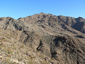
Mount Wilson in December 2006
|
|
| Highest point | |
| Elevation | 5,446 ft (1,660 m) NAVD 88 |
| Prominence | 3,205 ft (977 m) |
| Geography | |
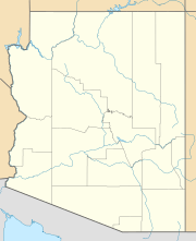
| Location | Mohave County, Arizona, U.S. |
| Parent range | Black Mountains |
| Topo map | USGS Mount Wilson |
Mount Wilson is a mountain located in Mohave County, Arizona, U.S.. It stands tall at about 5,456 feet (1,663 meters) above sea level. This makes it the second highest peak in the Black Mountains, right after Mount Perkins.
Contents
What is Mount Wilson?
Mount Wilson is more than just a mountain; it's also part of a special protected area called the Mount Wilson Wilderness. This wilderness area covers a huge space of about 23,900 acres (that's over 37 square miles!). It was created in 1990 to protect the natural desert environment around the mountain.
The Mount Wilson Wilderness Area
The Mount Wilson Wilderness is a place where nature is left wild and untouched. It's managed by the Bureau of Land Management, which helps keep it safe for plants, animals, and people to enjoy responsibly. This wilderness includes about eight miles of the Wilson Ridge, which is a long, narrow chain of hills. It's also surrounded by the Lake Mead National Recreation Area, a popular spot for outdoor activities.
Protecting areas like Mount Wilson Wilderness is important because it helps keep the desert ecosystem healthy. It provides a safe home for many different kinds of plants and animals that live in the desert.
Location and Geography
Mount Wilson is found in the northwestern part of Arizona, within Mohave County. It's part of the Black Mountains, which are a range of mountains known for their dark, volcanic rocks. The mountain's location near the Lake Mead National Recreation Area means it's close to the famous Lake Mead, a large reservoir on the Colorado River. The landscape around Mount Wilson is typical desert, with rugged terrain, dry washes, and unique rock formations.
Plants and Animals
Even though it's a desert, the Mount Wilson Wilderness is full of life! You can find many types of desert plants here, like different kinds of cacti, creosote bush, and ocotillo. These plants are specially adapted to survive in dry conditions.
The wilderness is also home to various animals. You might spot desert bighorn sheep climbing the rocky slopes, or see different types of lizards and snakes. Birds like roadrunners and various raptors (birds of prey) also live here. Keeping the area protected helps these animals thrive in their natural habitat.
Visiting Mount Wilson
While it's a wilderness area, people can still visit Mount Wilson to enjoy nature. Activities often include hiking and exploring the rugged landscape. Because it's a wilderness, there are usually no paved roads or facilities, so visitors need to be prepared for a true outdoor adventure. It's a great place to experience the quiet beauty of the Arizona desert and see wildlife in its natural setting. Remember to always respect the environment and leave no trace behind when visiting.
 | Mary Eliza Mahoney |
 | Susie King Taylor |
 | Ida Gray |
 | Eliza Ann Grier |


