Mount Worthington (Yukon) facts for kids
Quick facts for kids Mount Worthington |
|
|---|---|

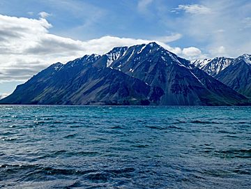
Mount Worthington and Kathleen Lake
|
|
| Highest point | |
| Elevation | 2,168 m (7,113 ft) |
| Geography | |
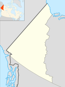
| Location | Kluane National Park Yukon, Canada |
| Parent range | Auriol Range Saint Elias Mountains |
| Topo map | NTS 115A/11 |
Mount Worthington is a tall mountain peak located in the beautiful Yukon territory of Canada. It stands at 2,168-metre (7,113-foot) (about 7,113 feet) above sea level. This impressive mountain is part of the Auriol Range, which is a section of the larger Saint Elias Mountains.
You can find Mount Worthington within the amazing Kluane National Park. It sits right above the clear waters of Kathleen Lake. The mountain is about 7.2 km (4 mi) northwest of another peak called Kings Throne Peak, which is across the lake. It's also about 19 km (12 mi) south-southeast of a town called Haines Junction, Yukon.
Mount Worthington is easy to spot from the Haines Highway. It rises dramatically 1,570-metre (5,150-foot) (about 5,151 feet) above Kathleen Lake, making it a very noticeable landmark. The mountain officially received its name on August 12, 1980, from the Geographical Names Board of Canada.
Contents
Discover Mount Worthington
Mount Worthington is a fantastic example of the rugged beauty found in Canada's Yukon. Its height and location make it a significant feature in the landscape. It's a great place to learn about mountains and their surroundings.
Where is Mount Worthington?
Mount Worthington is located in a very special part of Canada. It's in the Yukon, which is known for its vast wilderness and stunning natural beauty. The mountain is inside Kluane National Park, a huge protected area. This park is famous for its glaciers, towering mountains, and diverse wildlife.
The mountain overlooks Kathleen Lake, a popular spot for visitors. The lake offers amazing views of the surrounding peaks, including Mount Worthington. Its location near the Haines Highway means many people can see it. This makes it a memorable sight for travelers exploring the Yukon.
How Tall is Mount Worthington?
Mount Worthington stands at an elevation of 2,168-metre (7,113-foot). This makes it one of the many tall peaks in the Saint Elias Mountains. These mountains are some of the highest in North America. The height of Mount Worthington means it often has snow on its upper slopes, even in summer. Its impressive size helps it stand out from the landscape.
What's the Weather Like?
Mount Worthington experiences a subarctic climate. This type of climate has very long, cold, and snowy winters. Temperatures can drop very low during these months. Summers are usually mild and short. They are a welcome break from the cold.
This climate creates a unique environment for plants and animals. The snow often stays on the mountain for many months. This affects the types of plants that can grow there. It also influences the animals that call this area home.
Exploring Kluane National Park
Mount Worthington is part of Kluane National Park, which is a UNESCO World Heritage Site. This means it's recognized as a place of outstanding natural importance. The park is a huge wilderness area. It's home to some of the largest non-polar icefields in the world.
Wildlife in the Park
Kluane National Park is full of amazing wildlife. You might spot grizzly bears, black bears, and moose. There are also Dall sheep, caribou, and mountain goats. The park is a safe home for these animals. It allows them to live freely in their natural habitat. Birdwatchers can also find many different species of birds here.
Fun Things to Do
Even though Mount Worthington is a serious mountain, the area around it offers many activities. Visitors to Kluane National Park can enjoy hiking, camping, and fishing. There are trails for all skill levels. You can explore the beautiful scenery. Boating on Kathleen Lake is also popular. It's a great way to see Mount Worthington from the water.


