Mugdrum Island facts for kids
| Gaelic name | muc-dhruim |
|---|---|
| Meaning of name | hog-back |
| OS grid reference | NO225189 |
| Coordinates | 56°22′N 3°15′W / 56.36°N 3.25°W |
| Physical geography | |
| Island group | River Tay |
| Area | 32 ha |
| Highest elevation | 4 m |
| Administration | |
| Sovereign state | United Kingdom |
| Country | Scotland |
| Council area | Fife |
| Demographics | |
| Population | 0 |
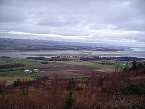
Mugdrum Island is a small island located in the Firth of Tay, a large river estuary in eastern Scotland. It lies offshore from the town of Newburgh in Fife. This island is known for its natural beauty and its interesting history.
Geography
Mugdrum Island is a very flat island, sitting low in the water. It is mostly covered in tall, grassy plants called reeds. Two main water channels, known as the "North Deep" and "South Deep," flow on either side of the island. The island covers an area of about 32 hectares (which is about 79 acres).
History
The name 'Mugdrum' comes from an old Scottish Gaelic phrase, muc-dhruim. This means 'hog-back', which describes a shape like a pig's back. There is also a place called Mugdrum House nearby, named after the island. It is located to the west of Newburgh.
Long ago, people used to collect the reeds from Mugdrum Island. These reeds were used for thatching, which is making roofs from straw or reeds. They also helped protect potatoes when they were being moved from one place to another.
Until 1926, Mugdrum Island even had a farm! Farmers grew crops like cereals (grains), potatoes, and turnips in the island's rich alluvial soil. Today, Mugdrum Island is a special nature reserve. This means it is a protected area for wildlife. The Tay Valley Wildfowlers' Association helps take care of it.
See also
 In Spanish: Mugdrum para niños
 | Precious Adams |
 | Lauren Anderson |
 | Janet Collins |


