
Nashua, Montana facts for kids
Quick facts for kids
Nashua, Montana
|
|
|---|---|

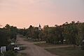
Charles Street in Nashua at sunset
|
|

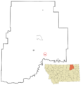
Location of Nashua, Montana
|
|
| Country | United States |
| State | Montana |
| County | Valley |
| Area | |
| • Total | 0.70 sq mi (1.83 km2) |
| • Land | 0.70 sq mi (1.83 km2) |
| • Water | 0.00 sq mi (0.00 km2) |
| Elevation | 2,067 ft (630 m) |
| Population
(2020)
|
|
| • Total | 301 |
| • Density | 426.95/sq mi (164.79/km2) |
| Time zone | UTC-7 (Mountain (MST)) |
| • Summer (DST) | UTC-6 (MDT) |
| ZIP code |
59248
|
| Area code(s) | 406 |
| FIPS code | 30-52900 |
| GNIS feature ID | 2413034 |
Nashua is a small town located in Valley County, Montana, in the United States. In 2020, about 301 people lived there.
The town started in 1888 as a stop along the St. Paul, Minneapolis & Manitoba Railway. Nashua saw a quick growth spurt in the 1930s. This happened when the Fort Peck Dam was being built nearby.
Contents
Geography of Nashua

Nashua covers a total area of about 0.70 square miles (1.83 square kilometers). All of this area is land.
Nashua's Climate
Nashua has a type of weather called a semi-arid climate. This means it's usually dry, but not a full desert. It gets some rain, but not a lot. On climate maps, this weather is shown as "BSk".
People Living in Nashua
| Historical population | |||
|---|---|---|---|
| Census | Pop. | %± | |
| 1920 | 272 | — | |
| 1930 | 351 | 29.0% | |
| 1940 | 943 | 168.7% | |
| 1950 | 691 | −26.7% | |
| 1960 | 796 | 15.2% | |
| 1970 | 513 | −35.6% | |
| 1980 | 495 | −3.5% | |
| 1990 | 375 | −24.2% | |
| 2000 | 325 | −13.3% | |
| 2010 | 290 | −10.8% | |
| 2020 | 301 | 3.8% | |
| U.S. Decennial Census | |||
Population in 2010
In 2010, there were 290 people living in Nashua. These people lived in 136 households. A household is a group of people living together in one home. About 85 of these households were families.
The town had about 439 people per square mile. Most people in Nashua were White (94.5%). Some were Native American (2.8%) or Asian (0.3%). A small number were from other backgrounds. About 1.4% of the people were Hispanic or Latino.
About 23.5% of homes had children under 18. Half of the homes (50%) had married couples. About 35.3% of homes were single people living alone. Many people (14%) living alone were 65 or older. The average household had 2.13 people. The average family had 2.66 people.
The average age in Nashua was 50.8 years old. About 19.7% of people were under 18. Many people (35.4%) were between 45 and 64. Also, 21.4% were 65 or older. There were slightly more males (53.1%) than females (46.9%) in the town.
Getting Around Nashua
The Amtrak train called the Empire Builder goes through Nashua. This train travels between Seattle/Portland and Chicago. However, the train does not stop in Nashua. The closest train station is in Glasgow, which is about 15 miles west of Nashua.
Nashua High School Life
Nashua High School is small. Even with few students, kids can play many sports. These include basketball, track and field, volleyball, cheerleading, and American football. This is possible because the school works with a nearby high school.
Students can also join clubs. They can be part of the Art Club. Another option is the FCCLA Club. FCCLA stands for Family, Career and Community Leaders of America. The sports teams at Nashua High School are called the Porcupines.
Images for kids
-
Charles Street in Nashua at sunset
-
Location of Nashua, Montana
See also
 In Spanish: Nashua (Montana) para niños
