Fort Peck Dam facts for kids
Quick facts for kids Fort Peck Dam |
|
|---|---|
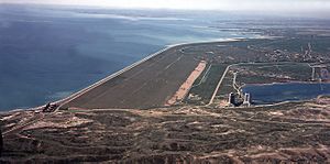
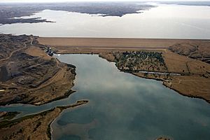
Aerial view of Fort Peck Dam is, looking west. Fort Peck, Montana. 1986
|
|
|
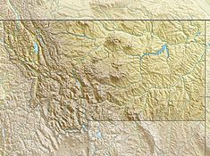
Location of the Fort Peck Dam in Montana
|
|
| Country | United States |
| Location | Fort Peck, Montana |
| Coordinates | 48°00′10″N 106°24′58″W / 48.00278°N 106.41611°W |
| Construction began | 1933 |
| Opening date | 1940 |
| Construction cost | $100 million |
| Owner(s) | |
| Dam and spillways | |
| Type of dam | Hydraulic earthfill |
| Impounds | Missouri River |
| Height | 250 ft (76 m) |
| Length | 21,026 ft (6,409 m) |
| Width (crest) | 50 ft (15 m) |
| Width (base) | 3,500 ft (1,100 m) |
| Dam volume | 125,628,000 cu yd (96,049,000 m3) |
| Spillway type | Controlled overflow, 8x bulkhead gates |
| Spillway capacity | 250,000 cu ft/s (7,100 m3/s) |
| Reservoir | |
| Creates | Fort Peck Lake |
| Total capacity | 18,463,000 acre⋅ft (22.774 km3) |
| Catchment area | 57,500 sq mi (149,000 km2) |
| Surface area | 241,000 acres (98,000 ha) |
| Power station | |
| Operator(s) | U.S. Army Corps of Engineers |
| Hydraulic head | 220 ft (67 m) |
| Turbines | 5x vertical Francis turbines |
| Installed capacity | 185 MW |
| Annual generation | 1,048 GWh |
| Website U.S. Army Corps of Engineers - Fort Peck Project |
|
|
Fort Peck Dam
|
|
| Lua error in Module:Location_map at line 420: attempt to index field 'wikibase' (a nil value). | |
| Location | On the Missouri River, Fort Peck, Montana |
| Area | 500 acres (200 ha) |
| Built | 1933 |
| Built by | U.S. Army Corps of Engineers |
| Architectural style | Art Deco |
| MPS | Fort Peck MRA |
| NRHP reference No. | 86002061 |
| Added to NRHP | August 13, 1986 |
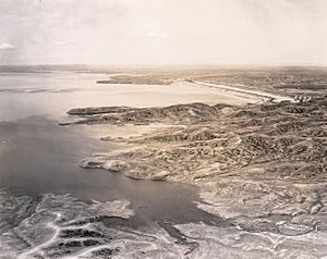
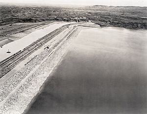
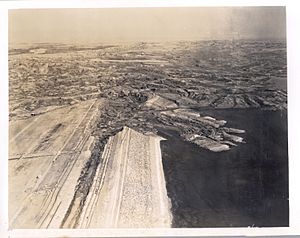
The Fort Peck Dam is one of the largest dams in the United States. It is located in northeast Montana, near the town of Fort Peck. This huge dam is 21,026 feet (6,409 m) long and over 250 feet (76 m) high. It is the biggest dam in the U.S. that was built using a special method called "hydraulically filled."
The dam creates Fort Peck Lake, which is the fifth largest artificial lake in the U.S. This lake is more than 130 miles (210 km) long and 200 feet (61 m) deep. Its shoreline stretches for 1,520 miles (2,450 km), which is longer than California's entire coastline!
The U.S. Army Corps of Engineers owns and runs the dam and the lake. They use it to make hydroelectric power (electricity from water), control floods, and manage water quality.
The dam can produce 185.25 megawatts of electricity. This power comes from five large generators. Three generators were finished in 1951 and make 105 MW. The other two were finished in 1961 and make 80 MW.
The lake's water level changes. It can be as high as 2,250 feet (690 m) above sea level. In February 2007, the water level was very low, at 2,197 feet (670 m). But in June 2011, during big floods, the dam had to release a huge amount of water. It let out almost 66,000 cubic feet per second (1,900 m3/s), much more than its previous record in 1975.
Contents
Building the Fort Peck Dam
The Fort Peck Dam was a major project of the Public Works Administration. This was a government program started during the New Deal to create jobs. Many people needed work during the Great Depression.
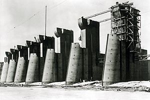
Construction of the dam began in 1933. At its busiest time in 1936, over 10,500 people worked on the dam. The dam was named after an old trading post from the 1800s. It was finished in 1940 and started making electricity in 1943.
A special town called Fort Peck, Montana was built for the engineers and important workers and their families. Many of the buildings from that time, like the recreation center and the Fort Peck Theater, are still used today. Other towns also grew up nearby to house the thousands of workers.
The Fort Peck Dam is one of six main dams on the Missouri River. All of these dams are run by the U.S. Army Corps of Engineers. The other dams are Garrison Dam, Oahe Dam, Big Bend Dam, Fort Randall Dam, and Gavins Point Dam. Together, these dams create huge lakes that hold a lot of water.
How the Dam Was Built
The dam was built on a part of the Missouri River that flowed from south to north. The riverbed had about 160 feet (49 m) of sand and gravel. Below that was a thick layer of rock called Bear Paw shale.
Workers first removed the soft clay from the riverbed. This allowed them to build the dam on the stronger sandy ground. They also put a strong steel wall deep into the ground to reach the solid shale. This wall helped make the dam stable.
The dam was designed to be 225 feet (69 m) tall from the riverbed. It stretches about 10,500 feet (3,200 m) from one side of the river to the other. The sides of the dam were built with a gentle slope.
Since the dam was built using a "hydraulic fill" method, four electric dredges were used. These dredges pumped material like sand and gravel from nearby areas. This material was then sent through pipes to the dam site. The heavier parts settled to form the outer parts of the dam. The finer materials settled in the middle, forming the dam's core.
A Dam Construction Accident
Building the dam was a huge and sometimes dangerous job. On September 22, 1938, a part of the dam's upstream side collapsed. This happened when the dam was almost finished.
Engineers noticed that a pipeline was too close to the water in the dam's core. This meant the ground under the pipeline might be sinking. They planned a meeting to discuss it.
Around 1:15 p.m., the core of the dam started to sink slowly. Cracks appeared in the embankment. Then, a large section of the upstream side of the dam slid into the reservoir. Water from the core quickly poured out of the hole.
A pump barge and several pieces of heavy equipment were swept away by the slide. Out of 134 men working in the area, 34 were caught in the sliding material. Sadly, eight men could not be rescued and lost their lives. Only two bodies were ever found, meaning six men are still buried in the dam.
After the accident, engineers studied what happened. They found that weak layers of bentonite clay in the shale rock were the main problem. High water pressure in the shale made these layers very weak, causing the slide.
Repairs After Flooding
In 2011, the Fort Peck Dam was damaged by record-high water and floods. The U.S. Army Corps of Engineers approved over $42.9 million for repairs to the dam. These repairs were needed to fix the damage caused by the massive amount of water.
Fort Peck Dam in Art and Books
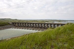
The Fort Peck Dam is famous for being on the cover of the very first issue of Life magazine. This was on November 23, 1936. The cover photo, taken by Margaret Bourke-White, showed the dam's spillway while it was still being built. Later, this photo was even used on a United States postage stamp!
The dam is also a big part of the book Bucking the Sun by Montana writer Ivan Doig. This novel tells the story of a fictional family and their roles in building the huge dam. It shows what life was like for the thousands of workers who built the Fort Peck Dam.
Another book, Fifty Cents an Hour: The Builders and Boomtowns of the Fort Peck Dam by Lois Lonnquist, shares the history of the dam's construction. It also talks about the towns that grew up around the dam and the people who lived there during the "dam days."
- Doig, Ivan (1996) Bucking the Sun, New York: Simon & Schuster, Inc. ISBN: 0-684-81171-5
- Lonnquist, Lois (2006) Fifty Cents an Hour: The Builders and Boomtowns of the Fort Peck Dam, MtSky Press ISBN: 0-9786963-0-1
See also
 In Spanish: Presa y lago de Fort Peck para niños
 | Misty Copeland |
 | Raven Wilkinson |
 | Debra Austin |
 | Aesha Ash |


