
National Register of Historic Places listings in eastern Puerto Rico facts for kids

This article explores amazing historic places in eastern Puerto Rico. These special spots are listed on the National Register of Historic Places. This list covers areas from Carolina in the northeast all the way to Arroyo in the southeast. It also includes the beautiful islands of Culebra and Vieques.
The National Register helps protect important buildings, sites, and objects that tell us about history. Think of it like a hall of fame for historical treasures! The names of these places are usually how they were first listed, even if the Spanish spelling is a bit different.
Contents
- Historic Places in Arroyo
- Historic Places in Canóvanas
- Historic Places in Carolina
- Historic Places in Ceiba
- Historic Places in Culebra
- Historic Places in Fajardo
- Historic Places in Humacao
- Historic Places in Las Piedras
- Historic Places in Loíza
- Historic Places in Luquillo
- Historic Places in Maunabo
- Historic Places in Naguabo
- Historic Places in Patillas
- Historic Places in Río Grande
- Historic Places in Vieques
- Historic Places in Yabucoa
Historic Places in Arroyo
- Faro de Punta de las Figuras
- This historic lighthouse is located southeast of Arroyo Pueblo. It was added to the National Register in 1981.
Historic Places in Canóvanas
- Villarán Bridge

Historic Places in Carolina
- Church San Fernando of Carolina
- This beautiful church dates back to 1860. You can find it on Muñoz Rivera Street, right in the Town Plaza. It became a historic site in 1984.

- Edificio Alcaldia
- This building, designed by Rafael Carmoega, was built in 1927. It's located on Sánchez Osorio Street. It was added to the National Register in 1983.
- Quebrada Maracuto
- This is an important archaeological site in the Cacao and Santa Cruz areas. It was added to the list in 2004.
Historic Places in Ceiba
- Ceiba Fire Station
- This fire station is located on Lauro Piñero Avenue. It was recognized as a historic place in 2013.
Historic Places in Culebra
- Faro Isla de Culebritas
- This lighthouse is on the small island of Culebrita. It's a very old lighthouse, added to the National Register in 1981.

Historic Places in Fajardo
- Church Santiago Apóstol of Fajardo
- This church is very old, built in 1776! It's located in the Town Plaza and was added to the National Register in 1984.
.jpg)
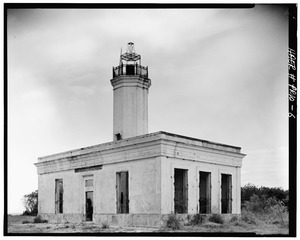
- Faro de las Cabezas de San Juan
- This lighthouse is found northeast of Soroco. It's another important lighthouse that was added to the list in 1981.

- U.S. Custom House
- This building on Union Street was built in 1930 and designed by Albert B. Nichols. It became a historic site in 1988.
Historic Places in Humacao
- Casa Roig
- This unique building on Antonio López Street was built in 1920. It's an example of Prairie School architecture. It was added to the National Register in 1977.

- Church Dulce Nombre de Jesús of Humacao
- This church, built in 1869, shows a Late Gothic Revival style. It's in the Town Plaza and was listed in 1984.

- Guzmán Family Pantheon
- This eclectic style pantheon (a monument for important people) was built in 1864. You can find it at the junction of Padre Rivera and Miguel Casillas Streets. It was added to the list in 1995.

- Humacao Customs House
- This Spanish Colonial building was designed by Julian Cruellas y Rovira and built in 1872. It's located at the junction of Marina and Aduana Streets in Punta Santiago. It became a historic site in 1995.

- Humacao District Courthouse
- This Classical Revival style courthouse, also known as Casa Alcaldía de Humacao, was built in 1925. It's at the junction of Dr. Vidal and Antonio López Streets and was listed in 1995.

- Palmira López de Pereyó House
- This Prairie School style house was designed by Francisco Valines Cofresi and built in 1930. It's located at the junction of Font Martelo and Minerva Streets. It was added to the National Register in 1995.
- Antonia Sáez School
- This school, built in 1922, features a Mission/Spanish Revival style. It's at the junction of Font Martelo and Isidro Ortiz Streets and was listed in 1995.
Historic Places in Las Piedras
- Cueva del Indio
- This important site is located north of Highway 198 in Quebrada Arenas. It was added to the National Register in 2003.
Historic Places in Loíza
- Cueva de Los Indios
- This site is in Torrecilla Baja and was added to the National Register in 1982.
- Parroquia del Espiritu Santo y San Patricio
- This church, dating back to 1729, is located in the Plaza de Loíza. It was listed as a historic place in 1976.

Historic Places in Luquillo
- Williams Products Corporation
- This site is located on Highway 992. It was added to the National Register in 2012.
Historic Places in Maunabo
- Faro de Punta de la Tuna
- This lighthouse is southeast of Puerto Maunabo. It was listed as a historic place in 1981.

Historic Places in Naguabo
- Bridge No. 122
- This bridge on Highway 3 crosses the Santiago River. It was added to the National Register in 1995.

- Church Nuestra Señora del Rosario of Naguabo
- This Spanish Colonial style church was designed by Mariano Bosch and built in 1856. It's in the Town Plaza and was listed in 1984.

- Icacos Petroglyph Group
- This site contains ancient petroglyphs (rock carvings). It was added to the National Register in 2015.
- Villa Del Mar
- Also known as "El Castillo," this building was constructed in 1917. It's located on Highway 3 and was listed in 1983.
Historic Places in Patillas
- María Dávila Semidey School
- This school on Muñoz Rivera Street was recognized as a historic place in 2012.
Historic Places in Río Grande
- Baño Grande
- This site is located on Highway 191. It was added to the National Register in 2017.
- Río Grande Fire Station
- This fire station on Juan R. González Street was listed as a historic place in 2013.
Historic Places in Vieques
- Rafael Acevedo House
- This house, built in 1900, shows a mix of Vieques Creole and Neoclassical styles. It's on Víctor Duteil Street in Isabel Segunda. It was added to the National Register in 1994.
- Algodones 2 (12VPr2-204)
- This is an important archeological site (an old village) in Puerto Diablo. It was listed in 1991.
- Algodones 3 (12VPr2-205)
- Another ancient village site in Puerto Diablo, added to the list in 1991.
- Algodones 6 (12VPr2-229)
- Yet another old village site in Puerto Diablo, listed in 1991.
- Camp Garcia (Campo Asilo) 3 (12VPr2-164)
- This site in Puerto Ferro is known for its petroglyphs (ancient rock carvings). It was added to the National Register in 1991.
- Casa Alcaldía de Vieques
- This town hall building in Isabel Segunda was built in 1850. It's at the junction of Carlos LeBrun and Benítez Guzmán Streets and was listed in 1994.

- Casa Augusto Delerme
- This "4-Room Creole House" was built in 1850. It's on Benítez Guzmán Street in Isabel Segunda and was added to the National Register in 1994.
- Casa Delerme-Anduze No. 2
- This "six-room Creole house" was built in 1876. It's on Antonio Mellado Street in Isabel Segunda and was listed in 1993.
- Casa de Jaime Puig Lemoine
- This Bungalow/Craftsman style house was designed by Jaime Puig and built in 1930. It's on 65 de Infantería Street in Isabel Segunda and was added to the National Register in 1994.
- Central Playa Grande
- This site in Llave features architecture by Matias Hjardemaal and others. It was added to the National Register in 1992.
- Delerme-Anduze House
- This Creole gallery house is on Antonio Mellado Street in Isabel Segunda. It was listed in 1994.
- Faro de Vieques
- This lighthouse, built in 1896, is located at Punta Mulas. It was added to the National Register in 1977.
.jpg)
- Fuerte de Vieques
- This fort was built in 1845 on Calle del Fuerte in Isabel Segunda. Today, it's home to the Vieques Museum of Art and History. It was listed in 1977.

- Hacienda Casa del Francés
- This plantation, built in 1910, was near Esperanza. Sadly, it was destroyed by fire in 2005. It was listed in 1977.
- Laguna Jalova Archeological District
- Also known as "Western Friendly Front Line," this important archeological area in Puerto Diablo was added to the National Register in 1992.
- Llave 13 (12VPr2-175)
- This site in Llave was added to the National Register in 1991.
- Loma Jalova 3 (12VPr2-219)
- This site in Puerto Diablo was added to the National Register in 1991.
- Monte Largo 2 (12VPr2-172)
- This site in Puerto Diablo was added to the National Register in 1991.
- Paramayón 2
- This site in Llave was added to the National Register in 1992.
- Le Pistolet (12VPr2-168)
- This site in Punta Arenas was added to the National Register in 1991.
- Playa Grande 9 (12VPr2-212)
- This site in Llave was added to the National Register in 1991.
- Playa Vieja
- This site in Punta Arenas was added to the National Register in 1992.
- Punta Jalova
- This site in Puerto Diablo was added to the National Register in 1992.
- Resolucion Historic District
- This historic district in Punta Arenas includes work designed by T. J. J. M. Le Guillou and others. It was added to the National Register in 1992.
- Smaine–Ortiz House
- This house on Antonio Mellado Street in Isabel Segunda was added to the National Register in 1994.
- Las Tumbas de J. J. María le Guillou
- This Classical Revival style site, dating from 1843, is on Highway 200 near Isabel Segunda. It was added to the National Register in 1994.
- Ventana Archeological District
- This archeological district in Llave was added to the National Register in 1992.
- Ventana 4 (12VPr2-171)
- This site in Punta Arenas was added to the National Register in 1991.
- Vieques Pharmacy
- This pharmacy building is at the junction of Carlos LeBrun and Víctor Duteil Streets in Isabel Segunda. It was added to the National Register in 1994.
- Yanuel 8 (12VPr2-173)
- This site in Puerto Diablo was added to the National Register in 1991.
- Yanuel 9 (12VPr2-220)
- This site in Puerto Diablo was added to the National Register in 1991.
Historic Places in Yabucoa
- Yabucoa Fire Station
- This fire station on Luis Muñoz Rivera Street was recognized as a historic place in 2013.

All content from Kiddle encyclopedia articles (including the article images and facts) can be freely used under Attribution-ShareAlike license, unless stated otherwise. Cite this article:
National Register of Historic Places listings in eastern Puerto Rico Facts for Kids. Kiddle Encyclopedia.