National Register of Historic Places listings in Clarke County, Virginia facts for kids
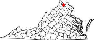
This article is about the amazing historic places in Clarke County, Virginia, United States. These special places are listed on the National Register of Historic Places. This list helps protect important buildings, sites, and areas that tell us about the past.
Clarke County has 41 properties and districts on this list. Two of them are even more special and are called National Historic Landmarks! They are like national treasures because they are so important to American history.
Contents
What is the National Register of Historic Places?
The National Register of Historic Places is the official list of the nation's historic places worth saving. It's like a special club for buildings, sites, and objects that are important to American history, architecture, archaeology, engineering, or culture. When a place is added to this list, it means it's recognized for its value and can sometimes get help for preservation.
Historic Gems in Clarke County
Clarke County is full of history, and many of its old buildings and areas are protected. Let's explore some of these fascinating places!
Greenway Court: A Home for a Lord and a Surveyor
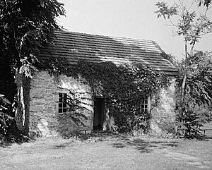
One of Clarke County's most important historic sites is Greenway Court. It was once the huge estate of Thomas Fairfax, 6th Lord Fairfax of Cameron. He was the only British noble (a "peer") to ever live in America! Imagine owning 5 million acres of land – that's how much he had!
A very famous person, George Washington, worked here as a young surveyor. He helped map out parts of Lord Fairfax's vast lands. This makes Greenway Court a truly special place, connecting us to the early days of America and one of its most famous leaders.
Saratoga: A Hero's Home
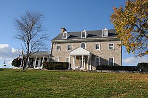
Another National Historic Landmark in Clarke County is Saratoga, located near Boyce. This beautiful house is made of gray limestone and was built in the Georgian style. It was the home of Brigadier General Daniel Morgan.
General Morgan was a hero of the American Revolutionary War. He is best known for his amazing victory over the British army at the Battle of Cowpens in 1781. His home, Saratoga, reminds us of his bravery and important role in winning America's freedom.
Old Mills and Historic Towns
Clarke County also has many other interesting places.
Burwell-Morgan Mill
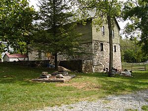
The Burwell-Morgan Mill in Millwood is a very old gristmill. Gristmills were super important long ago because they ground grain into flour. This mill shows us how people lived and worked in the past. It's a great example of early American industry.
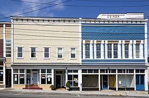
Berryville Historic District
The Berryville Historic District includes the main parts of Berryville. When you walk through this district, you can see many old buildings that tell the story of the town's growth. It's like stepping back in time to see how people lived and shopped.
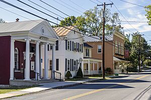
Boyce Historic District
Similar to Berryville, the Boyce Historic District protects many historic buildings in the town of Boyce. These districts help keep the unique look and feel of these old towns alive for future generations.
Important Schools and Farms
History isn't just about grand houses; it's also about everyday life and important community places.
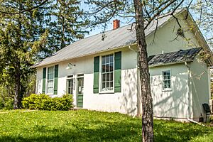
Josephine City School
The Josephine City School in Berryville is a significant site. It was an important school for African American children in the past. It reminds us of the history of education and the challenges and triumphs of different communities.
Blandy Experimental Farm Historic District
The Blandy Experimental Farm Historic District near Boyce is a unique place. It's a farm that has been used for scientific research, especially in plants and trees, for many years. It combines history with science and education.
Battlefields and Rural Landscapes
Clarke County also played a role in the American Civil War.
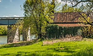
Cool Spring Battlefield
The Cool Spring Battlefield near Berryville is where a battle took place during the Civil War. Preserving battlefields helps us remember the sacrifices made and understand important moments in our nation's history.
Long Marsh Run Rural Historic District
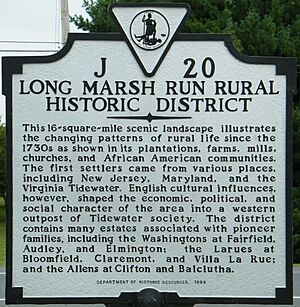
The Long Marsh Run Rural Historic District protects a large area of rural land. This district helps keep the beautiful countryside and historic farms of Clarke County looking much like they did many years ago. It shows us how important farming and the landscape were to the area's development.
Images for kids


