
National Register of Historic Places listings in Hamilton County, Ohio facts for kids

This page lists special places in Hamilton County, Ohio, United States, that are part of the National Register of Historic Places. Think of the National Register as an official list of buildings, sites, and objects that are important to American history, architecture, archaeology, engineering, or culture. When a place is added to this list, it means it's recognized for its unique value and efforts are made to protect it.
There are 373 historic places in Hamilton County on this list. This includes 14 places that are so important they are called National Historic Landmarks. Most of these, 277 to be exact, are located in the city of Cincinnati and have their own separate list. This page focuses on the other 96 historic places found outside of Cincinnati, including three National Historic Landmarks.
Contents
What is the National Register of Historic Places?
The National Register of Historic Places is the official list of the nation's historic places worth saving. It's managed by the National Park Service, which is part of the U.S. government.
Why are places listed?
Places are listed because they tell important stories about our past. They might be:
- Buildings where famous people lived or important events happened.
- Sites like old battlefields or ancient villages.
- Structures such as bridges or monuments.
- Objects like sculptures or even old ships.
- Districts which are groups of buildings or sites that together have historical importance.
Being on the list helps people understand and appreciate these places. It also helps protect them from being destroyed or changed too much.
Historic Places Outside Cincinnati
Hamilton County has many interesting historic spots outside the main city of Cincinnati. These places include old houses, schools, churches, and even ancient Native American sites. They show us how people lived, worked, and built communities long ago.
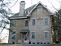
Notable Historic Homes
Many homes in Hamilton County are on the National Register because of their unique architecture or the important people who lived there.
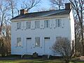
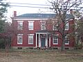
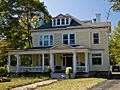
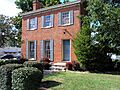
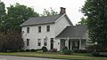
- The Joseph W. Baldwin House in Wyoming, Ohio is a beautiful example of older homes in the area.
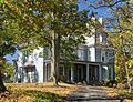
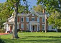
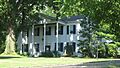
- The Joseph and Cecilia Bappert House in Green Township also holds a spot for its historical value.
- The Eliphalet Ferris House in Mariemont, Ohio and the Joseph Ferris House in Fairfax, Ohio are other examples of significant family homes.
- The Blair House in Montgomery, Ohio and the Cyrus Broadwell House in Anderson Township are also recognized.
Important Archeological Sites
Hamilton County is home to several ancient sites that teach us about early people who lived here.
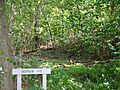
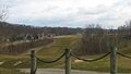
- The Benham Mound in Amberley, Ohio is an ancient earthwork.
- The Clough Creek and Sand Ridge Archeological District in Anderson Township contains important clues about past civilizations.
- The Colerain Works Archeological District and the Dunlap Archeological District in Colerain Township are also significant.
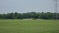
- The Shawnee Lookout Archeological District in Miami Township is a large area with many ancient features.
- The State Line Archeological District even stretches across the border into Indiana, showing how ancient cultures spread across regions.
Other Historic Buildings and Districts
Beyond homes and ancient sites, other types of places are listed.
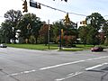
- The Glendale Historic District in Glendale, Ohio is a special area recognized as a National Historic Landmark District. This means the entire neighborhood is important for its history and design. The Glendale Police Station is also listed.
- The Greenhills Historic District in Greenhills, Ohio is another National Historic Landmark District. It was one of the planned communities built during the Great Depression.
- The Mariemont Historic District in Mariemont, Ohio is also a National Historic Landmark District, known for its unique design as a "garden suburb."
- The William Henry Harrison Tomb State Memorial in North Bend, Ohio is the burial place of the 9th U.S. President.
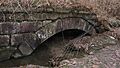
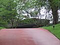
- The Jediah Hill Covered Bridge in Springfield Township is a historic bridge.
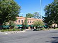
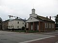
- The Norwood Municipal Building in Norwood, Ohio is an important public building.
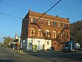
- The United States Playing Card Company Complex in Norwood, Ohio shows the history of industry in the area.
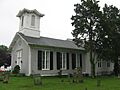
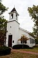
- The Wyoming Presbyterian Church in Wyoming, Ohio is a beautiful historic church.
These are just a few examples of the many interesting and important places in Hamilton County that are preserved for future generations to learn from and enjoy.
Images for kids
-
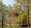
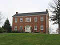
Joseph W. Baldwin House
-
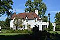
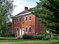
Joseph and Cecilia Bappert House
-
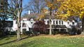
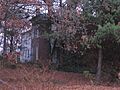
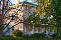
James Baxter House
-
Becker House
-
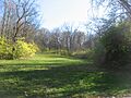
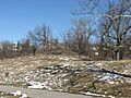
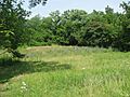
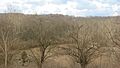
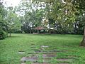
Benham Mound
-

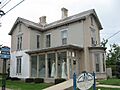
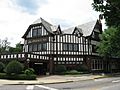
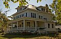
George Bennett House
-
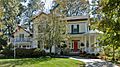
Blair House
-

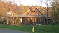
Cyrus Broadwell House
-
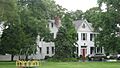
Jacob Bromwell House
-
Brown-Gorman Farm
-
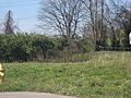
Burchenal Mound
-
Wesley Butler Archeological District
-
Hugh Campbell House
-
Cheviot Fieldhouse
-
Cincinnati and Whitewater Canal Tunnel
-
Clough Creek and Sand Ridge Archeological District
-
Clovernook
-
Colerain Works Archeological District
-
Conrad Mound Archeological Site
-
Dravo Gravel Site
-
Dunlap Archeological District
-
William Edwards Farmhouse
-

Eighteen Mile House
-
Elliott House
-
Charles Fay House
-
Eliphalet Ferris House
-
Joseph Ferris House
-
Glendale Historic District
-
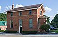
Glendale Police Station
-
Greenhills Historic District
-
Hahn Field Archeological District
-
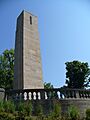
William Henry Harrison Tomb State Memorial
-
Harrison-Landers House
-
Elmer Hess House
-
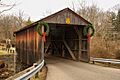
Jediah Hill Covered Bridge
-
Jefferson Schoolhouse
-
Jehu John House
-
Josiah Kirby House
-
Gretchen Kroger Barnes Graf House
-
Othniel Looker House
-
Luethstrom-Hurin House
-
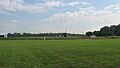
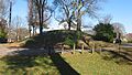
Mariemont Embankment and Village Site
-
Mariemont Historic District
-

Mathew Mound
-
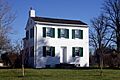
Thomas Miller House
-
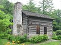
Miller-Leuser Log House
-
Montgomery Saltbox Houses
-
Charles H. Moore House
-
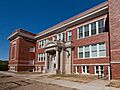
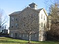
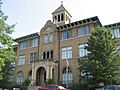
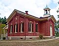
Mount Healthy Public School
-
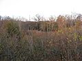
Mount Nebo Archaeological District
-
Norwood Mound
-
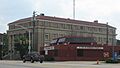
Norwood Municipal Building
-
Nurre-Royston House
-
Odd Fellows' Cemetery Mound
-
Old Gothic Barns
-
Professor William Pabodie House
-
Perin Village Site
-
Pine Meer
-
John C. Pollock House
-
Rennert Mound Archeological District
-
W.C. Retszch House
-
Riddle-Friend House
-
Roudebush Farm
-
St. Francis Seminary
-
Salem Methodist Church Complex
-
Louis Sawyer House
-
Shawnee Lookout Archeological District
-
Edwin M. Shield's House
-
Smith-Jessup House
-

State Line Archeological District
-
Edward R. Stearns House
-
William Stearns House
-
Sunny Knolls-Gordon E. Pape House
-
John Tangeman House
-
Gerald B. and Beverley Tonkens House
-
Turpin Site
-
Twelve Mile House
-
Twin Oaks
-
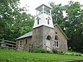
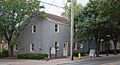
United Brethren in Christ
-
United Methodist Church
-
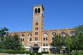
United States Playing Card Company Complex
-
Universalist Church Historic District
-
Village Historic District
-
Village of Addyston Historic District
-
Waldschmidt-Camp Dennison District
-
John Aston Warder House
-
Washington Heights School
-
James Whallon House
-
Whitewater Shaker Settlement
-
Wilder-Swaim House
-
W. L. Williams House
-
Charles Woodruff House
-
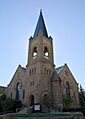
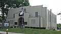
Wyoming Presbyterian Church
-
Yost Tavern


