National Register of Historic Places listings in LaSalle County, Illinois facts for kids
This article is about the amazing historic places in LaSalle County, Illinois, that are listed on the National Register of Historic Places. Think of it like a special list of buildings, areas, and sites that are important to history in the United States. These places are worth protecting and remembering!
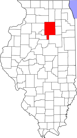
There are 32 different places in LaSalle County on this list. Three of them are even more special and are called National Historic Landmarks. You can often find their exact locations on a map using their latitude and longitude coordinates.
Contents
Exploring LaSalle County's Historic Treasures
What is the National Register of Historic Places?
The National Register of Historic Places is the official list of places in the U.S. that are important for their history, architecture, archaeology, engineering, or culture. When a place is added to this list, it means it's recognized as a significant part of our country's past. This helps to protect these places and teach people about them.
A National Historic Landmark is an even higher level of recognition. These are places that are considered to be of exceptional national importance. LaSalle County is lucky to have three of these!
Famous Landmarks in LaSalle County
LaSalle County has some truly special places that are recognized as National Historic Landmarks.
Starved Rock: A Natural Wonder
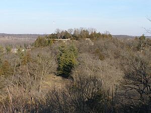
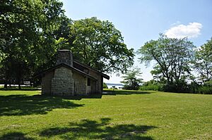
One of the most famous landmarks is Starved Rock, located in Starved Rock State Park near Utica. This amazing sandstone bluff is not only beautiful but also has a rich history, including stories from Native American tribes. It was listed as a National Historic Landmark on October 15, 1966.
Old Kaskaskia Village: Ancient History
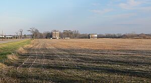
Also near Ottawa, on the northern side of the Illinois River, you'll find the Old Kaskaskia Village site. This area is important because it was once a large village of the Kaskaskia people, a Native American tribe. It became a National Historic Landmark on the same day as Starved Rock, October 15, 1966.
Hegeler-Carus Mansion: A Grand Home
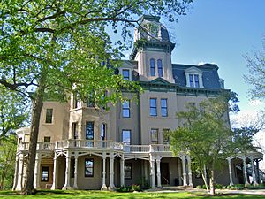
The Hegeler Carus Mansion in LaSalle is a stunning historic house. It was built in the late 1800s and is known for its amazing architecture and design. This mansion became a National Historic Landmark on August 9, 1995. It's a great example of the grand homes built during that time.
Other Important Historic Places
Beyond the National Historic Landmarks, many other sites in LaSalle County are on the National Register. These places tell different stories about the area's past.
Buildings with Cool Stories
- Armour's Warehouse in Seneca: This old warehouse, located at the junction of William and Bridge Streets, was listed on November 7, 1997. It reminds us of the industrial past of the area.
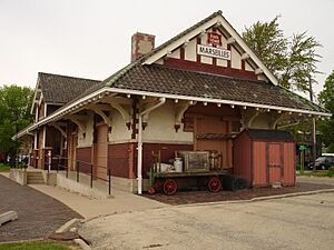
- Chicago, Rock Island and Pacific Railroad Depot in Marseilles: Found at 150 Washington Street, this train station was added to the list on November 7, 1995. Train depots were once very busy places, connecting towns and people.
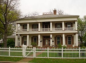
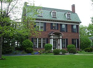
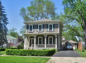
- Fisher–Nash–Griggs House in Ottawa: This historic home at 1333 Ottawa Avenue was listed on November 27, 1998. It gives us a peek into how people lived in the past.
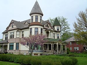
- Ruffin Drew Fletcher House in Streator: Located at 609 East Broadway Street, this house joined the list on August 5, 1991.
- Hauge Lutheran Church in Sheridan: This church at 3656 East 2631st Road was listed on April 26, 2016. Churches often play a big role in a community's history.
- Julius W. Hegeler I House in LaSalle: Another historic home in LaSalle, at 1306 7th Street, listed on February 18, 2009.
- John Hossack House in Ottawa: This house at 210 West Prospect Street was listed way back on March 16, 1972.
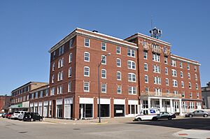
- Hotel Kaskaskia in LaSalle: This historic hotel at 217 Marquette Street was listed on November 3, 1988. Hotels were important gathering places in towns.
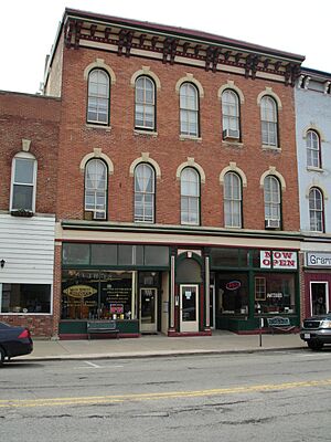
- Knuessl Building in Ottawa: At 215-217 West Main Street, this building was listed on May 11, 1992.
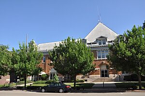
- LaSalle City Building in LaSalle: The city's official building at 745 2nd Street was listed on August 29, 1985.
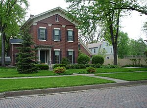
- Andrew J. O'Conor III House in Ottawa: This house at 637 Chapel Street was listed on April 22, 1993.
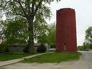
- Ransom Water Tower in Ransom: This water tower on Plumb Street was listed on November 2, 1990. Water towers are important for a town's water supply.
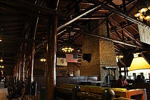
- Starved Rock Lodge and Cabins in Utica: Located within Starved Rock State Park, this lodge was listed on May 8, 1985. It's a beautiful place for visitors to stay.
- Jeremiah Strawn House in Ottawa: This house at 532 Congress Street was listed on January 24, 1995.
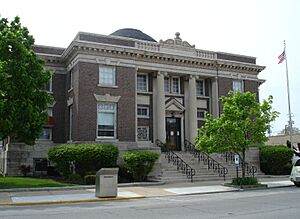
- Streator Public Library in Streator: The library at 130 South Park Street was listed on May 2, 1996. Libraries are important centers for learning and community.
- Silas Williams House in Streator: This home at 702 East Broadway was listed on June 23, 1976.
Important Natural and Cultural Sites
- Corbin Farm Site in Utica: This archaeological site is located between Illinois Route 71 and the Illinois River. It was listed on June 18, 1998, and helps us understand ancient cultures.
- Hotel Plaza Site in Utica: Northeast of the lodge at Starved Rock State Park, this site was listed on June 18, 1998.
- Little Beaver Site in Utica: Also within Starved Rock State Park, west of Illinois Route 178, this site was listed on June 18, 1998.
- Shaky Shelter Site in Utica: This site is in a ravine south of Illinois Route 71 at Starved Rock State Park. It was listed on June 18, 1998. Archaeological sites like these can reveal a lot about early human life.
- Spring Valley House-Sulfur Springs Hotel in Utica: Located on Dee Bennett Road, this site was listed on November 20, 1987. It was once a hotel, possibly known for its natural springs.
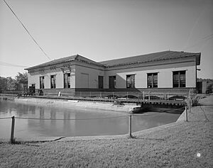
- Marseilles Hydro Plant in Marseilles: This plant on Commercial Street was listed on May 9, 1989. It's an example of early power generation.
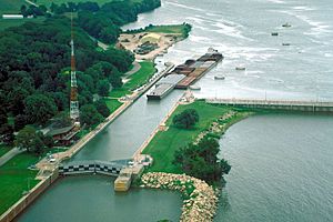
- Marseilles Lock and Dam Historic District in Marseilles: This district at 1 Hawk Drive was listed on March 10, 2004. Locks and dams are important for river navigation.
- Starved Rock Lock and Dam Historic District in Utica: This district on Dee Bennett Road was listed on March 10, 2004. Like Marseilles, it shows the importance of controlling river flow.
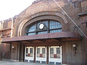
- Westclox Manufacturing Plant Historic District in Peru: This former factory at 300-315 5th Street was listed on June 1, 2007. It was once a major clock and watch manufacturer.
Historic Districts to Explore
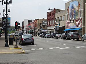
- Ottawa Commercial Historic District in Ottawa: This district, roughly covering parts of Columbus and LaSalle Streets, was listed on November 22, 2011. It includes many historic shops and buildings.
- Ottawa East Side Historic District in Ottawa: This district, between the Illinois and Fox Rivers, was listed on September 18, 2013. It features many historic homes and buildings.
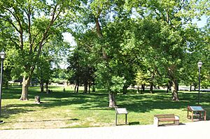
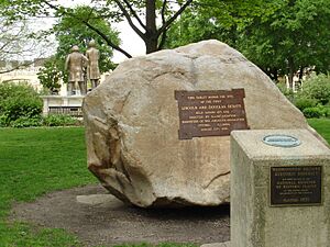
- Washington Park Historic District in Ottawa: Bounded by Jackson, LaSalle, Lafayette, and Columbus Streets, this district was listed on April 11, 1973. It's famous for being the site of one of the Lincoln-Douglas debates.


