
National Register of Historic Places listings in Linn County, Oregon facts for kids
Imagine a special list that helps protect important old buildings, places, and structures across the United States! This list is called the National Register of Historic Places. It's like a hall of fame for historical sites. When a place is added to this list, it means it's special and worth preserving for future generations. Linn County, Oregon, has many amazing places on this list, from old barns and houses to bridges and even parts of old roads. These sites tell us stories about the past and how people lived, worked, and traveled long ago in Linn County.
| Top - 0-9 A B C D E F G H I J K L M N O P Q R S T U V W X Y Z |
Historic Buildings and Homes in Linn County
Many of Linn County's historic places are old buildings and homes that show us what life was like in the past. These structures often have unique designs and tell stories about the families who lived or worked there.
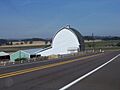
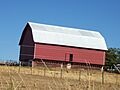
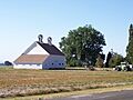
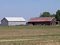
Farms and Barns: A Look at Rural Life
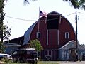
Farms and barns were very important in Linn County's history, as agriculture was a major part of life.
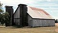
The Aegerter Barn: A Family's Legacy
The David and Maggie Aegerter Barn is a great example of a historic farm building. It was built by the Aegerter family, who were early settlers in the area near Scio. This barn, listed in 1999, shows us the kind of farming that happened in Linn County many years ago.

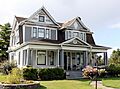
The Archibald Farmstead: A Glimpse into the Past
The Steven and Elizabeth Archibald Farmstead near Tangent was added to the list in 2004. A farmstead includes not just the house but also other buildings like barns and sheds, giving a full picture of a historic farm.
The Cochran Barn: A Piece of Brownsville History
Near Brownsville, you can find the William Cochran Barn, listed in 1999. Barns like this one are important because they show how farming methods and building styles have changed over time.
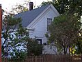
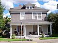
Notable Houses: Stories Within Walls
Many houses in Linn County are on the National Register because of their unique architecture or the important people who lived in them.
The Granville H. Baber House: A Historic Home
The Granville H. Baber House, located northeast of Albany, was listed in 1975. This house is a reminder of the early residents and their contributions to the community.

The George Earle Chamberlain House: A Governor's Home
In Albany, the George Earle Chamberlain House became a historic site in 1980. George Earle Chamberlain was a very important person; he served as the Governor of Oregon and later as a U.S. Senator! His house tells us about his life and the history of Oregon's leaders.

The John M. Moyer House: A Brownsville Landmark
The John M. Moyer House in Brownsville was listed way back in 1974. It's one of the older listings in the county and stands as a landmark in the town.
.jpg)
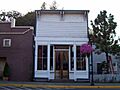
Historic Districts and Commercial Buildings
Sometimes, it's not just one building that's important, but a whole group of buildings or an area. These are called historic districts.
Albany's Downtown Commercial Historic District
The Albany Downtown Commercial Historic District was added to the list in 1982. This area includes many old shops and businesses in downtown Albany. It shows how the city grew and how people used to shop and work in the past. Walking through this district is like taking a step back in time!

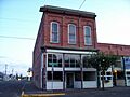
The Flinn Block: An Old Business Place
The Flinn Block in Albany, listed in 1979, is an example of an old commercial building. These buildings often have interesting architectural details and were once busy centers of trade and community life.

The C. J. Howe Building: A Brownsville Business
In Brownsville, the C. J. Howe Building was listed in 1980. This building likely housed businesses that were important to the local economy many years ago.

Historic Mills and Industry
Mills were crucial for processing crops and goods, playing a big role in the economy of early Linn County.
The Albany Custom Mill: Processing Goods
The Albany Custom Mill on Water Street in Albany was listed in 1980. Mills like this one were essential for turning raw materials, like grain, into useful products. They were often at the heart of a town's industry.

The Boston Flour Mill: A Glimpse of Grain Processing
East of Shedd, the Boston Flour Mill was added to the list in 1979. Flour mills were vital for making flour from wheat, which was a staple food. This mill shows us how food was produced in the past.

Elkins Flour Mill: Another Important Mill
The Elkins Flour Mill in Lebanon, listed in 1995, is another example of a historic mill. Its location near a canal and railroad tracks shows how important transportation was for these industries.

Historic Transportation and Infrastructure
How people traveled and moved goods around was very different in the past. Bridges and old roads tell us a lot about this.
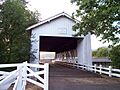
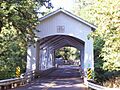
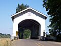
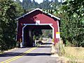
Covered Bridges: A Unique Part of Oregon's History
Linn County is famous for its beautiful covered bridges. These bridges were built with roofs to protect the wooden structures from rain and snow, making them last longer.
Crabtree Creek-Hoffman Covered Bridge
The Crabtree Creek-Hoffman Covered Bridge near Crabtree was listed in 1987. It's a picturesque example of these historic crossings.

Hannah Bridge: A Historic Crossing
The Hannah Bridge near Scio, listed in 1979, is another charming covered bridge. These bridges are not just ways to cross water; they are also beautiful pieces of engineering from the past.

Larwood Bridge: A Scenic Spot
Also near Crabtree, the Larwood Bridge was added in 1979. Many people enjoy visiting these old bridges because they offer a glimpse into a simpler time and are often in scenic locations.

Historic Roads: Pathways of the Past
Some old roads themselves are considered historic because of their importance in connecting communities.
McKenzie Highway Historic District: A Mountain Pass
The McKenzie Highway Historic District (Oregon Route 242) was listed in 2011. This road goes through the Cascade Mountains, connecting areas like Sisters and Belknap Springs. It was a challenging road to build and use, showing the determination of early travelers and engineers.
_(desD0010).jpg)
Santiam Wagon Road: An Early Trail
The Santiam Wagon Road, listed in 2010, was an important route through the Willamette National Forest and Deschutes National Forest. It was an early wagon trail used by pioneers and settlers to cross the mountains, playing a big role in the development of Oregon.

Oregon Pacific Railroad Linear Historic District: A Railroad Dream
This fascinating historic district, listed in 1999, is a section of an old railroad grade between Idanha and the Cascade Range summit. In the late 1800s, a man named Thomas Egenton Hogg tried to build a railroad all the way across the country, ending at the Oregon Coast. He didn't finish it, but the parts that were built, including this section, show us how difficult and ambitious these projects were. The remaining parts of the grade and old construction camps give us a unique look at how railroads were built and what life was like for the workers back then.

Other Significant Historic Sites
Linn County also has other types of historic places, like cemeteries and churches, which are important for understanding community life and beliefs.
Albany Hebrew Cemetery: A Place of Remembrance
The Albany Hebrew Cemetery, listed in 2015, is a significant historical site. Cemeteries are important because they tell us about the people who lived in an area, their cultures, and their traditions. This cemetery is a place of remembrance for the Jewish community in Albany.

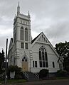
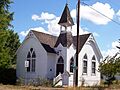
First Baptist Church of Brownsville: A Community Hub
The First Baptist Church of Brownsville, listed in 1991, is an example of a historic church. Churches often served as important community centers, not just for worship but also for social gatherings and events.

Lebanon Pioneer Cemetery: Honoring Early Settlers
The Lebanon Pioneer Cemetery, listed in 1998, is another important burial ground. Pioneer cemeteries are especially valuable because they hold the graves of the very first settlers and founders of a town, giving us a direct link to the past.

Former Listings: Places That Changed
Sometimes, a place that was once on the National Register of Historic Places might be removed. This usually happens if the building is destroyed, moved, or changed so much that it no longer has its historic value.
Angell-Brewster House: A Lost Home
The Angell-Brewster House near Lebanon was listed in 1992 but was removed in 2011 because it was sadly demolished in 2010. This shows why it's so important to protect these historic places.

St. Mary's Roman Catholic Church: Destroyed by Fire
St. Mary's Roman Catholic Church in Albany was listed in 1975 but removed in 1990 after it was destroyed by a fire in 1989.
Weddle Bridge: A Relocated Bridge
The Weddle Bridge near Crabtree was listed in 1979 but removed in 1989 because it was relocated in 1987. Even though it moved, it's still a part of Linn County's history!

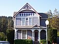
Images for kids
-

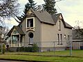
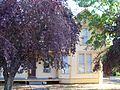
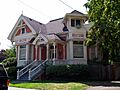
A home in the Albany Monteith Historic District.
-
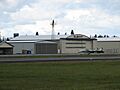
A hangar at the Albany Municipal Airport.
-
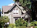
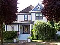
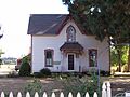
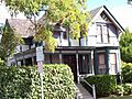
The Jerry Andrus House in Albany.
-
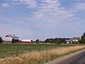
The Steven and Elizabeth Archibald Farmstead.
-
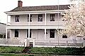
The Hiram Baker House in Lebanon.
-
The Dr. J. C. Booth House in Lebanon.
-
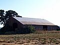
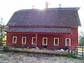
The Hugh Leeper Brown Barn.
-
The John and Amelia Brown Farmhouse.
-
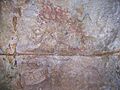
Markings inside Cascadia Cave.
-
The Matthew C. Chambers Barn.
-
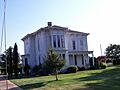
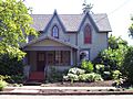
The George C. Cooley House.
-
The Louis A. Crandall House.
-
The Crawfordsville Bridge.
-
The Henry and Mary Cyrus Barn.
-
The Alfred Dawson House.
-
The Hugh Fields House.
-
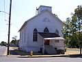
The First Evangelical Church of Albany.
-
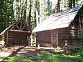
The Fish Lake Guard Station.
-
A house in the Hackleman Historic District.
-
The Harrisburg Odd Fellows Hall.
-
The George Hochstedler House.
-
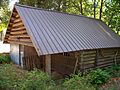
The Independence Prairie Ranger Station.
-
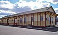
The Lebanon Southern Pacific Railroad Depot.
-
The Hector and Margaret Macpherson Barn.
-
The Marion Forks Guard Station.
-
The Joseph and Barbara Maurer House.
-
The Methodist Episcopal Church South.
-
The Gottlieb and Della Milde Barn.
-
The Thomas and Walter Monteith House.
-
The John and Mary Moore House.
-
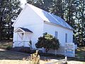
The Mt. Pleasant Presbyterian Church.
-
The Moses Parker House.
-
The E. C. Peery Building.
-

The Porter-Brasfield House.
-
The John and Lottie Ralston Cottage.
-
The John Ralston House.
-
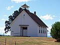
The Rock Hill School.
-
The Ross-Averill House.
-
The Michael and Mary Ryan Barn.
-
The Short Bridge.
-
The James Alexander and Elmarion Smith Barn.
-
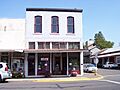
The Starr and Blakely Drug Store.
-
The Gus and Emma Stellmacher Farmstead.
-
The Thomas Creek-Gilkey Covered Bridge.
-
The Thomas Creek-Shimanek Covered Bridge.
-
The United Presbyterian Church and Rectory.
-
The United Presbyterian Church of Shedd.
-
The Joseph Wesely House.
-
The Wigle Cemetery.
-
The Abraham and Mary Wigle House.
-
The Jacob and Maranda K. Wigle Farmstead.
-
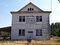
The Z.C.B.J. Tolstoj Lodge No. 224.


See also
- National Register of Historic Places listings in Oregon
- Listings in neighboring counties: Benton, Deschutes, Jefferson, Lane, Marion, Polk
- Historic preservation
- History of Oregon
- Lists of Oregon-related topics
External links
- Oregon Parks and Recreation Department, National Register Program
- National Park Service, National Register of Historic Places site
