
National Register of Historic Places listings in Salt Lake County, Utah facts for kids

Have you ever wondered about the old buildings and special places around you? Many places have amazing stories from the past! In Salt Lake County, Utah, there's a list of these important spots called the National Register of Historic Places. This list helps protect buildings, areas, and objects that are special because of their history, design, or what happened there. Think of it like a hall of fame for historic sites!
Salt Lake County is a big area in Utah. While many historic places are in Salt Lake City itself (and they have their own list!), this article focuses on the cool historic spots found in other parts of the county. There are over 140 of these special places outside of Salt Lake City. Some are even called National Historic Landmarks, which means they are super important to the history of the entire United States!
Contents
What are Historic Places?
The National Register of Historic Places is a list kept by the United States government. It includes places that are important to American history, architecture, archaeology, engineering, or culture. When a place is added to this list, it means it's recognized as valuable and worth preserving for future generations. It's a way to celebrate and protect our past!
Salt Lake County's Special Spots
Salt Lake County is home to many unique historic places. These include old houses, schools, churches, and even a huge mine! Each one tells a part of Utah's story. Let's look at some examples of these amazing sites.
Famous Landmarks
Two places in Salt Lake County are so important they are called National Historic Landmarks:
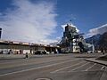
- Bingham Canyon Open Pit Copper Mine: This is a giant mine near Copperton. It's one of the biggest open-pit mines in the world! It shows how important mining was to Utah's history. It became a landmark in 1966.
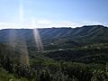
- Emigration Canyon: Located on the eastern edge of Salt Lake City, this canyon is famous for being the route that pioneers took when they first arrived in the Salt Lake Valley. It's a key part of Utah's settlement story and was named a landmark in 1966.
Cool Historic Buildings
Many other buildings in Salt Lake County are also on the National Register. Here are just a few examples:
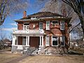
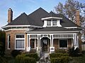
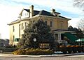
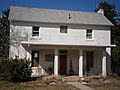
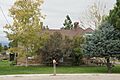
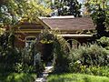
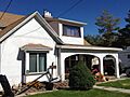
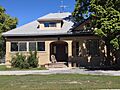
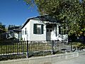
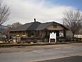
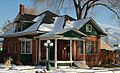
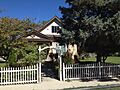
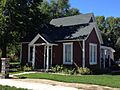
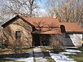
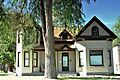
- J. R. Allen House in Draper: This house was listed in 1980. It's an example of the kind of homes built in the area long ago.
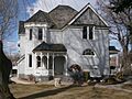
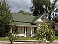
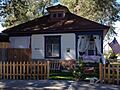
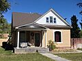
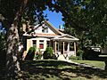
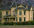
- Nathaniel Baldwin House in Millcreek: Nathaniel Baldwin was an inventor, famous for creating early headphones! His house was added to the list in 1985.
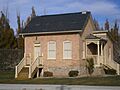
- Draper Park School in Draper: Built in 1980, this old school building reminds us of how education used to look in the community.
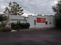
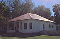
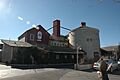
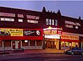
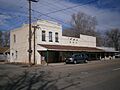
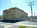
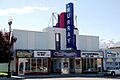
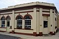
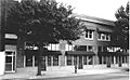
- Empress Theatre in Magna: This theater, listed in 1985, was once a popular spot for entertainment. Imagine watching a movie here decades ago!
- Gardner Mill in West Jordan: This mill, listed in 1982, shows how people used to process goods and materials in the past.
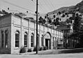
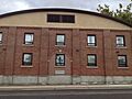
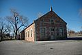
- Granite Paper Mill in Cottonwood Heights: This old paper mill, listed in 1971, highlights the early industries in the area.
- Hawarden in West Valley City: This historic home, listed in 1980, has a unique name and a long history.
- Iris Theater, Apartments and Commercial Building in Murray: Listed in 2001, this building was a hub for movies and businesses in Murray.
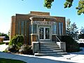
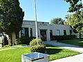
- Midvale City Hall in Midvale: This building, listed in 1994, used to be where the city's government operated. It's now a community building.
- Murray Theater in Murray: Another historic theater, listed in 2001, that was important for entertainment in Murray.
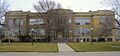
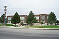
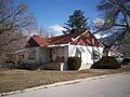
- Riverton Elementary School in Riverton: This school, listed in 1996, now serves as the Riverton City Office, showing how old buildings can find new uses.
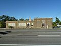
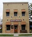
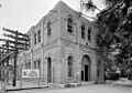
- Sandy City Bank in Sandy: Listed in 1997, this old bank building shows what financial places looked like in the past.
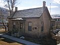
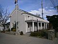
- Sandy Tithing Office in Sandy: This building, listed in 1985, was used by members of The Church of Jesus Christ of Latter-day Saints to donate goods and money.
- Henry J. Wheeler Farm in Murray: This farm, listed in 1976, is a great example of a historic farmstead and is now a popular spot for visitors to learn about farm life.
Historic Districts
Sometimes, a whole area or group of buildings is historic. These are called "historic districts."
- Copperton Historic District in Copperton: This district, listed in 1986, includes many buildings that show what life was like in this mining town.
- Evergreen Avenue Historic District in Millcreek: This area, listed in 2007, has many historic homes and buildings that tell a story about the community's growth.
- Granite Hydroelectric Power Plant Historic District in Cottonwood Heights: Listed in 1989, this district includes an old power plant that used water to create electricity.
- Murray Downtown Historic District in Murray: This area, listed in 2006, has many important buildings that were part of Murray's main business and social center.
- Sandy Historic District in Sandy: This district, listed in 2007, covers a significant part of Sandy's old town center, showing its development over time.
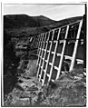
- Stairs Station Hydroelectric Power Plant Historic District in Big Cottonwood Canyon: Another hydroelectric power plant district, listed in 1989, showing early ways of generating power.
Places That Used to Be Listed
Sometimes, a historic place might be removed from the National Register. This can happen if the building is torn down or changed so much that it loses its historic importance. For example, the Jordan High School in Sandy was listed in 1984 but was later removed because it was demolished in 1997. The Utah-Idaho Sugar Factory in West Jordan was also delisted after it was torn down in 2011.
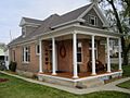
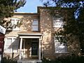
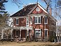
Images for kids
-
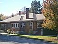
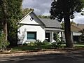
J. R. Allen House
-
Charles M. and Fannie M. Allsop Anderson House
-

Frederick C. and Anna Anderson House
-
John A. Anderson House
-
Y. Martin and Hannah Nelson Anderson House
-
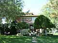
Nathaniel Baldwin House
-
Bateman Agriculture and Development Company
-
Reid Beck House
-
Amanda Conk Best House
-
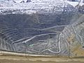
Bingham Canyon Open Pit Copper Mine
-

Ernie and Irmgard Bourne House
-
Brady-Brady House
-
Brinton-Dahl House
-
David B. Brinton House
-
John P. Cahoon House
-
Santa Anna Casto House
-
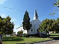
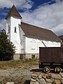
Copperton Community Methodist Church
-
Crescent Elementary School
-
Crossgrove House
-

Arthur and Ellen Cushing House
-
James and Maria Long Cushing House
-
Draper Park School
-
Draper Poultrymen and Egg Producers' Plant
-
Draper-Steadman House
-
Emigration Canyon
-
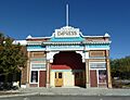
Empress Theatre
-
Evergreen Avenue Historic District
-
Benjamin and Jane Cook Farrer House
-
John William Farrer House
-
Perry and Agnes Wadsworth Fitzgerald House
-
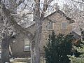
Gardner Mill
-
Archibald R. and Violet Clark Gardner House
-
Granite Hydroelectric Power Plant Historic District
-
Granite LDS Ward Chapel-Avard Fairbanks Studio
-
Granite Paper Mill
-
Riley H. and Sarah Ann Russell Graves House
-
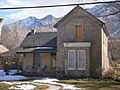
Hawarden
-
Anders Hintze House
-
Abba R. Holman Block
-
Iris Theater, Apartments and Commercial Building
-
Amos and Ida Jensen House
-
James B. and Ellen May Cushing Jensen House
-
Michael Jensen House
-
Jensen-Jensen House
-
David and Hattie S. Rasmuson Johnson House
-
John A. and Annie C. Olsen Johnson House
-
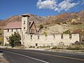
Kearns-St. Ann's Orphanage
-

Little Dell Station
-
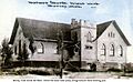
Magna Community Baptist Church
-
John and Mary Mattson House
-
David McDonald House
-
Benjamin and Olivia Meek House
-
Joseph E. and Mina W. Mickelsen House
-
S.J. Mickelsen Hardware Store and Lumber Yard
-
Hyrum and Mary A. Terry Peterson Mickelson House
-
Midvale City Hall
-
Mountain Dell Dam
-
Murray City Diesel Power Plant
-
Murray Downtown Historic District
-
Murray Downtown Residential Historic District
-
Murray LDS Second Ward Meetinghouse
-
Murray Theater
-
August M. and Mabel Jensen Nelson House
-
John and Elizabeth Brown Oldham House
-
Mary Ellen Parmley House
-
Edward Pugh House
-
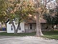
Riverton Elementary School
-
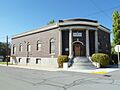
Salt Lake County Library
-
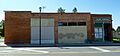
Sandy City Bank
-
Sandy Co-Op Block
-
Sandy Historic District
-
Sandy LDS Stake Recreational Hall
-
Sandy Second Ward Chapel
-
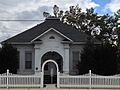
Sandy Tithing Office
-
Lauritz H. and Emma Smith House
-
Lauritz Smith House
-
Mary Smith House
-
Stairs Station Hydroelectric Power Plant Historic District
-
Niels and Mary Ann Fitzgerald Thompson House
-
Louis E. and Florence Jensen Van Dam House
-
William Tyler and Amorilla Gammet Vincent House
-
Glen M. and Roxie Walbeck House
-
Warenski-Duvall Commercial Building and Apartments
-
West Jordan Ward Meetinghouse
-
Henry J. Wheeler Farm


.jpg)


