
National Register of Historic Places listings in Seattle facts for kids

Seattle, a big city in Washington, has many cool old buildings, bridges, and places that are super important to its history. These special spots are listed on the National Register of Historic Places. This list helps protect them so future generations can learn from them.
There are over 200 of these historic places right here in Seattle! Let's explore some of the most interesting ones.
Contents
- Amazing Bridges of Seattle
- 12th Avenue South Bridge: A Steel Arch Wonder
- 14th Avenue South Bridge: A Demolished Drawbridge
- Arboretum Sewer Trestle: A Pretty Pedestrian Path
- Aurora Avenue Bridge: Connecting Neighborhoods
- Ballard Bridge: An Old Bascule Bridge
- Cowen Park Bridge: An Art Deco Design
- Fremont Bridge: A Historic Link
- Montlake Bridge: A Gateway to the Arboretum
- Mount Baker Ridge Tunnel: A Unique Tunnel
- Ravenna Park Bridge: Spanning a Ravine
- Schmitz Park Bridge: A Hidden Gem
- University Bridge: Connecting Campuses
- Historic Buildings and Districts
- Pike Place Market: A Bustling Historic Hub
- Pioneer Square: Seattle's Oldest Neighborhood
- Admiral Theater: A Classic Movie House
- Arctic Building: A Beautiful Landmark
- Ballard Carnegie Library: A Place for Books
- Bon Marche Department Store: A Shopping Icon
- Coliseum Theater: A Grand Entertainment Spot
- Federal Office Building: A Government Landmark
- Georgetown Steam Plant: Powering the Past
- King Street Station: A Historic Train Hub
- Moore Theatre and Hotel: A Cultural Gem
- Panama Hotel: A Place of History
- Paramount Theatre: A Grand Stage
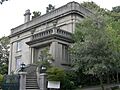
- Rainier Club: A Social Gathering Place
- Seattle Art Museum: A Home for Art
- Skinner Building: Home to the 5th Avenue Theatre
- Union Station: Another Important Train Station
- U.S. Marine Hospital: Now Pacific Medical Center
- Historic Ships and Boats
- Adventuress (schooner): A Sailing Treasure
- Duwamish (fireboat): A Heroic Fireboat
- John N. Cobb (fisheries research vessel): Exploring the Seas
- MV Westward (wooden motor vessel): A Historic Motor Vessel
- Pirate (R-class sloop): A Classic Sailboat
- Schooner Martha: A Sailing Beauty
- SS San Mateo: A Historic Ferry
- Virginia V: A Steamboat Legend
- Wawona (schooner): A Grand Old Ship
- Zodiac (schooner): Another Sailing Gem
- Parks and Other Special Places
- Former Listings
- Images for kids
Amazing Bridges of Seattle
Seattle has some really old and unique bridges that are part of its history.
12th Avenue South Bridge: A Steel Arch Wonder
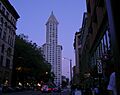
The 12th Avenue South Bridge, built in 1911, is the oldest steel arch bridge still standing in Washington state. It connects Beacon Hill and the International District over Dearborn Street. It was renamed the Jose Rizal Bridge in 1974.
14th Avenue South Bridge: A Demolished Drawbridge
The 14th Avenue South Bridge, also known as the South Park Bridge, was a special kind of bridge called a Scherzer Rolling Lift double-leaf bascule bridge. It opened in 1931 and crossed the Duwamish River. Sadly, it was taken down in 2010 because it wasn't safe anymore.
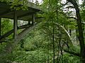
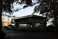
Arboretum Sewer Trestle: A Pretty Pedestrian Path
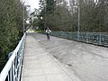
Built in 1910, the Arboretum Sewer Trestle was originally a sewer bridge made of reinforced concrete. Today, it's a beautiful pedestrian bridge in the Washington Park Arboretum. It's known for its fancy Art Deco style.
Aurora Avenue Bridge: Connecting Neighborhoods
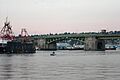
The Aurora Avenue Bridge, also called the George Washington Memorial Bridge, was built in 1931. This huge cantilever truss bridge carries traffic over the west end of Lake Union. It links the neighborhoods of Queen Anne and Fremont.
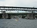
Ballard Bridge: An Old Bascule Bridge
The Ballard Bridge, built in 1917, is one of the oldest double-leaf bascule bridges in Washington. It crosses Salmon Bay in the Lake Washington Ship Canal, connecting Ballard with Queen Anne and Magnolia.
Cowen Park Bridge: An Art Deco Design
The Cowen Park Bridge was built in 1936 by the Works Progress Administration. This reinforced concrete arch bridge is famous for its cool Art Deco designs. It's part of 15th Ave NE and spans a ravine in Cowen Park.
Fremont Bridge: A Historic Link
The Fremont Bridge, built in 1917, is another important bridge that spans the Lake Washington Ship Canal. It's a key part of Seattle's historic bridge collection.
Montlake Bridge: A Gateway to the Arboretum
The Montlake Bridge, built in 1925, crosses the Lake Washington Ship Canal. It's a well-known landmark that connects the Montlake neighborhood to the Washington Park Arboretum and the University of Washington.
Mount Baker Ridge Tunnel: A Unique Tunnel
The Mount Baker Ridge Tunnel, completed in 1940, is a special tunnel that carries traffic through Mount Baker Ridge. It's part of the historic bridges and tunnels in Washington.
Ravenna Park Bridge: Spanning a Ravine
The Ravenna Park Bridge, built in 1913, crosses the Ravenna Park Ravine. It's another example of the historic bridges found in Seattle.
Schmitz Park Bridge: A Hidden Gem
The Schmitz Park Bridge, built in 1916, spans the Schmitz Park Ravine. It's a beautiful part of the city's historic bridge system.
University Bridge: Connecting Campuses
The University Bridge, built in 1919, crosses the Lake Washington Ship Canal. It's a vital link for the University of Washington area.
Historic Buildings and Districts
Seattle has many buildings and areas that tell stories of its past.
Pike Place Market: A Bustling Historic Hub
Pike Place Market is a famous historic district. It's bounded by Western Avenue, Virginia Street, 1st Avenue, and the south wall of the Economy Market and Outlook Building. This market has been a lively place for people to buy and sell goods since 1907!
Pioneer Square: Seattle's Oldest Neighborhood
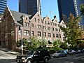
The Pioneer Square-Skid Road District is Seattle's oldest neighborhood. It's roughly bounded by the Viaduct, Railroad Ave S, King Street, 4th and 5th Avenues, and James and Columbia Streets. This area has many historic buildings, including the Pioneer Building and the Iron Pergola.
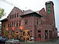
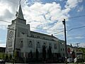
Admiral Theater: A Classic Movie House
The Admiral Theater, located at 2343 California Avenue SW, was built in 1942. It's a classic movie theater that has entertained people for decades.
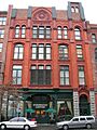
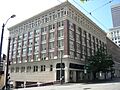
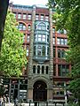
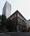
Arctic Building: A Beautiful Landmark
The Arctic Building, at 306 Cherry Street, was built in 1916. It's known for its unique architecture and has been a significant building in downtown Seattle for a long time.
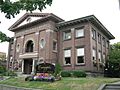
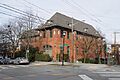
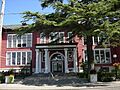
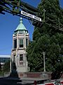
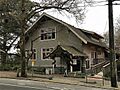
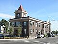
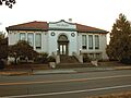
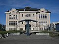
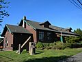
Ballard Carnegie Library: A Place for Books
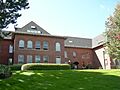
The Ballard Carnegie Library, built in 1904, is located at 2026 N. West Market Street. It's one of many libraries built with money from Andrew Carnegie, a famous businessman.
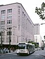
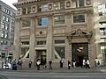
Bon Marche Department Store: A Shopping Icon
The Bon Marche Department Store, at 300 Pine Street, was built in 1929. It was once the main store for The Bon Marché, a popular department store. Today, it's a Macy's store.
Coliseum Theater: A Grand Entertainment Spot
The Coliseum Theater, located at 5th Avenue and Pike Street, was built in 1916. It was a grand movie palace and a popular spot for entertainment.
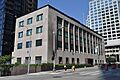
Federal Office Building: A Government Landmark
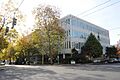
The Federal Office Building, at 909 1st Avenue, was built in 1932. It's an important government building in Seattle's downtown area.
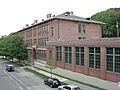
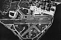
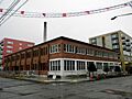
Georgetown Steam Plant: Powering the Past
The Georgetown Steam Plant, located off WA 99 at King County Airport, was built in 1906. It's a historic power plant that once provided electricity to the city.
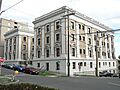
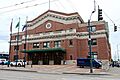
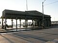
King Street Station: A Historic Train Hub
King Street Station at 3rd Street S and S. King Street, was built in 1906. It's a beautiful train station that has served as a major transportation hub for Seattle for over a century.
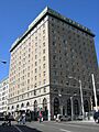
Moore Theatre and Hotel: A Cultural Gem
The Moore Theatre and Hotel, at 1932 2nd Avenue, was built in 1907. It's a historic theater and hotel that has hosted many performances and guests.
Panama Hotel: A Place of History
The Panama Hotel, at 605 South Main Street and 302 6th Avenue South, was built in 1910. It's a very important building because it tells the story of Japanese Americans in Seattle, especially during World War II.
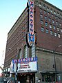
Paramount Theatre: A Grand Stage
The Paramount Theatre, at 901 Pine Street, was built in 1928. It's a grand theater known for its beautiful design and for hosting many concerts and shows.
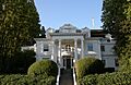
Rainier Club: A Social Gathering Place
The Rainier Club, at 810 4th Avenue, was built in 1904. It's a historic private club known for its beautiful architecture.
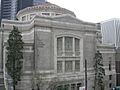
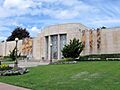
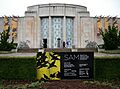
Seattle Art Museum: A Home for Art
The Seattle Art Museum, at 1400 E. Prospect Street, was built in 1933. It now houses the Seattle Asian Art Museum.
Skinner Building: Home to the 5th Avenue Theatre
The Skinner Building, at 1300-1334 5th Avenue, was built in 1926. It's famous for being home to the beautiful 5th Avenue Theatre.
Union Station: Another Important Train Station
Union Station, at 4th S and S. Jackson Streets, was built in 1911. It's another historic train station that played a big role in Seattle's transportation history.
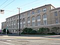
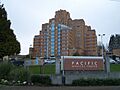
U.S. Marine Hospital: Now Pacific Medical Center
The U.S. Marine Hospital, at 1131 14th Avenue S, was built in 1932. It's now known as the Pacific Medical Center.
Historic Ships and Boats
Seattle's history is also tied to the water, with several historic vessels.
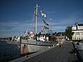
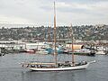
Adventuress (schooner): A Sailing Treasure
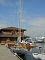
The Adventuress is a beautiful schooner (a type of sailing ship) built in 1913. It's a National Historic Landmark and can be found at the Lake Union drydock.
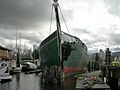
Duwamish (fireboat): A Heroic Fireboat
The Duwamish fireboat, built in 1909, is another National Historic Landmark. It was a brave fireboat that helped protect Seattle's waterfront for many years. It's located at the Lake Washington Ship Canal, Chittenden Locks.
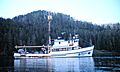
John N. Cobb (fisheries research vessel): Exploring the Seas
The John N. Cobb is a fisheries research vessel built in 1950. It's an important ship that helped scientists study the ocean and fish. It's located at 7600 Sand Point Way NE.
MV Westward (wooden motor vessel): A Historic Motor Vessel
The MV Westward is a wooden motor vessel built in 1924. It's a historic boat located at 1010 Valley Street.
Pirate (R-class sloop): A Classic Sailboat
The Pirate is an R-class sloop (a type of sailboat) built in 1927. It's a classic sailboat located at 1010 Valley Street.
Schooner Martha: A Sailing Beauty
The Schooner Martha, built in 1907, is a beautiful sailing ship. It was once located in Seattle but has since moved to Port Townsend.
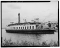
SS San Mateo: A Historic Ferry
The SS San Mateo, built in 1922, was a historic ferry that operated on the Seattle waterfront.
Virginia V: A Steamboat Legend
The Virginia V is a steamboat built in 1922. It's a National Historic Landmark and a beloved part of Seattle's maritime history. It's located at 4250 21st Avenue W.
Wawona (schooner): A Grand Old Ship
The Wawona was a schooner built in 1897. It was a very large and important sailing ship in its time. It was located at the Seattle Police Harbor Patrol Dock.
Zodiac (schooner): Another Sailing Gem
The Zodiac is a schooner built in 1924. It was once located at the Lake Union Dry Dock in Seattle, but its home port is now in Bellingham, Washington.
Parks and Other Special Places
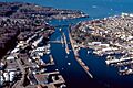
Chittenden Locks and Lake Washington Ship Canal: A Waterway Marvel
The Chittenden Locks and Lake Washington Ship Canal are a huge system of locks and canals that connect Puget Sound to Lake Union and Lake Washington. They were built in 1917 and are a marvel of engineering.
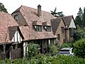
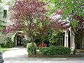
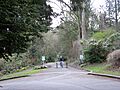
Dunn Gardens: A Beautiful Green Space
The Dunn Gardens, at 13533 Northshire Road NW, are historic gardens that were created in 1915. They are a beautiful example of early 20th-century landscape design.
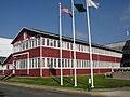
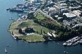
Fort Lawton: A Former Military Post
Fort Lawton, located on Magnolia Bluff, was a military post established in 1900. It's now mostly a park, but its historic buildings and grounds are preserved.
Gas Works Park: From Factory to Fun
Gas Works Park, at 2000 N. Northlake Way, is a unique park built on the site of an old gasification plant. It was added to the National Register in 2013 and is famous for its preserved industrial structures and amazing views of the city.
Volunteer Park: A Community Oasis
Volunteer Park, located between E. Prospect and E. Galer Streets, and Federal and E. 15th Avenues, was established in 1904. It's a beautiful park with gardens, a conservatory, and the Seattle Asian Art Museum.
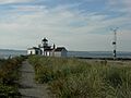
West Point Light Station: A Guiding Light
The West Point Light Station, located west of Fort Lawton, is a historic lighthouse built in 1881. It has guided ships safely into Seattle's harbor for many years.
Former Listings
Some historic places were once on the National Register but have since been removed.
Adams School: A Former School Building
The Adams School, at 2637 N.W. Sixty-second Street, was listed in 1988 but removed in 1990.
Broadway High School: Demolished History
Broadway High School, at Broadway Avenue and E. Pine Street, was listed in 1974 but also demolished that same year.
Girls' Parental School: A Former Institution
The Girls' Parental School, at 6612 Sixty-fifth Avenue S, was listed in 1988 and removed in 1990.
Lacey V. Murrow Floating Bridge: A Bridge Rebuilt
The Lacey V. Murrow Floating Bridge on Lake Washington was listed in 1987. However, it sank in 1990 and was later rebuilt. It was removed from the list in 1991.
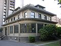
Images for kids
-
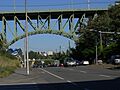
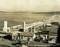
The 12th Avenue South Bridge, also known as the Jose Rizal Bridge.
-
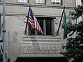
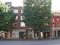
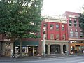
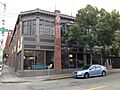
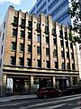
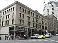
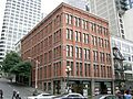
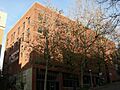
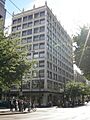
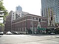
The 1411 Fourth Avenue Building.
-

The 14th Avenue South Bridge, also called the South Park Bridge, before it was demolished.
-
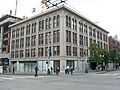
The 1600 East John Street Apartments.
-
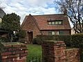
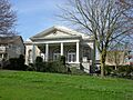
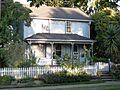
The 1926 Model Brick Home.
-
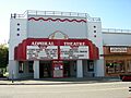
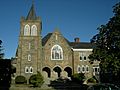
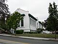
The historic Admiral Theater.
-
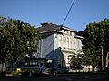
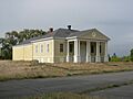
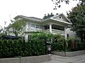
The Admiral's House, 13th Naval District.
-
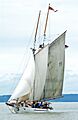
The schooner Adventuress sailing.
-
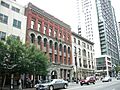
The Agen Warehouse.
-
The Alaska Trade Building.
-
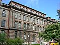
The John B. Allen School.
-

The Arboretum Sewer Trestle.
-

The Arctic Building.
-
The Assay Office.
-
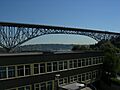
The Aurora Avenue Bridge, also known as the George Washington Memorial Bridge.
-
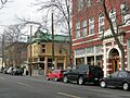
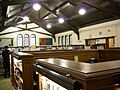
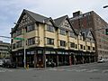
A view of the Ballard Avenue Historic District.
-
The Ballard Bridge.
-
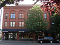
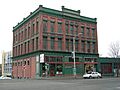
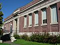
The Ballard Carnegie Library.
-
The Ballard-Howe House.
-
The Richard A. Ballinger House.
-
The Julian and Marajane Barksdale House.
-
The Barnes Building.
-
The Bay View Brewery building.
-
The Bell Apartments, also known as the Austin A. Bell Building.
-
The Jesse C. Bowles House.
-
Building No. 105, Boeing Airplane Company.
-
The Bon Marche Department Store, now Macy's.
-
The Butterworth Building.
-
The Calhoun Hotel.
-

The Cambridge Apartments.
-
The Camlin Hotel.
-
The Chelsea Family Hotel.
-
The James and Pat Chiarelli House.
-

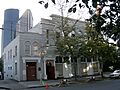
The Chinese Baptist Church.
-
The Hiram M. Chittenden Locks and Lake Washington Ship Canal.
-
The Church of the Blessed Sacrament.
-
The Cobb Building.
-
The Colman Automotive Building.
-
The Coliseum Theater.
-
The Colman Building.
-

The Colonial Hotel.
-
A building in the Columbia City Historic District.
-
The Frank B. Cooper School.
-
The Cornish School.
-
The Cowen Park Bridge.
-
The De La Mar Apartments.
-
The Henry H. Dearborn House.
-
The Charles P. and Ida Dose House.
-
The Dunn Gardens.
-
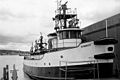
The fireboat Duwamish.
-
Relics from the Duwamish Number 1 Site.
-
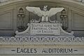
The Eagles Auditorium Building.
-
The El Rio Apartment Hotel.
-
The Ellsworth Storey Cottages Historic District.
-
The Ellsworth Storey Residences.
-
The Federal Office Building.
-
The Federal Reserve Bank of San Francisco, Seattle Branch.
-
The Pierre P. Ferry House.
-
Fire Station No. 18.
-
Fire Station No. 23.
-
Fire Station No. 25.
-
The First Methodist Episcopal Church.
-
The First Methodist Protestant Church of Seattle.
-
The Ford Motor Company Assembly Plant.
-
Fort Lawton.
-

The Fourth Church of Christ, Scientist (now Town Hall Seattle).
-
The Fremont Bridge.
-
The Fremont Building.
-
The Caroline Kline Galland House.
-
Gas Works Park.
-
The Georgetown Steam Plant.
-
The Globe Building, Beebe Building and Hotel Cecil (now Alexis Hotel).
-
The J. S. Graham Store.
-
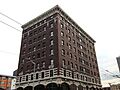
The Grand Pacific Hotel.
-
The Guiry and Schillestad Building.
-
A building in the Harvard-Belmont District.
-
Hawthorne Square.
-
The Samuel Hill House.
-
The Hoge Building.
-
The Holyoke Building.
-
The Home of the Good Shepherd.
-
The Hull Building.
-
The Samuel Hyde House.
-
The Immanuel Lutheran Church.
-
The Interlake Public School (now Wallingford Center).
-
The Iron Pergola.
-
The fisheries research vessel John N. Cobb.
-
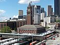
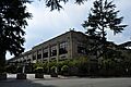
King Street Station.
-
The Joseph Kraus House.
-
The Leamington Hotel and Apartments.
-

The Eliza Ferry Leary House.
-
The Liggett Building.
-
The Lyon Building.
-
The MV Westward.
-
The Magnolia Public Library.
-
The Medical Dental Building.
-
The R. D. Merrill House.
-
The Montlake Bridge.
-
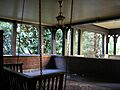
A path in the Montlake Historic District.
-
The Moore Theatre and Hotel.
-
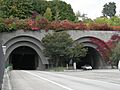
The Mount Baker Ridge Tunnel.
-
The Mount Baker Park Improvement Club Clubhouse.
-
The National Building.
-
Naval Air Station (NAS) Seattle.
-
The Naval Military Hangar-University Shell House.
-
The Naval Reserve Armory.
-
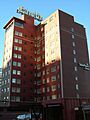
The New Richmond Hotel, also known as the Downtowner Hotel.
-
The New Washington Hotel.
-
The Nihon Go Gakko.
-
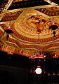
The Nippon Kan Theatre.
-
The Northern Bank and Trust Building.
-
The Northern Life Tower, also known as Seattle Tower.
-
The Nuclear Reactor Building.
-
The Old Georgetown City Hall.
-
The Old Public Safety Building.
-
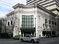
The Olympic Hotel.
-
The Panama Hotel.
-
The Paramount Theatre.
-
The Park Department, Division of Playgrounds building.
-
The William Parsons House.
-
The Phillips House.
-
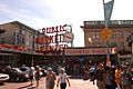
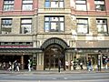
Pike Place Market.
-
The Pioneer Building.
-
Pioneer Hall.
-
Smith Tower in the Pioneer Square-Skid Road District.
-
The R-class sloop Pirate.
-
The Queen Anne Club.
-
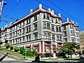
Queen Anne High School.
-
The Queen Anne Post Office and Regional Headquarters.
-
The Queen Anne Public School.
-
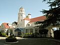
The Rainier Club.
-
The Ravenna Park Bridge.
-
The Raymond-Ogden Mansion.
-
The Rector Hotel.
-

The Redelsheimer-Ostrander House.
-
A building in the Roanoke Park Historic District.
-
The Judge James T. Ronald House.
-
The SS San Mateo.
-
The Schmitz Park Bridge.
-

The Schooner Martha.
-
The Seattle Art Museum, now the Seattle Asian Art Museum.
-
A building in the Seattle Chinatown Historic District.
-
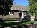
The Columbia City Library.
-
The Seattle Public Library Fremont Branch.
-
The Seattle Public Library Green Lake Branch.
-
The Seattle Public Library Queen Anne Branch.
-
The Seattle Public Library University Branch.
-
The West Seattle Library.
-
The Seattle Yacht Club.
-
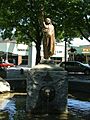
The Chief Seattle Statue.
-
The Shafer Building.
-
The Henry Owen Shuey House.
-
The Skinner Building, home to the 5th Avenue Theatre.
-
The Stimson-Green House.
-
The Stuart House and Gardens.
-
The Summit School, now Northwest School.
-
The Supply Laundry Building.
-
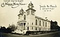
Temple de Hirsch.
-
The Will H. Thompson House.
-
The Times Building.
-

The Triangle Hotel and Bar.
-
Trinity Parish Church.
-
The Turner-Koepf House.
-

The U.S. Courthouse.
-
The U.S. Immigrant Station and Assay Office.
-
The U.S. Marine Hospital, now Pacific Medical Center.
-
The Union Stables.
-
Union Station.
-
The United Shopping Tower.
-
The University Bridge.
-
The University Heights School.
-
The University of Washington Faculty Club.
-
The U.S. Immigration Building.
-
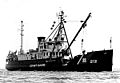
The USCGC Fir.
-

The Victorian Apartments.
-
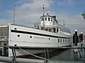
The steamboat Virginia V.
-
The William Volker Building.
-
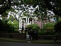
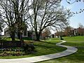
A view of Volunteer Park.
-
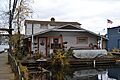
The Wagner Houseboat.
-
The Wallingford Fire and Police Station.
-
The Ward House.
-

Washington Hall.
-
The Washington Street Public Boat Landing Facility.
-
The schooner Wawona.
-
The West Point Light Station.
-
The White Center Fieldhouse and Caretaker Cottage.
-
The Wilke Farmhouse.
-
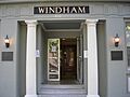
The Windham Apartments.
-
The Women's University Club of Seattle.
-
Ye College Inn.
-
The YWCA Building.
-
The schooner Zodiac.
-
Adams School.
-
Broadway High School.
-
Construction of the Lacey V. Murrow Floating Bridge.


.jpg)


.jpg)


_2005_05_23.jpg)


_2007-08.jpg)


_from_east_05.jpg)


.jpg)


.jpg)


