
Pioneer Square, Seattle facts for kids
|
Pioneer Square–Skid Road District
|
|
 |
|
| Lua error in Module:Location_map at line 420: attempt to index field 'wikibase' (a nil value). | |
| Location | Seattle, Washington |
|---|---|
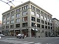
| Built | 1853 |
| Architect | Elmer H. Fisher (original) |
| Architectural style | Late Victorian, Romanesque (original) Italianate, Romanesque (increase) Chicago (2nd increase) |
| NRHP reference No. | 70000086 (original) 78000341 (increase 1) 88000739 (increase 2) |
Quick facts for kids Significant dates |
|
| Added to NRHP | June 22, 1970 |
| Boundary increases | July 7, 1978 June 16, 1988 |

Pioneer Square is a historic neighborhood in Downtown Seattle, Washington. It was the very first part of Seattle where settlers made their homes in 1852. Before that, they had tried living for a short time at Alki Point.
Most of the early buildings in Pioneer Square were made of wood. Sadly, almost all of them burned down in the Great Seattle Fire of 1889. But people quickly rebuilt the area! By the end of 1890, many new buildings made of brick and stone stood in their place. Today, the neighborhood still looks like it did in the late 1800s, with many buildings showing a style called Richardsonian Romanesque.
The neighborhood gets its name from a small, triangle-shaped park called Pioneer Place. This park is near First Avenue and Yesler Way. The larger Pioneer Square–Skid Road Historic District, which includes the park and many blocks around it, is listed on the National Register of Historic Places. This means it's a special place protected for its history.

Contents
Exploring Pioneer Square's Location
Like most neighborhoods, Pioneer Square doesn't have exact lines marking its edges. It's generally bordered by:
- Alaskan Way S. to the west, where you'll find the docks of Elliott Bay.
- S. King Street to the south, beyond which is the SoDo area.
- 5th Avenue S. to the east, next to the International District.
- It goes about one or two blocks north of Yesler Way, leading into the rest of Downtown.
Yesler Way is an important street because it divides two different land areas. This means the streets north of Yesler don't line up perfectly with the streets in Pioneer Square. Because of this, the northern border of the historic district has a zigzag shape. The historic district also stretches a bit further in some places. For example, it includes Union Station and some blocks south of S. King Street.
Pioneer Square's Interesting History
How Pioneer Square Began
Pioneer Square became very important in 1852. This was when Henry Yesler chose the spot for his lumber mill. The mill was right on Elliott Bay, at the end of what is now Yesler Way. This spot was also on the border between land claimed by David Swinson "Doc" Maynard and land claimed by Arthur Denny and Carson Boren.
Much of Pioneer Square today is built on land that was once water or very low-lying. In the early days, the area between First and Second Avenues, south of Jackson Street, and almost up to Yesler Way, was actually a small island! The original shoreline was much different, and there were steep hills nearby. Over time, these hills were flattened, and the land was filled in to create more space.
Rebuilding After the Great Fire
By 1889, Seattle was a big city with 40,000 people. That year, the Great Seattle Fire destroyed all of Pioneer Square. But the city's economy was strong, so people quickly rebuilt the neighborhood. Many new buildings were built in the Romanesque Revival style, which was popular then.
Because of drainage issues, the new buildings were constructed at a higher level than the old ones. This literally buried parts of old Pioneer Square! Many buildings were built with two entrances: one at the old, lower level and another higher up. Today, you can take the Seattle Underground Tour to see what's left of the old streets and storefronts underground.
Just before the fire, cable car service started from Pioneer Square. These cars traveled along Yesler Way all the way to Lake Washington and the Leschi neighborhood.
The 20th Century in Pioneer Square

During the Klondike Gold Rush in 1897 and 1898, Seattle was a main stop for people heading to Alaska to find gold. Thousands of these "stampeders" passed through Seattle, which made the city's businesses very successful.
In 1899, a group of businessmen took a Tlingit totem pole and put it in Pioneer Place Park. When a fire destroyed this pole in 1938, the city sent the pieces back to the Tlingit tribe. The tribe carved a new one and gave it to Seattle. In 1909, a beautiful iron pergola (a garden archway) and a statue of Chief Seattle were also added to the park.
In 1914, the Smith Tower was finished. It was the tallest building west of the Mississippi River at the time! However, by then, the main part of Downtown Seattle had started to move north. A new road, Second Avenue Extension, was built in 1928-29. This road changed the eastern part of the neighborhood, cutting through some buildings. The cable car line that served the area stopped running on August 10, 1940.
Saving Pioneer Square in the 1960s
In the 1960s, there were plans to change Pioneer Square a lot. Some people wanted to tear down old buildings to build parking garages for Downtown Seattle. For example, the historic Seattle Hotel was replaced by a parking garage in 1962. This garage is still there and is sometimes called the "Sinking Ship" because of how it looks. Another idea was to build a big road that would have destroyed many of Pioneer Square's buildings.
Luckily, many buildings were saved thanks to people like landowner Sam Israel, who didn't sell his properties often. Architect Ralph Anderson bought the Union Trust Building from him and fixed it up. This project showed how old buildings could be saved and reused. In 1970, people who wanted to protect history, like Bill Speidel and Victor Steinbrueck, successfully got the neighborhood listed as a historic district on the National Register of Historic Places. Later that year, Pioneer Square became a special city preservation district.
Streetcars Return in the 1980s
Streetcar service came back to Pioneer Square on May 29, 1982, with the opening of the Waterfront Streetcar. This streetcar line ran until November 19, 2005, when its storage building was removed to make space for the Olympic Sculpture Park.
Pioneer Square Today

Today, Pioneer Square is a lively place! It has many art galleries, internet companies, cozy cafés, sports bars, and nightclubs. You can also find bookstores and a part of the Klondike Gold Rush National Historical Park here. The other part of this park is in Skagway, Alaska. Pioneer Square is often known as the center of Seattle's nightlife.
Challenges in the Early 2000s
In early 2001, Pioneer Square faced a few tough times.
- On January 15, a large semi-truck crashed into the beautiful pergola, breaking it into many pieces. Luckily, it has since been fixed and restored.
- On February 27, during Mardi Gras celebrations, there was violence in the neighborhood.
- The very next day, February 28, a big earthquake shook the area and damaged some buildings. However, most buildings had been made stronger to resist earthquakes, so the damage was not as bad as it could have been.
Remembering Heroes: Fallen Firefighters Memorial
Every spring since 1989, around June 6, Seattle celebrates the Pioneer Square Fire Festival. This event includes a parade, displays of old and new fire trucks, demonstrations by firefighters, food, and crafts. On June 6, 1998, which was the anniversary of the 1889 fire, the Fallen Fire Fighter Memorial was officially dedicated. This memorial is a bronze sculpture with a granite block that lists the names of every Seattle firefighter who died while on duty.
Gallery
-
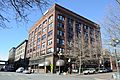
Manufacturers Building, now home to F. X. McRory
-
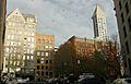
The heart of Pioneer Square
-
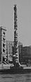
The original Pioneer Square Totem Pole in 1907
-
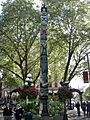
Pioneer Square Totem Pole, 2007
-
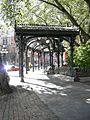
The reconstructed Pioneer Square pergola
-
The Chin Gee Hee - Kon Yick Building, one of the last reminders of the historic Chinese presence in the neighborhood
-
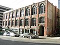
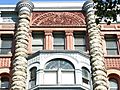
The Scheuerman Block, an example of the Romanesque Revival style used after the Great Seattle Fire
-
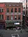
The Merchants Café, Seattle's oldest restaurant
-
Heritage Building, a typical early 20th century commercial building
-
Cast iron pergola, detail
-
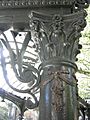
Pioneer Building, detail
-
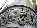
Stylized lion, entrance of Grand Central Hotel, Squire–Latimer Building
-
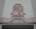
Fisher Building, detail
-
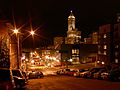
Looking west toward Pioneer Square at night
-
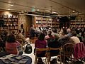
Author reading at Elliott Bay Books
-
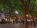
Occidental Mall on a "First Thursday" when art galleries open new shows
-
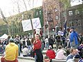
A political demonstration in Occidental Park
-
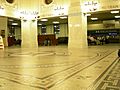
Waiting room, King Street Station
-
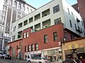
The upper part of the Drexel Hotel Building is older, but was updated after 1945
-
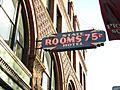
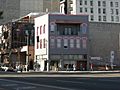
The State Hotel Building still has a sign from the old "Skid Road" era
-
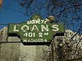
Barney's Loans continues as a pawn shop as of 2008
-
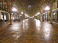
Occidental Mall at night in February 2011
-
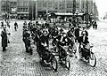
Motorcyclists in 1915.
-

Artist gathering at All City Coffee, Pioneer Square in 2007


