
National Register of Historic Places listings in Siskiyou County, California facts for kids

Have you ever wondered about really old and important places in California? In Siskiyou County, there's a special list of historic spots called the National Register of Historic Places. It's like a hall of fame for buildings, sites, and areas that tell amazing stories about the past. Siskiyou County is in northern California, known for its beautiful mountains and rich history.
This list includes 21 unique places. One of them is even a National Historic Landmark, which means it's super important for the whole country! These places help us remember and learn about the people and events that shaped Siskiyou County and even the United States.
Contents
Historic Places in Siskiyou County
Siskiyou County is home to many fascinating places that are protected because of their historical importance. Let's explore some of them!
Captain Jack's Stronghold

Deep within the Lava Beds National Monument near Tulelake, you'll find Captain Jack's Stronghold. This amazing natural fortress is made of rough lava flows and caves. It was used by a group of Modoc Native Americans led by their chief, Captain Jack, during the Modoc War in 1872-1873.
The Modoc warriors used the strong natural defenses of the lava beds to hold off a much larger United States Army force for many months. This site shows how clever and brave the Modoc people were in defending their homeland. It's a powerful reminder of a difficult time in history.
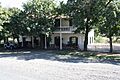
Dunsmuir Historic Commercial District

The heart of Dunsmuir holds the Dunsmuir Historic Commercial District. This area includes many old buildings along Sacramento and Shasta Avenues. These buildings were built when Dunsmuir was a busy railroad town.
In the late 1800s and early 1900s, Dunsmuir was a key stop for trains traveling through the mountains. The buildings in this district, like old shops and hotels, show what life was like during that time. They tell the story of a town that grew because of the railroad.
Edgewood Store

The Edgewood Store is located in Edgewood. This building has been a central part of the community for a long time. It served as a general store, providing supplies and a meeting place for local residents.
Built in the early 1900s, the store represents the kind of small businesses that were vital to rural communities in California. It shows how people lived and traded goods in the past.
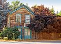
Lewis Falkenstein House

In Yreka, you can find the Lewis Falkenstein House. This beautiful home was built in the late 1800s. It belonged to Lewis Falkenstein, an important person in Yreka's early days.
The house is a great example of the architectural styles popular during that time. It gives us a peek into the lives of wealthy families who helped build the town.
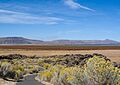
Lower Klamath National Wildlife Refuge

The Lower Klamath National Wildlife Refuge near Dorris is a very special place. It was created in 1908 and was the first large area of public land set aside in the United States specifically for wildlife! This means it's a National Historic Landmark, recognized for its importance to the entire country.
This refuge is a vital home for many birds and other animals. It shows the early efforts to protect nature and wildlife. It also highlights the ongoing challenge of balancing protecting nature with other human needs, like farming.
McCloud Historic District

The town of McCloud has its own Historic District. This area includes many buildings that tell the story of McCloud as a company town. It was built by a large lumber company in the early 1900s.
The company built homes, stores, and other buildings for its workers and their families. Walking through this district is like stepping back in time to see how a logging town operated and how its community lived.
West Miner Street-Third Street Historic District

Another important historic area in Yreka is the West Miner Street-Third Street Historic District. This district includes many of the oldest buildings in downtown Yreka.
These buildings were part of Yreka's busy commercial center, especially during the California Gold Rush era. They show the architectural styles and the lively atmosphere of a frontier town that grew quickly because of gold mining.
Yreka Carnegie Library

The Yreka Carnegie Library is a beautiful old building in Yreka. It was built with money donated by Andrew Carnegie, a famous businessman who funded many libraries across the United States.
Built in 1915, this library has served the community for over a century. It represents the importance of education and reading in the early 20th century and continues to be a valuable resource today.
Images for kids
-
The Forest House in Yreka
-
The Fort Jones House
-
Hospital Rock Army Camp Site
-

Inside a lava tube at Lava Beds National Monument
-
Sawyers Bar Catholic Church
-
The Weed Lumber Company Boarding House


