
McCloud, California facts for kids
Quick facts for kids
McCloud
|
|
|---|---|

McCloud with Mount Shasta in the background, January 2022
|
|

Location in Siskiyou County and the state of California
|
|

McCloud, California
Location in the United States
|
|
| Country | |
| State | |
| County | Siskiyou |
| Area | |
| • Total | 2.488 sq mi (6.444 km2) |
| • Land | 2.422 sq mi (6.274 km2) |
| • Water | 0.066 sq mi (0.171 km2) 2.65% |
| Elevation | 3,271 ft (997 m) |
| Population
(2020)
|
|
| • Total | 945 |
| • Density | 379.82/sq mi (146.65/km2) |
| Time zone | UTC-8 (Pacific (PST)) |
| • Summer (DST) | UTC-7 (PDT) |
| ZIP code |
96057
|
| Area code(s) | 530 |
| FIPS code | 06-44784 |
| GNIS feature ID | 0277555 |
McCloud is a small community in Siskiyou County, California, United States. It's not a city, but a "census-designated place" (CDP), which means it's a community that the government counts for population statistics. In 2020, about 945 people lived here. It's a bit smaller than it used to be, as 1,101 people lived here in 2010.
Contents
Fun Things to Do in McCloud
McCloud is a popular spot for visitors because it's in the beautiful Shasta Cascade area of Northern California. Many people come here to enjoy the outdoors.
- Fishing: The nearby McCloud, Sacramento, and Klamath Rivers are famous for trout fishing.
- Mountain Adventures: You can use McCloud as a starting point to explore and climb Mount Shasta, Castle Crags, or the Trinity Alps.
- Winter Sports: In winter, people enjoy skiing, both downhill and cross-country.
- Hiking and Biking: There are many trails for biking and hiking to waterfalls, streams, and lakes. Some popular spots include Falls of the McCloud River, Burney Falls, Mossbrae Falls, Lake Siskiyou, Castle Lake, and Shasta Lake.
- History: You can also visit old buildings from the 1920s, a time known as the "Roaring Twenties."
Where is McCloud?
McCloud is located on the southern side of Mount Shasta. It sits about 3,271 feet (997 meters) above sea level.
The community covers a total area of about 2.5 square miles (6.4 square kilometers). Most of this area is land, with a small part (about 0.1 square miles or 0.17 square kilometers) being water.
Who Lives in McCloud?
Let's look at the numbers from the 2010 census:
- Population: 1,101 people lived in McCloud.
- Homes: There were 528 households. About 20% of these homes had children under 18. Many homes (45.5%) were married couples living together.
- Age Groups:
* About 17% of the people were under 18. * About 26% were 65 or older. * The average age in McCloud was 51.8 years old.
- Housing: Most people (61.4%) owned their homes, while others (38.4%) rented.
What's the Weather Like?
McCloud has a type of weather called a "warm-summer Mediterranean climate." This means it has warm, dry summers and mild, wet winters. The average monthly temperatures in summer are not extremely hot.
| Climate data for McCloud (1909-2012) | |||||||||||||
|---|---|---|---|---|---|---|---|---|---|---|---|---|---|
| Month | Jan | Feb | Mar | Apr | May | Jun | Jul | Aug | Sep | Oct | Nov | Dec | Year |
| Record high °F (°C) | 71 (22) |
79 (26) |
84 (29) |
90 (32) |
100 (38) |
105 (41) |
108 (42) |
107 (42) |
106 (41) |
96 (36) |
83 (28) |
73 (23) |
108 (42) |
| Mean daily maximum °F (°C) | 45.9 (7.7) |
49.1 (9.5) |
54.4 (12.4) |
61.8 (16.6) |
70.7 (21.5) |
78.7 (25.9) |
87.3 (30.7) |
86.5 (30.3) |
80.2 (26.8) |
69.3 (20.7) |
55.2 (12.9) |
47.3 (8.5) |
65.5 (18.6) |
| Mean daily minimum °F (°C) | 24.5 (−4.2) |
25.9 (−3.4) |
28.2 (−2.1) |
31.6 (−0.2) |
37.8 (3.2) |
43.7 (6.5) |
48.6 (9.2) |
46.4 (8.0) |
40.6 (4.8) |
33.9 (1.1) |
28.3 (−2.1) |
24.3 (−4.3) |
34.5 (1.4) |
| Record low °F (°C) | −11 (−24) |
−12 (−24) |
−2 (−19) |
8 (−13) |
14 (−10) |
21 (−6) |
28 (−2) |
20 (−7) |
21 (−6) |
11 (−12) |
0 (−18) |
−14 (−26) |
−14 (−26) |
| Average precipitation inches (mm) | 8.16 (207) |
7.96 (202) |
6.29 (160) |
3.4 (86) |
2.26 (57) |
1.26 (32) |
0.22 (5.6) |
0.32 (8.1) |
0.9 (23) |
2.96 (75) |
5.84 (148) |
8.04 (204) |
47.61 (1,209) |
| Average snowfall inches (cm) | 26.9 (68) |
17.8 (45) |
12.8 (33) |
3.9 (9.9) |
0.5 (1.3) |
0 (0) |
0 (0) |
0 (0) |
0 (0) |
0.1 (0.25) |
5.7 (14) |
20 (51) |
87.8 (223) |
| Average precipitation days | 12 | 12 | 11 | 9 | 7 | 5 | 1 | 2 | 3 | 6 | 9 | 12 | 89 |
| Source: WRCC | |||||||||||||
The Nestle Plant Story
In 2006, a company called Nestlé wanted to build a large bottled water plant in McCloud. They planned to use water from the springs of Mount Shasta. Some local groups were concerned about this. They worried about how it would affect the local water supply and if the plant would really bring as many jobs as promised.
Nestlé later decided to make the plant much smaller. They also agreed to check how the plant would affect the water for two years. However, in 2009, Nestlé announced they would not build any bottling plant in McCloud. They decided to sell the land they had bought, which used to be a lumber mill.
In 2014, a new group of investors called McCloud Partners, LLC, bought the old lumber mill site. They have been working to bring new businesses and jobs to the area. The property now helps support fire agencies and has even hosted CalFire fire camps. This shows how much the new owners care about the community.
Famous People from McCloud
Some notable people have come from McCloud:
- Pat Clements - a baseball player
- Joel DeBortoli - a basketball player
- Rolin Eslinger - a professional world champion lumberjack
- Jerre Noe - a computer scientist
- Mike Summers - a broadcaster
Images for kids
-
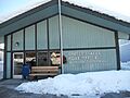
The U.S. post office at McCloud, December 2012

See also
 In Spanish: McCloud (California) para niños
