National Register of Historic Places listings in Somerset County, Maryland facts for kids
Have you ever wondered about the oldest and most special places in your community? In Somerset County, Maryland, there are many buildings, farms, and even boats that are so important they've been added to a special list called the National Register of Historic Places. This list helps protect these amazing spots so people can learn about them for many years to come.
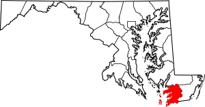
This page is a list of these cool historic places in Somerset County, Maryland. There are 73 properties and areas on this list!
Contents
Awesome Historic Places in Somerset County
Somerset County is full of history, and many places here have been recognized for their importance. Let's explore some of them!
Historic Homes and Buildings
Many old houses and buildings in Somerset County tell stories of the past.
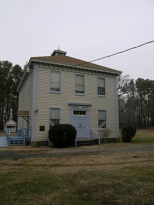
- Academy Grove Historic District: This area in Upper Fairmount, Maryland was added to the list in 1984. It includes the historic Fairmount Academy.
- Adams Farm: Located in Princess Anne, Maryland, this farm became historic in 1988.
- Arlington: You can find this historic spot in Westover, Maryland. It was added to the list in 1992.
- Beauchamp House: This old house in Westover, Maryland joined the list in 1984.
- Beckford: A beautiful place in Princess Anne, Maryland, recognized in 1974.
- Beverly: South of Princess Anne, Maryland, Beverly became a historic place in 1973.
- Brentwood Farm: Another historic farm in Westover, Maryland, added in 1986.
- Caldicott: This property near Rehobeth, Maryland was listed in 1983.
- Burton Cannon House: Found north of Cokesbury, Maryland, this house was added in 1975.
- Catalpa Farm: In Princess Anne, Maryland, this farm was recognized in 1988.
- Cedar Hill: Located in Westover, Maryland, Cedar Hill joined the list in 1991.
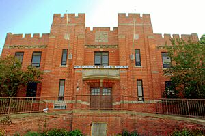
- Crisfield Armory: This building in Crisfield, Maryland was added in 1985. Armories are places where military reserves train.
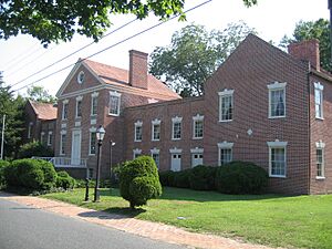
- Glebe House: In Princess Anne, Maryland, this house became historic in 2009.
- Harrington: Northwest of Princess Anne, Maryland, Harrington was listed in 1975.
- Jeptha Hayman House: This house in Kingston, Maryland was added in 1990.
- Hayward's Lott: Northwest of Pocomoke City, Maryland, this property was recognized in 1976.
- Kingston Hall: A historic hall in Kingston, Maryland, listed in 1974.
- Lankford House: In Marion Station, Maryland, this house was added in 1984.
- Liberty Hall: South of Westover, Maryland, Liberty Hall became historic in 1976.
- George Maddox Farm: This farm in Manokin, Maryland was listed in 1985.
- Maddux House: In Upper Fairmount, Maryland, this house was added in 2002.
- Make Peace: Southeast of Crisfield, Maryland, this property was recognized in 1975.
- Nelson Homestead: In Crisfield, Maryland, this homestead was added in 1985.
- Panther's Den: Located in Venton, Maryland, this spot was listed in 1984.
- Pomfret Plantation: In Marion Station, Maryland, this plantation was recognized in 1984.
- Dr. William B. Pritchard House: This house in Princess Anne, Maryland was added in 1996.
- Puncheon Mill House: Near Pocomoke City, Maryland, this mill house was listed in 1994.
- Reward: Southeast of Shelltown, Maryland, Reward became historic in 1974.
- Salisbury Plantation: Southwest of Westover, Maryland, this plantation was added in 1975.
- Schoolridge Farm: In Upper Fairmount, Maryland, this farm was listed in 1984.
- William S. Smith House: This house in Oriole, Maryland was recognized in 1991.
- Somerset Academy Archaeological Site: This site in Princess Anne, Maryland was added in 1986. It's an archaeological site, meaning it holds clues about the past underground.
- Sudler's Conclusion: Northwest of Manokin, Maryland, this property was listed in 1973.
- Capt. Leonard Tawes House: In Crisfield, Maryland, this house was added in 1990.
- Teackle Mansion: A grand mansion in Princess Anne, Maryland, recognized in 1971.
- Tudor Hall: Southeast of Upper Fairmount, Maryland, Tudor Hall was listed in 1974.
- William T. Tull House: In Westover, Maryland, this house was added in 1996.
- Waddy House: In Princess Anne, Maryland, this house was recognized in 1988.
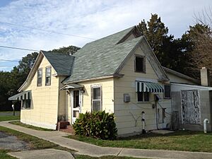
- Ward Brothers' House and Shop: In Crisfield, Maryland, this special place was added in 1997. The Ward Brothers were famous for carving wooden duck decoys.
- Waterloo: In Princess Anne, Maryland, Waterloo was listed in 1986.
- Waters' River: In Manokin, Maryland, this property was added in 1984.
- Watkins Point Farm: In Marion Station, Maryland, this farm was recognized in 2002.
- White Hall: In Princess Anne, Maryland, White Hall was listed in 1984.
- Williams' Conquest: In Marion Station, Maryland, this property was added in 1984.
Historic Churches
Churches often have a long history and are important to their communities.
- All Saints Church at Monie: Near Venton, Maryland, this church was added to the list in 1990.
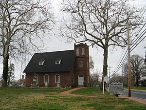
- Coventry Parish Ruins: These ruins near Rehobeth, Maryland were recognized in 1984.
- Grace Episcopal Church: In Mount Vernon, Maryland, this church was listed in 1990.
- Manokin Presbyterian Church: In Princess Anne, Maryland, this church became historic in 1976.
- Mt. Zion Memorial Church: In Princess Anne, Maryland, this church was added in 2007.
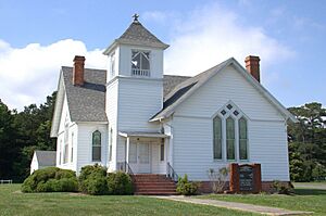
- Quindocqua United Methodist Church: In Marion Station, Maryland, this church was recognized in 1996.
- Rehobeth Presbyterian Church: South of Rehobeth, Maryland, this church was listed in 1974.
- Rock Creek Methodist Episcopal Church: Near Chance, Maryland, this church was added in 1990.
- St. John's Methodist Episcopal Church and Joshua Thomas Chapel: In Deal Island, Maryland, these churches were recognized in 1990.
- St. Mark's Episcopal Church: In Kingston, Maryland, this church was listed in 1990.
- St. Paul's Methodist Episcopal Church: In Westover, Maryland, this church was added in 1996.
- St. Paul's Protestant Episcopal Church: Near Tulls Corner, Maryland, this church was recognized in 1990.
- St. Peter's Methodist Episcopal Church: In Hopewell, this church was listed in 1990.
Historic Districts
Sometimes, a whole area or neighborhood is considered historic because it has many important buildings or tells a big story.
- Academy Grove Historic District: This district in Upper Fairmount, Maryland was added in 1984.
- Crisfield Historic District: A large area in Crisfield, Maryland, recognized in 1990.
- Cullen Homestead Historic District: Also in Crisfield, Maryland, this district was added in 2009.
- Deal Island Historic District: This district in Deal Island, Maryland was listed in 2006.
- Manokin Historic District: Southwest of Princess Anne, Maryland, this district was recognized in 1976.
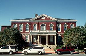
- Princess Anne Historic District: A major historic area in Princess Anne, Maryland, added in 1980. It includes the Somerset County Courthouse.
- University of Maryland Eastern Shore: The campus of this university in Princess Anne, Maryland was recognized as a historic district in 2005.
- Upper Fairmount Historic District: This district in Upper Fairmount, Maryland was added in 1993.
Historic Boats (Skipjacks)
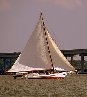
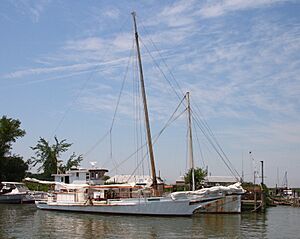
Somerset County is on the water, so it's no surprise that some historic boats are on the list! These are called skipjacks, which are traditional fishing boats from the Chesapeake Bay.
- CLARENCE CROCKETT: This skipjack was listed in 1985.
- F.C. LEWIS, JR: Another skipjack added in 1985.
- FANNIE L. DAUGHERTY: This skipjack was also recognized in 1985.
- HOWARD: This skipjack joined the list in 1985.
- IDA MAY: This skipjack was listed in 1985.
- ISLAND BELLE: This vessel from Smith Island, Maryland was recognized in 1979.
- SEA GULL: This skipjack was added in 1985.
- SUSAN MAY: Another skipjack listed in 1985.
- THOMAS W. CLYDE: This skipjack was also recognized in 1985.


