
Pocomoke City, Maryland facts for kids
Quick facts for kids
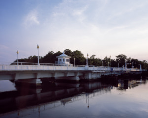
Pocomoke City, Maryland
|
|||
|---|---|---|---|
.jpg) |
|||
|
|||
| Nickname(s):
Friendliest Town on the Eastern Shore
|
|||

Location in Worcester County and the state of Maryland
|
|||

Pocomoke City, Maryland
Location in Maryland

Pocomoke City, Maryland
Location in the United States
|
|||
| Country | United States | ||
| State | Maryland | ||
| County | Worcester | ||
| Incorporated | 1878 | ||
| Area | |||
| • Total | 4.04 sq mi (10.45 km2) | ||
| • Land | 3.79 sq mi (9.81 km2) | ||
| • Water | 0.25 sq mi (0.64 km2) | ||
| Elevation | 7 ft (2 m) | ||
| Population
(2020)
|
|||
| • Total | 4,295 | ||
| • Density | 1,133.84/sq mi (437.81/km2) | ||
| Time zone | UTC−5 (Eastern (EST)) | ||
| • Summer (DST) | UTC−4 (EDT) | ||
| ZIP code |
21851
|
||
| Area code | 410, 443 | ||
| FIPS code | 24-62475 | ||
| GNIS feature ID | 0591031 | ||
| Website | www.cityofpocomoke.com | ||


Pocomoke City is a friendly city in Worcester County, Maryland, United States. People often call it simply Pocomoke. In 2020, about 4,295 people lived there.
Pocomoke City is an important place for business in the lower part of Maryland's Eastern Shore. It has an industrial park where companies work on defense, aerospace, and plastics. The city is also close to the Wallops Island Flight Facility in Wallops Island, Virginia.
Contents
History of Pocomoke City
Early Settlement and Name Changes
Pocomoke City started as a small settlement in the late 1600s. It was first known as Stevens Landing (or Stevens Ferry). This settlement grew around a ferry crossing on the south side of the Pocomoke River.
In 1865, the town was officially named Newtown. But in 1878, it was renamed again to Pocomoke City. This new name came from the American Indian name for the river, which means "black water."
Growth and Industry
For a while, Newtown was just a small river crossing. But in the 1880s, a major railroad line was built through the town. This line connected Wilmington, Delaware, to Cape Charles in Eastern Shore of Virginia. The railroad helped the town grow a lot.
Besides farming, other industries became important. These included lumber milling and shipbuilding. Later, factories made barrels and baskets for farm crops. They also canned these crops.
Challenges and New Opportunities
In 1922, a big fire destroyed many businesses in downtown Pocomoke City. But the town quickly rebuilt. As farming changed, the poultry industry grew and became very important.
Later, organizations like NASA, the U.S. Navy, and the Coast Guard brought more jobs to the area. Pocomoke City was even recognized as an "All-America City" in 1984–85. This award celebrates communities that work together to solve problems.
Culture and Community
Historic Places to Visit
Pocomoke City has several historic sites. The Sturgis One Room School Museum is a one-room schoolhouse that teaches about local African-American history.
Other important historic buildings include Beverly, Littleton T. Clarke House, Crockett House, Hayward's Lott, Puncheon Mill House, and Young-Sartorius House. These are all listed on the National Register of Historic Places.
Museums and Arts
The Delmarva Discovery Museum is in Pocomoke City. It's an interactive museum where you can learn about the local environment and history. You can also visit The Isaac Costen House Museum.
The MarVa Theater is a beautiful old building from 1927. It's known for its great sound quality. This theater is being restored to become a center for performing arts in the region.
Sports History
In the past, Pocomoke City had its own baseball teams. These teams played in the Eastern Shore Baseball League. They were sometimes called the Salamanders, the Red Sox, or the Chicks.
Education in Pocomoke City
Pocomoke City is home to three schools that are part of the Worcester County Public Schools system. These are Pocomoke Elementary, Pocomoke Middle, and Pocomoke High. Both the elementary and high schools have been named "Blue Ribbon Schools." This award recognizes schools for their high levels of student achievement.
Geography and Climate
Location and Area
Pocomoke City is located at 38°4′8″N 75°33′42″W / 38.06889°N 75.56167°W. The city covers about 3.94 square miles (10.2 square kilometers). Most of this area is land, with a small part being water.
Local Climate
The climate in Pocomoke City is known as a "Humid Subtropical Climate." This means summers are often hot and humid. However, cool fronts from the north can bring milder temperatures.
Spring and fall are usually pleasant, with cool to mild temperatures and less humidity. Winters are generally mild compared to areas further north. But cold spells can make temperatures drop below freezing. Snowfall is usually light, averaging 5 to 10 inches per year. However, some years can see much more snow, especially during strong winter storms. Tropical storms can also affect the area in summer and fall.
City Status
Pocomoke City is officially called a "city" by the Census Bureau. However, some state documents might refer to it as a "town." In Maryland, there isn't a big difference between cities and towns. They are both called "municipalities" and are treated the same under state law.
Population Changes Over Time
| Historical population | |||
|---|---|---|---|
| Census | Pop. | %± | |
| 1870 | 1,195 | — | |
| 1880 | 1,425 | 19.2% | |
| 1890 | 1,866 | 30.9% | |
| 1900 | 2,124 | 13.8% | |
| 1910 | 2,369 | 11.5% | |
| 1920 | 2,444 | 3.2% | |
| 1930 | 2,609 | 6.8% | |
| 1940 | 2,739 | 5.0% | |
| 1950 | 3,191 | 16.5% | |
| 1960 | 3,329 | 4.3% | |
| 1970 | 3,573 | 7.3% | |
| 1980 | 3,558 | −0.4% | |
| 1990 | 3,922 | 10.2% | |
| 2000 | 4,098 | 4.5% | |
| 2010 | 4,179 | 2.0% | |
| 2020 | 4,295 | 2.8% | |
| U.S. Decennial Census | |||
The population of Pocomoke City has grown steadily over the years. In 2010, there were 4,184 people living in the city. The population included families with children, married couples, and individuals living alone. The average age of residents was about 36.4 years old.
Notable People
- Hugh Latimer Dryden, who was a director of NACA and later a Deputy Administrator of NASA, was born in Pocomoke City.
See also
 In Spanish: Pocomoke City (Maryland) para niños
