Navan Fort facts for kids
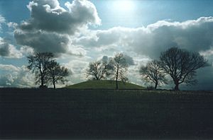
Navan Fort or Eamhain Mhacha
|
|
| Location | County Armagh, Northern Ireland |
|---|---|
| Coordinates | 54°20′53″N 6°41′50″W / 54.34806°N 6.69722°W |
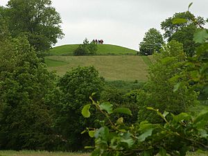
Navan Fort, also known as Eamhain Mhacha, is a very old and special place in Northern Ireland. It is near the city of Armagh. Long ago, people believed it was one of the most important royal sites in ancient Gaelic Ireland. It was thought to be the capital city of the Ulaidh people.
Navan Fort is a large circular area on top of a hill. It has a big bank and a ditch around it. Inside, there is a round mound and traces of another old burial site. Archaeologists have found evidence of buildings here. One was a huge round structure, like a temple. This wooden building was filled with stones, burned on purpose, and then covered with earth. This created the mound we see today.
People think Navan Fort was a sacred place for ancient ceremonies. It appears in many old Irish stories, especially the tales of the Ulster Cycle. These stories tell us that the Eamhain Mhacha of myth was even grander than what archaeologists have found.
Navan Fort is part of a bigger area called the 'Navan complex'. This area includes other ancient sites. These are Haughey's Fort, an older hill fort, and the King's Stables, a man-made pool used for rituals. There is also Loughnashade, a natural lake where ancient offerings were found.
The name Eamhain Mhacha might mean "Macha's twins" or "Macha's brooch." Macha was a goddess. The name 'Navan' comes from the Irish name An Eamhain.
Contents
What's in a Name?
The old Irish name for Navan Fort is Eamhain Mhacha. The second part, Macha, refers to a goddess. The city of Armagh is also named after her. But the full meaning of Eamhain Mhacha is not completely clear.
Some people think it means "Macha's twins" or "Macha's pair." This could refer to the two main features on the hill. Or it might mean Navan Fort and another nearby monument. Another idea is "Macha's brooch," because of the monument's shape. There are old stories that try to explain how the name came to be.
A Greek mapmaker named Ptolemy wrote about a place called Isamnion around 100 AD. Some experts believe this was Emain. They think it means "holy mound" in an older language.
Over time, Eamhain Mhacha became shorter, An Eamhain. Then, English speakers changed it to 'Owenmagh', 'Nawan', and finally 'Navan'.
Navan Fort is a protected historical site. It is on a low hill about 1.6 kilometers (1 mile) west of Armagh. The site is a large circle, about 250 meters (820 feet) across. It has a big bank and a ditch all around the hill.
What's interesting is that the ditch is on the inside of the bank. This suggests the earthwork was not for defense, but more for showing importance or for rituals. Inside this big circle, you can see two main things. To the northwest, there is an earthen mound. It is 40 meters (130 feet) wide and 6 meters (20 feet) high. To the southeast, you can see the circular outline of a ring-barrow. This is about 30 meters (98 feet) wide.
Building and Early History
People were active at Navan Fort as far back as the Neolithic period, from about 4000 to 2500 BC. This is shown by flint tools and pieces of pottery found there.
Around 800 BC, during the Bronze Age, a circle of wooden poles was built. This was at the western part of the site, where the big mound is now. It was 35 meters (115 feet) wide. A ditch surrounded it, with an entrance on the east side.
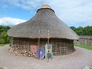
Later, in the Iron Age (around 400 BC), a new wooden structure was built in the same spot. It was a round building connected to a larger round enclosure, shaped like a figure-of-eight. Both parts had eastern entrances. The larger ring was 30 meters (98 feet) wide, and the smaller one was about 20 meters (66 feet) wide. The smaller building had a fireplace.
Archaeologists think this was a roundhouse with a yard, or a building used for rituals. Finds from this time suggest important people lived here, like a king or a priest. They found a fancy pin and the skull of a Barbary monkey. This monkey was likely a pet, brought from far away. This structure was rebuilt many times over the next few centuries.
The Great Roundhouse
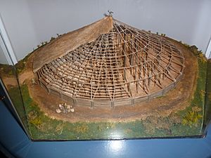
In the first century BC, a huge wooden roundhouse was built on the same spot. It was 40 meters (130 feet) wide. It had an outer wall and four inner rings of posts that probably held up a roof. In the very center was a huge oak pillar. This pillar was cut in 95 BC and might have stood 13 meters (43 feet) tall. The building had an entrance facing west, towards the setting sun. This suggests it was not a normal home.
Around the same time, the huge bank and ditch that circles the entire hill was dug.
Not long after it was built, this large wooden building was filled with thousands of stones. The stones reached almost 3 meters (10 feet) high. This stone pile was flat on top and divided into sections, looking like a spoked wheel from above. Some evidence suggests these stones came from an older monument nearby.
Then, the building was deliberately burned down. After that, it was covered with a mound of earth. The earth came from different types of soil, meaning it was brought from other areas. Similar building and burning rituals happened at other ancient sites like Tara.
Around the first or second century BC, a figure-of-eight structure was also built at the eastern part of the site. It was similar to the ones at the western site. This structure was later removed and replaced by another round wooden building. This one had double walls, a central fireplace, and an eastern entrance. Two graves were found just outside its entrance. This building was then replaced by a ring-barrow, which is a round mound usually built over a burial, surrounded by a ditch and bank.
Why Was it Built?
People believe that building the mound was a special ritual, but its exact meaning is still a mystery. There are several ideas about it. The wooden building might have been built just to be burned, or it might have been a temple for a short time before its planned destruction.
Experts suggest that the event was an offering to the gods. The structure was symbolically given to the Otherworld by being burned and buried. Some compare it to the 'wicker man' ritual, where a large wooden figure was burned with a sacrifice inside. The huge outer bank and ditch likely marked the hilltop as a sacred place. It might also have been a way to keep the power of the Otherworld within that special area.
One idea is that the mound was a way to connect this world with the Otherworld. It might have been built to look like an ancient burial mound (called a sídhe). These mounds were thought to be doorways to the Otherworld and homes of ancient gods. This theory suggests the mound was a platform where priests would perform ceremonies. Kings might have been crowned there, gaining power from the gods and ancestors.
Each part of the monument might represent something. The stones inside the wooden structure could be souls in the house of the dead. Or they could be the souls of brave warriors. Another idea is that the monument shows the three main groups of society: priests (the wooden frame), warriors (the stones), and farmers (the soil). The central pillar might represent a world tree that connects the sky, earth, and underworld. The pattern of the stone pile might look like a sun wheel, a symbol linked to Celtic sun gods.
One expert, Dr. Chris Lynn, believes that in the early first century BC, Navan was seen as a place of the Otherworld. It was home to gods and goddesses. It was a Celtic tribe's holy place, their capital, and a symbol of their power and unity.
Recent studies using special technology have found signs of more buildings underground. These date from the Iron Age and medieval times. This suggests Navan Fort was a very important religious and cultural center long ago.
In the Ulster Cycle of Irish mythology, Emain Macha is the royal capital of the Ulaidh people. These people gave their name to the province of Ulster. The stories say it was the home of Conchobar mac Nessa, the king of Ulster. He was said to have a warrior training school there. King Conchobar's great hall was called in Chraebruad, meaning "the red-branched" or "red-poled building." His royal warriors are known as the Red Branch Knights.
Emain Macha is said to be named after Macha, who was likely a goddess of the Ulaidh. One story tells that Macha, a queen, made her enemies' sons dig the big bank and ditch. She marked out the area with her neck-brooch, which is where the name eomuin (brooch) comes from.
In another tale, Macha is a fairy wife. Her husband, Crunnchu, brags that she can outrun the king's horses. The king forces the pregnant Macha to race. She wins, but then gives birth to twins at the finish line. Before she dies, she curses the Ulstermen. She says they will feel the exhaustion of childbirth when they need strength the most. This story explains why the Ulstermen were weak during the Táin Bó Cúailnge (Cattle Raid of Cooley). This tale explains the name Emain Macha as "Macha's twins."
Old records say that a group called the Three Collas took over the area in 331 AD. They burned Emain Macha and made the Ulaidh people move east. Another story says that Niall of the Nine Hostages, or his sons, destroyed Emain Macha later.
Many other famous characters from Irish mythology are connected to Emain Macha, including:
- Cú Chulainn, a very famous warrior
- Emer, his strong and beautiful wife
- Conall Cernach, Cú Chulainn's foster-brother and friend
- Cathbad, the main druid (priest)
- Fergus mac Róich, another great warrior and king
- Deirdre of the Sorrows, and Naoise, her brave lover
For many years, a nearby limestone quarry threatened Navan Fort. But in 1985, a group called Friends of Navan helped stop the quarrying. They also suggested that Navan should be made ready for visitors.
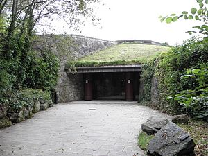
A visitor center opened in 1993. It had old artifacts and videos about the site. It closed in 2001 because of money problems. But it reopened in 2005 after the local council bought the site.
Other important ancient sites are close by. These include Haughey's Fort, an older Bronze Age hill fort about 1 kilometer (two-thirds of a mile) to the west. There's also the King's Stables, a man-made pool from the Bronze Age. And Loughnashade, a natural lake where Iron Age objects have been found.
See also
 In Spanish: Emain Macha para niños
 | Delilah Pierce |
 | Gordon Parks |
 | Augusta Savage |
 | Charles Ethan Porter |


