Nevado del Plomo facts for kids
Quick facts for kids Nevado del Plomo |
|
|---|---|

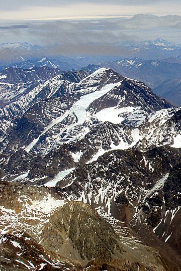
Northeast side of Nevado del Plomo in Argentina with its glaciers Alfa and Beta.
|
|
| Highest point | |
| Elevation | 6,070 m (19,910 ft) |
| Prominence | 1,500 m (4,900 ft) |
| Parent peak | Tupungato |
| Listing | Ultra |
| Geography | |
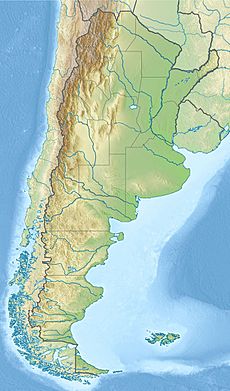
| Location | Chile / Argentina |
| Parent range | Principal Cordillera, Andes |
| Climbing | |
| First ascent | 20/01/1910 by Frederick Reichert, Friedrich Bade, Robert Helbling (Germany) |
Nevado del Plomo, also known as Nevado El Plomo, is a tall mountain located right on the border between Argentina and Chile. It's a part of the Andes mountain range, which is the longest mountain range in the world!
This impressive peak stands at about 6,070 metres (19,915 feet) high. A glacier called Juncal Sur Glacier flows down its western side. This glacier is very important because its melting ice feeds the Olivares River.
The Argentine part of Nevado del Plomo is protected within the Tupungato Volcano Provincial Park. The mountain also sits on the border of two provinces: Mendoza in Argentina and Cordillera in Chile. Its slopes are near the cities of Luján de Cuyo in Argentina and San José de Maipo in Chile.
Contents
First Climb to the Top
Who Climbed Nevado del Plomo First?
The first time anyone successfully climbed to the very top of Nevado del Plomo was on January 20, 1910. This amazing feat was achieved by three German climbers: Friedrich Reichert, Friedrich Bade, and Robert Helbling. They were the first to reach its summit!
How Tall is Nevado del Plomo?
Measuring the Mountain's Height
Nevado del Plomo has an official height of 6,070 metres (about 19,915 feet). Scientists use different ways to measure mountains. For example, some digital maps show its height as 6,062 metres or even 6,037 metres. These small differences happen because of how the measurements are taken.
Understanding Mountain Features
Mountains have special features that climbers and geographers measure:
- Topographic Prominence: This tells you how much a mountain stands out from the land around it. Imagine the lowest point you would have to go down to before climbing up another higher mountain. For Nevado del Plomo, this "prominence" is 1,500 metres. This means it rises quite dramatically from its surroundings.
- Parent Peak: Every mountain has a "parent peak," which is the closest higher mountain. For Nevado del Plomo, its parent peak is Tupungato.
- Topographic Isolation: This measures how far away the nearest higher point is. Nevado del Plomo is about 39.5 kilometres away from a higher peak.
See also
 In Spanish: Nevado El Plomo para niños
 | Delilah Pierce |
 | Gordon Parks |
 | Augusta Savage |
 | Charles Ethan Porter |


