New Johnsonville, Tennessee facts for kids
Quick facts for kids
New Johnsonville, Tennessee
|
||
|---|---|---|
|
||
| Motto(s):
"Friendly people, working together"
|
||

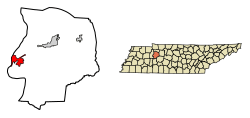
Location in Humphreys County, Tennessee
|
||
| Country | United States | |
| State | Tennessee | |
| County | Humphreys | |
| Incorporated | 1949 | |
| Area | ||
| • Total | 6.88 sq mi (17.83 km2) | |
| • Land | 5.14 sq mi (13.33 km2) | |
| • Water | 1.74 sq mi (4.50 km2) | |
| Elevation | 436 ft (133 m) | |
| Population
(2020)
|
||
| • Total | 1,804 | |
| • Density | 350.63/sq mi (135.38/km2) | |
| Time zone | UTC-6 (Central (CST)) | |
| • Summer (DST) | UTC-5 (CDT) | |
| ZIP code |
37134
|
|
| Area code(s) | 931 | |
| FIPS code | 47-52820 | |
| GNIS feature ID | 1295581 | |
New Johnsonville is a small city located in Humphreys County, Tennessee, in the United States. In 2020, about 1,804 people lived there. It's known for its friendly community and interesting history.
Contents
A Look Back in Time
New Johnsonville has a cool story! It started from an older town called Johnsonville. This original town was right on the Tennessee River, about 3 miles (4.8 km) downstream from where New Johnsonville is today.
The Civil War Battle
The first Johnsonville was named after Andrew Johnson, who later became president. It was a very important place during the American Civil War. A big fight called the Battle of Johnsonville happened there.
Moving the Town
In 1944, something big changed the old town. The Tennessee Valley Authority (TVA) built the Kentucky Dam. This dam caused the Tennessee River to flood the old Johnsonville. Because of the flood, many people had to move. They moved to the higher ground where New Johnsonville is now. The new city was officially started in 1949.
Where is New Johnsonville?
New Johnsonville is in the western part of Humphreys County, Tennessee. It sits right next to Kentucky Lake, which is part of the Tennessee River.
Roads and Nearby Towns
U.S. Route 70 is a main road that goes through the city. If you drive northeast on this road for about 12 miles (19 km), you'll reach Waverly. Waverly is the main town for Humphreys County. If you go west for about 8 miles (13 km), you'll find Camden.
Land and Water
The city covers a total area of about 6.88 square miles (17.83 square kilometers). Most of this area, about 5.14 square miles (13.33 square kilometers), is land. The rest, about 1.74 square miles (4.50 square kilometers), is water, mostly from Kentucky Lake.
Who Lives Here?
The number of people living in New Johnsonville has changed over the years.
| Historical population | |||
|---|---|---|---|
| Census | Pop. | %± | |
| 1960 | 559 | — | |
| 1970 | 970 | 73.5% | |
| 1980 | 1,824 | 88.0% | |
| 1990 | 1,643 | −9.9% | |
| 2000 | 1,905 | 15.9% | |
| 2010 | 1,951 | 2.4% | |
| 2020 | 1,804 | −7.5% | |
| Sources: | |||
In 2020, there were 1,804 people living in New Johnsonville. There were 729 households and 533 families. Most of the people living in the city are White (about 89%). There are also smaller groups of Black or African American, Native American, and Asian people. About 6.5% of the population identifies as Other/Mixed race, and about 2% are Hispanic or Latino.
What Does New Johnsonville Do?
New Johnsonville is important for producing electricity and chemicals.
Power Plant
The city is home to the Johnsonville Combustion Turbine Plant. This plant used to be called the Johnsonville Fossil Plant and made electricity from 1951 to 2017. Now, it uses gas turbines to create power for the area.
Chemical Production
The plant also makes steam. This steam is used by a nearby factory called Chemours. The Chemours plant is very important because it produces about 25% of all the titanium dioxide used in America. Titanium dioxide is a white powder used in many things, like paint, plastics, and sunscreen.
Fun Things to Do
If you're looking for something fun and historical, you can visit Johnsonville State Historic Park. This park is about 4 miles (6.4 km) north of the city. It's a great place to learn more about the area's past, especially its role in the Civil War.
See also
 In Spanish: New Johnsonville para niños


