Camden, Tennessee facts for kids
Quick facts for kids
Camden
|
|
|---|---|

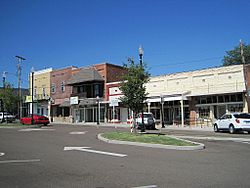
Downtown Camden
|
|

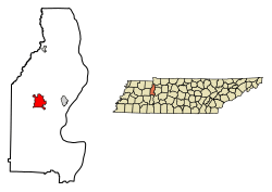
Location of Camden in Benton County, Tennessee.
|
|
| Country | United States |
| State | Tennessee |
| County | Benton |
| Founded | 1836 |
| Incorporated | 1838 |
| Named for | Camden, South Carolina |
| Area | |
| • Total | 5.68 sq mi (14.70 km2) |
| • Land | 5.68 sq mi (14.70 km2) |
| • Water | 0.00 sq mi (0.00 km2) |
| Elevation | 449 ft (137 m) |
| Population
(2020)
|
|
| • Total | 3,674 |
| • Density | 647.17/sq mi (249.88/km2) |
| Time zone | UTC-6 (Central (CST)) |
| • Summer (DST) | UTC-5 (CDT) |
| ZIP code |
38320
|
| Area code(s) | 731 |
| FIPS code | 47-10560 |
| GNIS feature ID | 1305616 |
Camden is a small city in Tennessee, located in Benton County. It is the main town, also known as the county seat, of Benton County. In 2020, about 3,674 people lived here.
Contents
History of Camden
People have lived in the Camden area for a very long time. Native Americans were here as early as the Archaic period, which was from about 8000 to 1000 BC. A special place called the Eva Site has been found nearby. It shows signs of people living there for 7,000 years. This site is now under Kentucky Lake.
The first European settlers came to Benton County around 1818. This was shortly after the land was bought from the Chickasaw people. Camden started as a resting stop for stagecoaches traveling between Nashville and Memphis.
At first, the community was called "Tranquility." By the 1830s, it was known as "Camden." This name was inspired by the Revolutionary War and the Battle of Camden. When Benton County was created in 1835, Camden was chosen as its county seat. The city of Camden officially became a city in 1838.
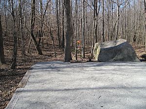
A sad event happened near Camden on March 5, 1963. Famous country music stars Patsy Cline, Cowboy Copas, and Hawkshaw Hawkins died in a plane crash here.
Geography of Camden
Camden is located along Cypress Creek. This creek flows into Kentucky Lake, which is a large lake formed by the Tennessee River. The lower 10 miles (16 km) of Cypress Creek were covered by the lake when Kentucky Dam was finished in 1944.
The area around Camden has low hills to the north and west. To the east, there are wetlands, which are areas of land covered by water. Many of these wetlands are protected by the Camden Wildlife Management Area.
According to the United States Census Bureau, the city covers an area of 5.7 square miles (14.7 km2). All of this area is land.
Camden's Population
| Historical population | |||
|---|---|---|---|
| Census | Pop. | %± | |
| 1850 | 176 | — | |
| 1860 | 159 | −9.7% | |
| 1870 | 148 | −6.9% | |
| 1880 | 200 | 35.1% | |
| 1890 | 330 | 65.0% | |
| 1900 | 399 | 20.9% | |
| 1910 | 692 | 73.4% | |
| 1920 | 800 | 15.6% | |
| 1930 | 955 | 19.4% | |
| 1940 | 992 | 3.9% | |
| 1950 | 2,029 | 104.5% | |
| 1960 | 2,774 | 36.7% | |
| 1970 | 3,052 | 10.0% | |
| 1980 | 3,279 | 7.4% | |
| 1990 | 3,643 | 11.1% | |
| 2000 | 3,828 | 5.1% | |
| 2010 | 3,582 | −6.4% | |
| 2020 | 3,674 | 2.6% | |
| Sources: | |||
People in Camden (2020)
| Race | Num. | Perc. |
|---|---|---|
| White (non-Hispanic) | 3,168 | 86.23% |
| Black or African American (non-Hispanic) | 158 | 4.3% |
| Native American | 10 | 0.27% |
| Asian | 49 | 1.33% |
| Other/Mixed | 149 | 4.06% |
| Hispanic or Latino | 140 | 3.81% |
In 2020, there were 3,674 people living in Camden. There were 1,516 households, which are groups of people living together. There were also 759 families.
Camden's Economy
Farming is a very important part of the economy in Camden and Benton County. Sorghum was once a major crop here. Sorghum is a type of grain used for food and other products. The last place that processed sorghum closed in 2001.
Jones Plastic and Engineering has a large factory in Camden. It covers about 60,000-square-foot (5,600 m2).
Camden is also a bedroom community. This means many people who live in Camden travel to other towns for work. Some work for the Tennessee Valley Authority (TVA), which provides electricity. Others work at the DuPont factory in nearby New Johnsonville. This factory makes titanium dioxide.
Parks and Recreation
- Birdsong Trail Ride
- Camden Speedway
Education in Camden
The Benton County School System serves Camden. The schools include:
- Camden Elementary
- Camden Junior High School
- Camden Central High School
Media in Camden
Radio Stations
- WRJB-FM 95.9 "Magic 95.9 the Valley"
Newspapers
- The Camden Chronicle
- The Marketplace
- Tennessee Magnet Publications
Transportation in Camden
Roads and Highways
- U.S. Route 70 connects Camden to Nashville in the east and Memphis in the west. There is also a business route (US 70 Business) that goes through the center of town. The main highway goes around Camden to the south.
- Tennessee State Route 191 connects Camden to Eva and to Nathan Bedford Forrest State Park to the northeast. It also connects to Interstate 40 to the southeast.
- U.S. Route 641 crosses US 70 Business in the western part of Camden. It also crosses US 70 south of Camden. This route connects the area to Paris and Kentucky to the north. To the south, it connects to I-40 and Parsons.
- Tennessee State Route 69A starts in Camden. It begins where US 70 Business and TN 191 meet. It then goes north to Big Sandy.
Notable People from Camden
- Nyman Furr, a musician known as "The Tennessee Fiddler"
- Tanner Hudson, an NFL tight end who plays for the Cincinnati Bengals
- Frank P. Lashlee, a member of the Tennessee General Assembly
- Col. Littleton, a fashion designer
- Charles F. Pendleton, who received a Medal of Honor for his brave actions in the Korean War
See also
 In Spanish: Camden (Tennessee) para niños
 | Frances Mary Albrier |
 | Whitney Young |
 | Muhammad Ali |


