
Niotaze, Kansas facts for kids
Quick facts for kids
Niotaze, Kansas
|
|
|---|---|

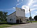
1895 Niotaze Methodist Episcopal Church
|
|

Location within Chautauqua County and Kansas
|
|

|
|
| Country | United States |
| State | Kansas |
| County | Chautauqua |
| Incorporated | 1910 |
| Area | |
| • Total | 0.37 sq mi (0.96 km2) |
| • Land | 0.37 sq mi (0.96 km2) |
| • Water | 0.00 sq mi (0.00 km2) |
| Elevation | 758 ft (231 m) |
| Population
(2020)
|
|
| • Total | 90 |
| • Density | 243/sq mi (94/km2) |
| Time zone | UTC-6 (CST) |
| • Summer (DST) | UTC-5 (CDT) |
| ZIP code |
67355
|
| Area code | 620 |
| FIPS code | 20-50750 |
| GNIS ID | 2395237 |
Niotaze is a small city located in Chautauqua County, Kansas, in the United States. In 2020, about 90 people lived there.
Contents
History of Niotaze
Niotaze likely got its name from other towns called Niota in Illinois or Tennessee. Around 1910, Niotaze was a much bigger place. It had about 317 people living there. It was an important spot for sending goods like grain, farm animals, and fresh food. This was because two different railroads met there.
Where is Niotaze?
Niotaze is a small city. It covers an area of about 0.37 square miles (0.96 square kilometers). All of this area is land. There are no large bodies of water within the city limits.
People Living in Niotaze
The number of people living in Niotaze has changed over time. In 1910, there were 317 residents. By 2020, the population was 90 people.
Niotaze Population in 2020
The 2020 United States census counted 90 people in Niotaze. These people lived in 30 households, and 20 of these were families. The city had about 243 people per square mile. Most of the people (60%) were white. About 19% were Native American. About 20% of the people were from two or more racial backgrounds. A small number (3.3%) were Hispanic or Latino.
In the households, about one-third had kids under 18 years old. Almost half of the households were married couples living together. The average age of people in Niotaze was 38.3 years old. About 29% of the population was under 18. About 18% were 65 or older.
Niotaze Population in 2010
In the census of 2010, there were 82 people living in Niotaze. They lived in 33 households, and 22 of these were families. The city had about 222 people per square mile. Most people (85.4%) were White. About 7.3% were Native American. Another 7.3% were from two or more racial backgrounds.
The average age in the city was 42 years. About 26% of residents were under 18. About 22% were 65 or older. There were more males (57.3%) than females (42.7%) in the city.
Education in Niotaze
Students in Niotaze attend schools in the Caney Valley USD 436 public school district.
Getting Around Niotaze
Roads and Highways
U.S. Route 166 is a main highway that goes through Niotaze. It runs from east to west.
Railroads
Long ago, two different railroads used to go through Niotaze. These were the Santa Fe and Missouri Pacific lines. However, both of these railroad lines are no longer in use.
Images for kids
-
Former U.S. Post Office (2013)

See also
 In Spanish: Niotaze (Kansas) para niños
