Nissequogue River facts for kids
Quick facts for kids Nissequogue River |
|
|---|---|

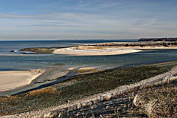
Mouth on Long Island Sound
|
|
| Country | United States |
| State | New York |
| Region | Suffolk |
| District | Smithtown |
| Physical characteristics | |
| Main source | Caleb Smith Park (at northern end of New Mill Pond) 29 ft (8.8 m) 40°50′34″N 73°13′40″W / 40.8428°N 73.2279°W |
| River mouth | Nissequogue River State Park at Long Island Sound 0 ft (0 m) 40°54′15″N 73°13′48″W / 40.90426°N 73.23011°W |
| Length | 8.3 mi (13.4 km), SN |
The Nissequogue River is a cool river on Long Island, New York. It's about 8.3 miles (13.4 km) long. The river flows from Smithtown, New York all the way to the Long Island Sound. It's special because it gets all its water from underground, not from lakes! This underground water is called groundwater.
The Nissequogue River has the most water flow of any freshwater river on Long Island. Its name comes from the Algonquian-speaking Nissequaq tribe who used to live in the area.
The River's Journey
The Nissequogue River starts south of NY-454 near the Hauppauge County Offices. It flows into Blydenburgh Park Pond. Other small streams from East Hauppauge and Commack join it here. These streams are held back by a dam at Blydenburgh Pond.
The river then flows northeast. It picks up more water from streams in Caleb Smith Park in Smithtown. This park is a great spot for special trout fishing. The river is dammed one more time before it becomes an estuary at NY-25.
An estuary is where a river meets the sea, and fresh water mixes with salty ocean water. From there, the river flows to Kings Park, New York. Finally, it reaches the Long Island Sound at Nissequogue River State Park. Because much of the river is an estuary, people who go canoeing can travel in both directions, depending on the ocean tides.
River Life: Fish and More
The Nissequogue River is home to many different kinds of fish. You can find fish like Striped Bass, Bluefish, and Summer Flounder. There are also Winter Flounder, Porgies, and Eels.
Freshwater fish like Brown, Rainbow, and Brook Trout live here too. Other fish include Yellow Perch, Largemouth Bass, Alewives, Herring, and Shad. It's a busy place for aquatic life!
Bridges and Crossings
Many roads and paths cross over the Nissequogue River. These crossings help people travel around the area.
- Main River Crossings:
In Smithtown: Landing Avenue: An unnamed road bridge crosses here. NY-25 and NY-25A (Main Street): Another unnamed road bridge. Old Main Street Bridge: This is a bridge just for people walking. Long Island Rail Road Port Jefferson Branch Trestle: A railroad bridge crosses the river. In Blydenberg County Park: Mill Dam Road: A private road bridge. New Mill Road: This road is part of the Long Island Greenbelt Trail. Blydenberg County Park Driveway: Another unnamed road bridge. In Hauppauge: NY-454 (Veterans Memorial Highway): An unnamed road bridge. Raoul Wallenberg Drive: A county access road bridge.
- Northeast Branch Crossings:
The Northeast Branch is a smaller part of the river. It also has several crossings. In Smithtown: Brooksite Drive: An unnamed road bridge. CR-15 (Maple Avenue): Another unnamed road bridge. In Village of The Branch: NY-111 (Main Street): An unnamed road bridge. Terrace Lane: An unnamed road bridge. Branch Drive: An unnamed road bridge. In Hauppauge: NY-347 (Veterans Memorial Highway): An unnamed road bridge. Bow Drive: This bridge is closed to cars. CR-67 (Town Line Road): An unnamed road bridge.
 | Bayard Rustin |
 | Jeannette Carter |
 | Jeremiah A. Brown |


