
Norcross, Minnesota facts for kids
Quick facts for kids
Norcross, Minnesota
|
|
|---|---|

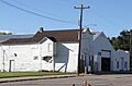
Water tower at railroad crossing
|
|

Location of Norcross, Minnesota
|
|
| Country | United States |
| State | Minnesota |
| County | Grant |
| Platted | December 1881 |
| Incorporated | February 20, 1904 |
| Area | |
| • Total | 1.558 sq mi (4.034 km2) |
| • Land | 1.558 sq mi (4.034 km2) |
| • Water | 0.000 sq mi (0.000 km2) |
| Elevation | 1,040 ft (317 m) |
| Population
(2020)
|
|
| • Total | 52 |
| • Estimate
(2022)
|
52 |
| • Density | 33.38/sq mi (12.89/km2) |
| Time zone | UTC−6 (Central (CST)) |
| • Summer (DST) | UTC−5 (CDT) |
| ZIP Code |
56274
|
| Area code(s) | 320 |
| FIPS code | 27-46492 |
| GNIS feature ID | 0648581 |
| Sales tax | 6.875% |
Norcross is a small city located in Grant County, Minnesota, United States. It sits right by the Mustinka River. In 2020, about 52 people lived there, making it a very small and quiet place.
Contents
History of Norcross
Norcross was planned out as a town in 1881. It began as a large farm that grew grain, owned by N.F. Griswold and Captain J.N. Cross. They convinced the Great Northern Railway to build a train station at their farm. This was instead of building it two miles north at a planned town called Gorton.
How Norcross Got Its Name
Trains often stopped at the farm to pick up wheat. Because of this, the railroad decided to build a station and grain storage buildings there. The town's name, Norcross, comes from two of its founders: Henry Allyn Norton and Judson Newell Cross. N.F. Griswold, the third founder, got "Griswold Avenue" named after him.
Growing as a Community
The town officially became a city in 1913, with 140 people living there. A bank opened in 1909 but closed in 1931 because of the Great Depression, a time when many businesses struggled.
The first school, called "New School," opened in 1903. Later, when a newer school was built, this old building became home to the Norwegian Lutheran Church. In 1928, a big fire destroyed many buildings on the south side of town. Even after the fire, the people of Norcross worked hard to rebuild. They opened a creamery (a place that makes dairy products), a town hall, and a store that sold drinks. This store later became a pool hall.
Churches and Community Spirit
At one time, Norcross had three churches. Our Savior's Lutheran Church celebrated its 75th anniversary in 1976. It is now a private home. Long ago, early settlers walked 17 miles to a church northeast of Norcross to attend services.
St. Mary's Catholic Church opened in 1905 but closed in 1923. The Faith United Methodist Church started services in a school in 1919. They built their own church in 1952, which closed in 2007.
Remembering Veterans
The American Legion Hillestad-Borgeson Post #410, which is based in Norcross, created a special memorial for veterans. This monument is in Norcross Park on Highway 9. It honors "all the men and women who have served their country in all wars." The names of local heroes, like Jacob Veldhouse, a National Guardsman who served in Iraq, are written there.
The Norcross Town Hall
The Norcross Town Hall was built in the late 1920s. It was a very important place for the community. People would gather there for dances, roller skating, and even basketball games. It also hosted funerals, wedding parties, and church dinners. The brick building eventually became too old and was taken down in 1997. The bricks were given away to the public.
The Post Office and School
A post office has been operating in Norcross since 1881. In October 2019, the United States Postal Service moved its services to the post office in Herman, a nearby town.
The Norcross school building is considered very special and could be added to the National Register of Historic Places. It was built in 1938 by the WPA (Works Progress Administration), a government program that created jobs during the Great Depression. The building is made entirely of poured concrete and is a great example of Art Deco style. For over 30 years, students from first to seventh grade learned in this three-room school. The school joined with Herman's school in 1971, and now the building is privately owned.
Geography of Norcross
Norcross is located in Minnesota. According to the United States Census Bureau, the city covers an area of about 1.558 square miles (4.034 square kilometers). All of this area is land.
Minnesota State Highway 9 is the main road that runs through the community, making it easy to travel to and from Norcross.
People of Norcross
| Historical population | |||
|---|---|---|---|
| Census | Pop. | %± | |
| 1910 | 177 | — | |
| 1920 | 195 | 10.2% | |
| 1930 | 163 | −16.4% | |
| 1940 | 180 | 10.4% | |
| 1950 | 179 | −0.6% | |
| 1960 | 153 | −14.5% | |
| 1970 | 137 | −10.5% | |
| 1980 | 124 | −9.5% | |
| 1990 | 86 | −30.6% | |
| 2000 | 59 | −31.4% | |
| 2010 | 70 | 18.6% | |
| 2020 | 52 | −25.7% | |
| 2022 (est.) | 52 | −25.7% | |
| U.S. Decennial Census 2020 Census |
|||
Norcross Population in 2010
In 2010, the census showed that 70 people lived in Norcross. There were 29 households, which are groups of people living together in one home. Out of these, 20 were families.
The population density was about 44.9 people per square mile (17.3 people per square kilometer). Most of the people living in Norcross were White (74.3%). Some were Native American (1.4%), and 20.0% were from other backgrounds. About 25.7% of the population identified as Hispanic or Latino.
About 27.6% of the households had children under 18 living with them. Most households (58.6%) were married couples living together. The average household had 2.41 people, and the average family had 3.05 people.
The average age of people in Norcross was 41.5 years old. About 28.6% of residents were under 18, and 21.4% were 65 or older. The population was 37.1% male and 62.9% female.
Images for kids
-
Former Post Office

See also
 In Spanish: Norcross (Minnesota) para niños
