
Odenwald facts for kids
Quick facts for kids Odenwald |
|
|---|---|

Overview of the Odenwald
|
|
| Highest point | |
| Peak | Katzenbuckel |
| Elevation | 626 m (2,054 ft) NHN |
| Dimensions | |
| Area | 2,500 km2 (970 sq mi) |
| Geography | |

Location in Germany
|
|
| Country | Germany |
| State/Province | Hesse, Bavaria, Baden-Württemberg |
| Range coordinates | 49°35′N 9°1′E / 49.583°N 9.017°E |

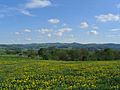
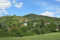
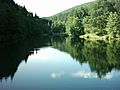
The Odenwald is a beautiful mountain area in Germany. It stretches across parts of Hesse, Bavaria, and Baden-Württemberg. It's a popular place for people to visit and enjoy nature.
Contents
Exploring the Odenwald
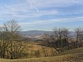
The Odenwald is a mountain chain, which means it's a long group of mountains. It is bordered by important rivers. To the south, you'll find the Neckar River. The Main River is to the east. And the Rhine River valley is to the west.
The Highest Point
The tallest mountain in the Odenwald is called the Katzenbuckel. This name means "cat's hump" in German! It stands 626 meters (about 2,054 feet) high.
Fun Things to Do
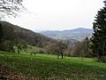
Many people from nearby cities like Mannheim and Frankfurt am Main love to visit the Odenwald. It's known for its clean, fresh air. There are many marked paths perfect for hiking. You can also find wild blueberries, strawberries, and mushrooms in the forests.
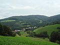
Charming Towns and Climate
The Odenwald region has several very pretty small towns. One example is Weinheim, located on the Bergstraße Route. Another lovely town is Michelstadt. The weather here is often mild, which means it's usually not too hot or too cold.
Images for kids
-
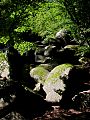
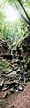
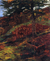
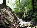
The Reichenbach felsenmeer in autumn
-
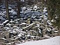
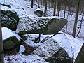
Felsenmeer near Reichenbach (Lautertal) in winter
-
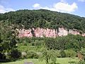
Characteristic sandstone formation near Eberbach
-
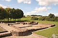
Roman manor house Villa Haselburg near Höchst (Mümling)
-
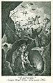
Wild Woman (Wildweibchen) with a unicorn (Straßburg around 1500)
-
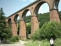
The Himbächel viaduct on the Odenwald Railway)
-
The Margarethenschlucht (gorge)
-
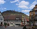
Every year the Heppenheimer Street Theatre Gassensensationen occupies the marketplace and other corners of the old town
-
Granite-Gneiss-Odenwald (Altherr, 1999)
-
Granite-Gneiss-Odenwald (Stein, 2001)
-
Granite-Gneiss- and Redsandstone-Odenwald (Stein, 2001 + Weber, Geo-Naturpark)
-
Geological profile (from left): Rheinplane, Granite-Odenwald, Gneiss-Odenwald, Redsandstone-Odenwald (Geo-Naturpark)
-
Siegfriedbrunnen by Wilhelm Trübner. In the legend there is no exact description in respect of the hunting trip.
-
Rodenstein Castle is the scene of the Rodensteiner ghost legend (19th-century picture).
-
The Crystal Teaching Path around the Katzenbuckel starts near the old volcanic quarry (below-mentioned)
-
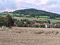
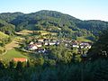
Neutsch with a view to Neunkirchen and the Neunkircher Höhe
-
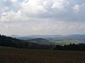
View from Weschnitz- Valley to the mountains Hardberg (with transmitter), Götzenstein, Kisselbusch (from left)
-
Weschnitz- Valley with a view to Tromm-mountain range
-
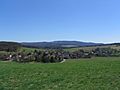
Overlooking the Krehberg (view from Lindenfels)
-
The Waldskopf in the Gorxheim valley
-
The Melibokus near Zwingenberg
-
With a view from the Lauter- Valley (Hohenstein) to the Melibokus (right) and the Auerbach Castle (background, in the middle)
-
The Gesprenz-Valley gneiss-sandstone-mountain range: Böllsteiner Höhe on the left, Morsberg in the middle
-
The Felsberg (with transmitter, view from the Lauter-Valley), Auerbach-Castle and Melibokus on the left
-
The Daumberg in the Gorxheim valley
-
The Weschnitz-Valley with Hirschkopf-Juhöhe-mountain range (view from the Tromm)
-
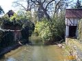
The Gersprenz in Dieburg
-
The Mümling in Erbach
-
The Eutersee near Hesseneck
-
Climbing path at the Breuberg-Hainstadt quarry
-
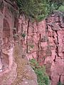
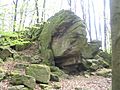
Hohenstein near Reichenbach (Baryte-quartz-cliff)
-
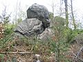
Borstein near Reichenbach (Baryte-quartz-cliff)
-
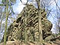
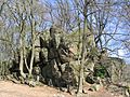
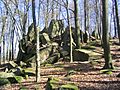
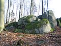
Giant tortoise gneiss rocks (Böllstein)
-
Granite rocks (Tromm)
-
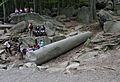
Reichenbach-Felsenmeer: The giant column (Riesensäule) is a workpiece of Roman stonemasons.
-
Granite rocks Wildfrauhaus (Fischbachtal)
-
Zwingenberg (Neckar) gorge: Wolfsschlucht
-
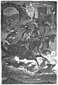
When Caspar und Max begin with casting the magic bullets in the Wolf’s Glen the Wild Hunt appears in the air with demoniacal noise.
-
The rocks at the Juhöhe are supposed to be the petrified dogheads of the Rodensteiner cry of hounds
-
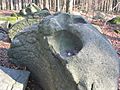
It is said, that the holes of the Opfersteine were offering cups for the devil.
-
People of the Kreiswald near the Juhöhe told, that a long time ago the granite formation was the flat iron of Giant-ladies


.jpg)
_Odw7.jpg)


See also
 In Spanish: Selva de Oden para niños
