Onderbanken facts for kids
Quick facts for kids
Onderbanken
Óngerbenk
|
|||
|---|---|---|---|
|
Former Municipality
|
|||

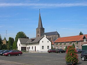
Church in Jabeek
|
|||
|
|||

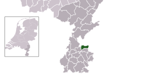
Location in Limburg
|
|||
| Country | Netherlands | ||
| Province | Limburg | ||
| Municipality | Beekdaelen | ||
| Established | 1 January 1982 | ||
| Merged | 2019 | ||
| Area | |||
| • Total | 21.24 km2 (8.20 sq mi) | ||
| • Land | 21.18 km2 (8.18 sq mi) | ||
| • Water | 0.06 km2 (0.02 sq mi) | ||
| Elevation | 68 m (223 ft) | ||
| Population
(May 2014)
|
|||
| • Total | 7,892 | ||
| • Density | 373/km2 (970/sq mi) | ||
| Time zone | UTC+1 (CET) | ||
| • Summer (DST) | UTC+2 (CEST) | ||
| Postcode |
6447–6456
|
||
| Area code | 045, 046 | ||
Onderbanken (pronounced like ON-der-bank-en) was a municipality, which is like a local government area, located in the southeastern part of the Netherlands. It was a small region in the province of Limburg.
In 2019, Onderbanken joined with two other nearby municipalities, Nuth and Schinnen. Together, they formed a new, larger municipality called Beekdaelen. This means Onderbanken no longer exists as a separate municipality.
Contents
What Was Onderbanken?
Onderbanken was officially created on January 1, 1982. It served as a local government for its residents for many years. The area was known for its quiet villages and green landscapes.
The name "Onderbanken" comes from the Dutch words meaning "under the benches." This might refer to its location near certain geographical features or historical boundaries.
Villages and Towns
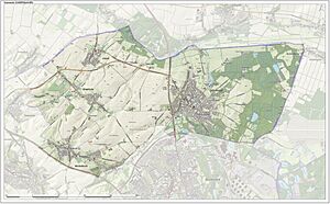
Even though Onderbanken is no longer a separate municipality, the villages and towns that were part of it still exist. These communities are now part of the larger Beekdaelen municipality.
The main villages and towns that made up Onderbanken included:
- Bingelrade
- Douvergenhout
- Etzenrade
- Jabeek
- Merkelbeek
- Op den Hering
- Quabeek
- Raath
- Schinveld
- Viel
The Land and Its Features
Onderbanken was located in the Limburg province, which is known for its rolling hills. The land in Onderbanken was mostly flat, with an average elevation of about 68 meters (223 feet) above sea level. This made it a pleasant area for farming and quiet living.
The total area of Onderbanken was about 21.24 square kilometers (8.20 sq mi). Most of this was land, with only a small amount of water. The region had a typical European climate, with warm summers and mild winters.
Life in Onderbanken
Before the merger, Onderbanken was home to several thousand people. The population density was moderate, meaning there were a good number of people living there, but it wasn't overly crowded.
Life in the villages was generally peaceful. Residents enjoyed the local community feel and the natural surroundings. The area had its own postal codes and telephone area codes, just like any other municipality.
Merger into Beekdaelen
The decision to merge Onderbanken with Nuth and Schinnen was made to create a stronger, more efficient local government. This new municipality, Beekdaelen, started operating in 2019.
The merger aimed to combine resources and improve services for the residents of all three former municipalities. While Onderbanken as a name for a municipality is gone, its history and the communities within it continue as part of Beekdaelen.
 | Tommie Smith |
 | Simone Manuel |
 | Shani Davis |
 | Simone Biles |
 | Alice Coachman |


