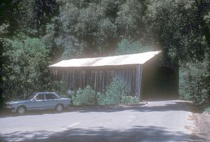
Oregon Creek Covered Bridge facts for kids
Quick facts for kids Oregon Creek Covered Bridge |
|
|---|---|
 |
|
| Carries | Pedestrian |
| Crosses | Oregon Creek |
| Locale | Yuba County, California |
| Characteristics | |
| Design | Queen post truss covered bridge |
| Total length | 101.1 feet (30.8 m) |
| Width | 11.8 feet (3.6 m) |
| Longest span | 77.1 feet (23.5 m) |
| History | |
| Designer | Unknown |
| Opened | 1860-1871 |
|
Oregon Creek Covered Bridge
|
|
| Nearest city | North San Juan, California |
| Built | 1860-1871 |
| Architectural style | Queen post truss covered bridge |
| NRHP reference No. | 75000499 |
| Added to NRHP | May 30, 1975 |
The Oregon Creek Covered Bridge is a really old and special bridge. It crosses Oregon Creek, which flows into the Middle Yuba River. You can find it about 3 miles northeast of North San Juan. It's right near California State Route 49 in the Tahoe National Forest. This bridge is part of the Oregon Creek Day Use Area.
The Bridge Today
The Oregon Creek Covered Bridge got a big makeover in early 2018. It was fixed up and is now open for light vehicles. These vehicles must weigh less than 5 tons. The repairs included replacing the entire roof and fixing the supports at each end.
Before these repairs, the bridge was closed to cars. Only people walking could use it. It was listed as "structurally deficient," meaning it needed repairs. There was also a lot of graffiti inside the bridge. The roof is now made of wavy metal sheets. Strong metal I-beams support the bridge deck.
In 1974, when the bridge was nominated for a special list, it was described. The big wooden beams were made of Ponderosa Pine. They were about 16 inches square and still very strong. The sides of the bridge had wooden siding. The roof was originally made of shake, which are thin wooden tiles.
The bridge's stone supports were originally built without mortar. The east support still looks like it did back then. However, the west support was covered with concrete later on. About 40 to 50 years before 1974, the county replaced the wooden siding. They also changed the shake roof to a corrugated tin roof. This was done to help the bridge handle heavy snow.
Bridge History
The Oregon Creek Covered Bridge was added to the National Register of Historic Places in 1975. This is a list of important historical places in the United States. The exact year the bridge was built is a bit of a mystery. Some records say Tom Freeman built a bridge here in 1858. Other records suggest he built another one nearby in 1871 for $2,500. The first bridge was washed away after the new one was built.
Other sources mention different dates, like 1860, 1861, or 1862. No matter the exact year, this bridge is one of the oldest covered bridges in the western United States. It has been used continuously for over a century.
Tom Freeman built the bridge and also ran it. He also operated another bridge nearby across the Middle Yuba River. These were "toll bridges," meaning people had to pay to cross. He ran them until he passed away in 1892. Later, Yuba County took over the bridge. They still manage it today. The county likely bought the bridge around 1910.
This bridge is special because its entrances, called portals, curve outwards. This unique design makes it stand out from other covered bridges.
In 1883, a big flood happened. The English Dam, located far upstream on the Middle Yuba River, broke. A huge amount of water rushed downstream. This flood caused Oregon Creek to swell. The high water lifted the bridge right off its supports and carried it about 50 yards away.
When the floodwaters went down, the bridge was found. Mr. Freeman hired a logging contractor named Solon Chatfield to put the bridge back. But during the flood, the bridge had turned around. So, the west end of the bridge was placed on the east support. The east end was placed on the west support. It has stayed that way ever since!
Historically, the bridge was very important for local communities. It helped connect mining and logging towns. It was part of the Allegheny Ridge Road. This road was also part of the Henness Pass Road. This was a major route for carrying goods over the Sierra Nevada mountains. This route became very busy after gold and silver were discovered in the Comstock Lode in Virginia City in 1859.
The route was popular because goods could be shipped by boat up the Sacramento River. They would go from the San Francisco Bay to Marysville. From there, the goods were loaded onto wagons for the journey over the Sierra Nevada.
Images for kids
-
Http://bridgehunter.com/photos/20/31/203124-L.jpg
A photo showing the queen post and truss design of the bridge.
-
Http://bridgehunter.com/photos/20/31/203128-L.jpg
A photo of the plaque from the Native Daughters of the Golden West at the bridge.
-
Http://bridgehunter.com/photos/20/31/203129-L.jpg
A photo of the Highway 49 plaque at the bridge.
-
Http://bridgehunter.com/photos/10/13/101327-M.jpg
A photo of the bridge taken in 1922 by Larry Matthews.
-
Http://sunsite.berkeley.edu/FindingAids/dynaweb/calher/miscster/figures/I0047282A.jpg
A photo of the Rudyard (English) Dam, which caused a flood in 1883.


