Orestes, Indiana facts for kids
Quick facts for kids
Orestes, Indiana
|
||
|---|---|---|
 |
||
|
||
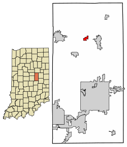
Location in Madison County, Indiana
|
||
| Country | United States | |
| State | Indiana | |
| County | Madison | |
| Township | Monroe | |
| Government | ||
| • Type | Council–manager government | |
| Area | ||
| • Total | 0.40 sq mi (1.04 km2) | |
| • Land | 0.40 sq mi (1.04 km2) | |
| • Water | 0.00 sq mi (0.00 km2) | |
| Elevation | 869 ft (265 m) | |
| Population
(2020)
|
||
| • Total | 329 | |
| • Density | 816.38/sq mi (315.01/km2) | |
| Time zone | UTC-5 (Eastern (EST)) | |
| • Summer (DST) | UTC-4 (EDT) | |
| ZIP code |
46063
|
|
| Area code(s) | 765 | |
| FIPS code | 18-56952 | |
| GNIS feature ID | 2396835 | |
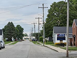
Orestes is a small town located in Monroe Township, Madison County, Indiana, in the United States. It is part of the larger Indianapolis–Carmel–Anderson metropolitan area. In 2020, the town had a population of 329 people. This was a decrease from 414 people counted in 2010.
Contents
The Story of Orestes: A Town's History
Orestes was officially started in 1876. This happened when a railroad line was built and extended to this area. The town officially became an incorporated town in 1894.
How Orestes Got Its Name
Before it was called Orestes, this small village was known as "Lowrys Switch." The town board decided they wanted a new name. They asked people to send in their ideas. A man named Nathan McMahan suggested his son's name, Orestes. The town liked the name, and so "Orestes" it became!
Orestes McMahan, the boy the town was named after, was born on Christmas Day in 1876. He lived until September 14, 1946. He worked as a farmer his whole life and never got married.
Special Landmarks and Local Industry
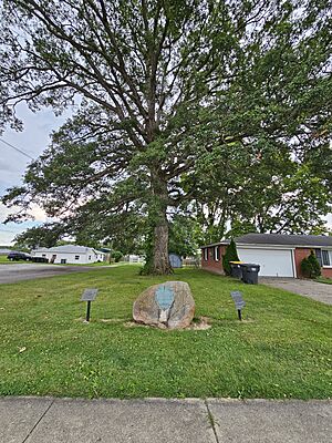
Orestes is famous for a very old oak tree. Experts believe this tree is at least 350 years old! For many years, the town celebrated this tree with an annual event called the Oak Tree Festival.
The town is also home to a large factory that cans tomatoes. This factory is owned by a company called Red Gold Tomatoes.
Where is Orestes Located?
Orestes is found in the northern part of Madison County, Indiana. Indiana State Road 28 runs along the northern edge of the town. If you go east on this road for about 3 miles, you will reach Alexandria. If you go west for about 6 miles, you will get to Elwood. Anderson, which is the main city of Madison County, is about 14 miles south of Orestes.
The town covers an area of about 0.47 square miles, and all of it is land. Lilly Creek flows near the southeast part of Orestes. This creek eventually flows into Pipe Creek and then into the White River.
Who Lives in Orestes? A Look at the Population
Population in 2010
In 2010, the town of Orestes had 414 people living there. These people lived in 148 households, and 114 of these were families. The town had about 668 people per square mile. There were 177 homes in total.
Most of the people in Orestes in 2010 were White (95.7%). A small number were African American (0.2%), Native American (0.5%), or from other backgrounds. About 4.8% of the population identified as Hispanic or Latino.
In 148 households, about 38.5% had children under 18 living with them. Most households (60.1%) were married couples. About 12.2% had a female head of household with no husband present. Around 4.7% had a male head of household with no wife present. About 18.9% of all households were single individuals. About 10.8% of households had someone aged 65 or older living alone. The average household had 2.80 people, and the average family had 3.11 people.
The average age of people in Orestes in 2010 was 35.8 years. About 24.6% of residents were under 18. About 11.8% were between 18 and 24. Another 24.6% were between 25 and 44. About 25.6% were between 45 and 64. Finally, 13.3% were 65 years old or older. The town had slightly more males (51.4%) than females (48.6%).
The Flag of Orestes
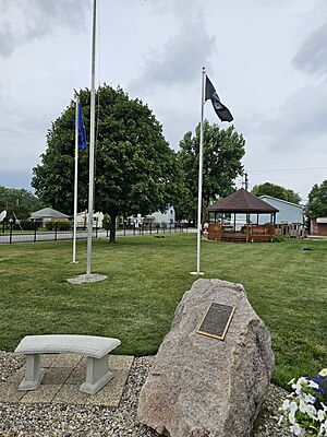
The official flag of Orestes was designed by a town resident named Carolyn Shettle. The Town Board accepted her design in 1976.
What the Flag Looks Like and Means
The flag has three white rings on a blue background. In the middle of the rings, there is a red flame. Mrs. Shettle explained what each part of the flag means:
- The rings themselves stand for things that last forever. They show the past, present, and future of Orestes. The rings also look like the letter "O" for Orestes.
- The three different rings have special meanings:
- One ring represents the town's connection to its Delaware American-Indian Heritage.
- Another ring stands for the "Gas Boom." This was a time when natural gas was discovered, which helped the town grow.
- The third ring represents the very old Orestes Oak Tree, which is a source of pride for the town.
- The flame on the flag stands for the Torch of Liberty. It also reminds people of the discovery of natural gas, which was important for the town's creation.
- The flag uses the colors red, white, and blue. These colors represent freedom, which the people of Orestes value greatly. The blue color is brighter than usual to show their strong love for independence.
Mrs. Shettle also noticed something interesting by accident: a shape that looks like a dove flying down can be seen in the blue part of the flame. A dove is a symbol of peace and Christianity.
See also
 In Spanish: Orestes (Indiana) para niños
 | Misty Copeland |
 | Raven Wilkinson |
 | Debra Austin |
 | Aesha Ash |


