
Alexandria, Indiana facts for kids
Quick facts for kids
Alexandria, Indiana
|
|
|---|---|
 |
|
| Nickname(s):
"Small Town USA"
|
|

Location in Madison County, Indiana
|
|

Alexandria, Indiana
Location in Indiana

Alexandria, Indiana
Location in the United States

Alexandria, Indiana
Location in North America
|
|
| Country | United States |
| State | Indiana |
| County | Madison |
| Township | Monroe |
| Area | |
| • Total | 3.02 sq mi (7.83 km2) |
| • Land | 3.02 sq mi (7.83 km2) |
| • Water | 0.00 sq mi (0.00 km2) |
| Elevation | 869 ft (265 m) |
| Population
(2020)
|
|
| • Total | 5,149 |
| • Density | 1,702.15/sq mi (657.25/km2) |
| Time zone | UTC-5 (EST) |
| • Summer (DST) | UTC-4 (EDT) |
| ZIP code |
46001
|
| Area code(s) | 765 |
| FIPS code | 18-00910 |
| GNIS feature ID | 2393917 |
Alexandria is a city in Indiana, United States. It is located in Madison County, within Monroe Township. The city is about 48 miles (77 km) northeast of Indianapolis, a major city in Indiana.
In 2020, about 5,149 people lived in Alexandria. This number was very close to its population in 2010.
Contents
History of Alexandria

Alexandria was first planned out in 1836. This happened because people thought the Indiana Central Canal would reach the area. The city officially became a town in 1898.
A special type of train line, called an Interurban railway, started in 1898. This was Indiana's very first interurban line. It connected Alexandria to the city of Anderson. Interurban railways were like early electric streetcars that traveled between cities.
Where is Alexandria Located?
Alexandria is in the northern part of Madison County. Indiana State Road 9 runs along the east side of the city. This road goes south 11 miles (18 km) to Anderson, which is the county seat. It also goes north 21 miles (34 km) to Marion.
Another road, State Road 28, crosses the northern edge of Alexandria. This road leads west 9 miles (14 km) to Elwood. It goes east 23 miles (37 km) to Albany.
The city covers about 3.0 square miles (7.8 square kilometers) of land. There is no water area within the city limits. A stream called Pipe Creek flows through the southern part of Alexandria. It eventually joins the White River.
People of Alexandria
| Historical population | |||
|---|---|---|---|
| Census | Pop. | %± | |
| 1870 | 287 | — | |
| 1880 | 488 | 70.0% | |
| 1890 | 715 | 46.5% | |
| 1900 | 7,221 | 909.9% | |
| 1910 | 5,096 | −29.4% | |
| 1920 | 4,172 | −18.1% | |
| 1930 | 4,408 | 5.7% | |
| 1940 | 4,801 | 8.9% | |
| 1950 | 5,147 | 7.2% | |
| 1960 | 5,582 | 8.5% | |
| 1970 | 5,600 | 0.3% | |
| 1980 | 6,028 | 7.6% | |
| 1990 | 5,709 | −5.3% | |
| 2000 | 6,260 | 9.7% | |
| 2010 | 5,145 | −17.8% | |
| 2020 | 5,149 | 0.1% | |
| U.S. Decennial Census | |||
Alexandria is part of the larger Indianapolis–Carmel–Anderson metropolitan area. This means it is connected to the bigger cities nearby.
Population in 2010
In 2010, there were 5,145 people living in Alexandria. Most of the people living in the city were White (97.4%). About 25.6% of the residents were under 18 years old. Around 15.6% of the people were 65 years old or older. The average age in the city was 38.2 years.
Getting Around Alexandria
Alexandria Airport
The Alexandria Airport is a public airport. It is located about 3 miles (5 km) southeast of the main part of Alexandria.
Schools and Learning
The public schools in Alexandria are run by the Alexandria Community School Corporation. The city also has a public library where people can borrow books. It is called the Alexandria-Monroe Public Library.
Famous People from Alexandria
- Joey Feek, a country music singer
- Bill Gaither, a gospel singer and songwriter
- Danny Gaither, a gospel singer
- Gloria Gaither, an author, lyricist, and gospel singer
- Robert L. Rock, a politician
Gallery
-
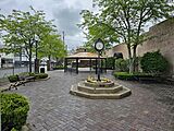
Clock in Alexandria, Indiana
-
Fountain in park in Alexandria
-
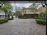
The Commons Theatre in Alexandria Indiana
-
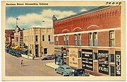
Harrison Street in Alexandria, circa 1930–1945
-
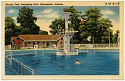
Beulah Park Swimming Pool in Alexandria, circa 1930–1945
-
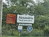
Welcome to Alexandria


.jpg)
.jpg)

See also
 In Spanish: Alexandria (Indiana) para niños
