
Oriskany Falls, New York facts for kids
Quick facts for kids
Oriskany Falls, New York
|
|
|---|---|
|
Village
|
|

Location in Oneida County and the state of New York.
|
|
| Country | United States |
| State | New York |
| County | Oneida |
| Area | |
| • Total | 0.51 sq mi (1.31 km2) |
| • Land | 0.51 sq mi (1.31 km2) |
| • Water | 0.00 sq mi (0.00 km2) |
| Elevation | 974 ft (297 m) |
| Population
(2020)
|
|
| • Total | 658 |
| • Density | 1,300.40/sq mi (501.85/km2) |
| Time zone | UTC-5 (Eastern (EST)) |
| • Summer (DST) | UTC-4 (EDT) |
| ZIP code |
13425
|
| Area code(s) | 315 |
| FIPS code | 36-55376 |
| GNIS feature ID | 0959483 |
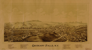
Oriskany Falls is a small village located in Oneida County, New York, in the United States. In 2020, about 658 people lived there. The village gets its name from a beautiful waterfall on a nearby stream.
Oriskany Falls is mostly found in the southeastern part of the town of Augusta. However, a small portion of it also extends into the town of Marshall. Important roads like Route 12B and Route 26 meet and briefly run together through the village.
Contents
History of Oriskany Falls
Early Settlement and Naming
The area where Oriskany Falls is now located was first settled around the year 1794. Back then, it had a different name: Cassety Hollow. Later, in the 1880s, the community officially became a village and was named Oriskany Falls.
Community Development
In the middle and late 1900s, a kind man named Mr. George Tucker owned a large part of the village. He generously gave much of his property to the community. This included a local church and a popular store called "Tucker's Big M."
The store was later sold in 2004 to a company called "Shur-Fine." They updated the store and added a gas station. In 2006, the store was sold again to two brothers-in-law, Badal Singh and Sukhminder Singh, who were originally from India.
The First Congregational Free Church is an important historical building in Oriskany Falls. It was added to the National Register of Historic Places in 1979. This means it's recognized as a special place worth preserving.
Geography of Oriskany Falls
Location and Area
Oriskany Falls is located at coordinates 42°56′17″N 75°27′46″W / 42.93806°N 75.46278°W. This helps pinpoint its exact spot on a map.
According to the United States Census Bureau, the village covers a total area of about 0.5 square miles (1.3 square kilometers). All of this area is land, meaning there are no large bodies of water like lakes within the village limits.
Natural Features
The village is situated right on the Oriskany Creek. It is also very close to the border of Madison County.
Population of Oriskany Falls
Population Changes Over Time
The number of people living in Oriskany Falls has changed over many years. Here's a look at the population counts from different censuses:
| Historical population | |||
|---|---|---|---|
| Census | Pop. | %± | |
| 1870 | 628 | — | |
| 1880 | 598 | −4.8% | |
| 1890 | 625 | 4.5% | |
| 1900 | 811 | 29.8% | |
| 1910 | 892 | 10.0% | |
| 1920 | 1,014 | 13.7% | |
| 1930 | 853 | −15.9% | |
| 1940 | 930 | 9.0% | |
| 1950 | 893 | −4.0% | |
| 1960 | 972 | 8.8% | |
| 1970 | 927 | −4.6% | |
| 1980 | 802 | −13.5% | |
| 1990 | 795 | −0.9% | |
| 2000 | 698 | −12.2% | |
| 2010 | 732 | 4.9% | |
| 2020 | 658 | −10.1% | |
| U.S. decennial census | |||
Community Demographics
In the year 2000, there were 698 people living in Oriskany Falls. These people lived in 292 different households. About 29% of these households had children under 18 living there. Many households were made up of married couples living together.
The population included people of different ages. About 24.6% of the residents were under 18 years old. About 18.3% were 65 years old or older. The average age in the village was 39 years.
Education in Oriskany Falls
Students in Oriskany Falls attend schools within the Waterville Central School District.
See also
 In Spanish: Oriskany Falls para niños
