Otter Lake (Seguin, Parry Sound District, Ontario) facts for kids
Quick facts for kids Otter Lake |
|
|---|---|

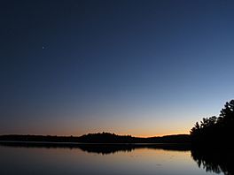
Sunset over Otter Lake
|
|
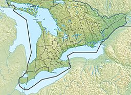
| Location | Parry Sound District, Ontario |
| Coordinates | 45°16′41″N 79°58′03″W / 45.27806°N 79.96750°W |
| Type | Glacial lake, oligotrophic, dimictic |
| Primary inflows | Natural springs |
| Primary outflows | Boyne River |
| Basin countries | Canada |
| Max. length | 6.5 km (4.0 mi) |
| Max. width | 7.25 km (4.50 mi) |
| Surface area | 5.06 km2 (1,250 acres) |
| Average depth | 10.8 m (35 ft) |
| Max. depth | 45 m (148 ft) |
| Surface elevation | 208 m (682 ft) |
| Frozen | Mid-December to Late April |
| Islands | Bluebell, Delta, Fair, Angel, Rusholme, Round Sentinel, Snake, Robinson |
| Settlements | (None on lake) |
Otter Lake is a beautiful lake located in Foley Township. This area is part of the municipality of Seguin, in the Parry Sound District of Central Ontario, Canada.
The original First Nations people who lived here called the lake 'Nigge-Cu-Bing'. This special name means 'Lake of Many Otters'.
Contents
About Otter Lake
Otter Lake is not just one big open space. It has several interesting parts or "segments".
Lake's Shape and Sections
- The Long Arm is a narrow part that stretches out to the east.
- The Little Long Arm sticks out towards the west.
- The Little Otter section is found to the north. It is separated from the rest of the lake by a narrow area called the Otter Lake Narrows.
Water Control and Communities
The water level in Otter Lake is carefully controlled. A dam is located at the Little Otter part of the lake. This dam manages the water flowing out into the Boyne River.
Two small communities, Otter Lake and Holmur, are located near the lake. Otter Lake is right at the Narrows, and Holmur is on the north side of the lake.
Life Around the Lake
Otter Lake is a popular spot for people to relax.
Cottages and Visitors
There are more than 400 cottages built around the lake. Many families enjoy spending their summers and holidays here.
Railways Near the Lake
Two major railway lines pass by Otter Lake. The Canadian Pacific Railway line goes near the Otter Lake Narrows. The Canadian National Railway line runs along the north shore of the lake. These railways have been important for transportation in the area for a long time.


