Oxbow, North Dakota facts for kids
Quick facts for kids
Oxbow, North Dakota
|
|
|---|---|

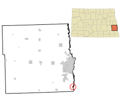
Location of Oxbow, North Dakota
|
|
| Country | United States |
| State | North Dakota |
| County | Cass |
| Founded | October 25, 1988 |
| Area | |
| • Total | 1.53 sq mi (3.97 km2) |
| • Land | 1.53 sq mi (3.97 km2) |
| • Water | 0.00 sq mi (0.00 km2) |
| Elevation | 915 ft (279 m) |
| Population
(2020)
|
|
| • Total | 381 |
| • Estimate
(2023)
|
371 |
| • Density | 248.69/sq mi (96.00/km2) |
| Time zone | UTC-6 (Central (CST)) |
| • Summer (DST) | UTC-5 (CDT) |
| ZIP code |
58047
|
| Area code(s) | 701 |
| FIPS code | 38-60480 |
| GNIS feature ID | 1033709 |
Oxbow is a small city in Cass County, North Dakota, United States. It is a quiet place where many people live and then travel to work in bigger nearby cities. This type of community is called a bedroom community.
Oxbow is located about 15 miles (24 km) south of Fargo. The city was officially started on October 25, 1988.
Contents
Where is Oxbow Located?
Oxbow is in the state of North Dakota, within Cass County. The city covers a total area of about 0.42 square miles (1.09 square kilometers). All of this area is land.
How Many People Live in Oxbow?
The number of people living in Oxbow has grown over the years. In 1990, there were 100 people. By the 2020 census, the population had grown to 381 people.
| Historical population | |||
|---|---|---|---|
| Census | Pop. | %± | |
| 1990 | 100 | — | |
| 2000 | 248 | 148.0% | |
| 2010 | 305 | 23.0% | |
| 2020 | 381 | 24.9% | |
| 2022 (est.) | 373 | 22.3% | |
| U.S. Decennial Census 2020 Census |
|||
Who Lives in Oxbow?
In 2010, there were 305 people living in Oxbow. Most of the people living there were White. A small number of people were of Hispanic or Latino background.
Many households in Oxbow had children under 18 living with them. Most families were married couples living together. The average age of people in the city was about 39 years old.
Famous People from Oxbow
- Amy Anderson is a professional golfer who comes from Oxbow.
See also
 In Spanish: Oxbow (Dakota del Norte) para niños
 | Dorothy Vaughan |
 | Charles Henry Turner |
 | Hildrus Poindexter |
 | Henry Cecil McBay |

