Paddy's Lake (Hastings County) facts for kids
Quick facts for kids Paddy's Lake Lake |
|
|---|---|
| Location | Limerick, Hastings County, Ontario |
| Coordinates | 44°48′34″N 77°42′05″W / 44.80944°N 77.70139°W |
| Primary inflows | Mud Creek, unnamed creek |
| Primary outflows | Mud Creek |
| Basin countries | Canada |
| Max. length | 740 m (2,428 ft) |
| Max. width | 520 m (1,706 ft) |
| Surface elevation | 318 m (1,043 ft) |
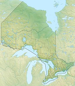
Paddy's Lake is a beautiful lake located in Ontario, Canada. It's found in the township of Limerick, within Hastings County. This lake is part of a larger water system, including the Trent River and Lake Ontario.
Paddy's Lake is about 1.4 kilometres (0.9 mi) southeast of a small place called Murphy Corners. It's also 5.2 kilometres (3.2 mi) west of Ontario Highway 62 and about 30 kilometres (19 mi) south of the town of Bancroft.
About the Lake's Water
This section explains how water flows into and out of Paddy's Lake. This is called its hydrology.
The lake is about 740 metres (2,428 ft) long and 520 metres (1,706 ft) wide. It sits at an elevation of 318 metres (1,043 ft) above sea level.
Water Flow In and Out
The main stream that flows into Paddy's Lake is called Mud Creek. It enters the lake from the southwest side. There's also another small, unnamed stream that flows in from the south.
The water then flows out of Paddy's Lake from the east side. Guess what? It's Mud Creek again! This means Mud Creek flows both into and out of Paddy's Lake.
Where the Water Goes
After leaving Paddy's Lake, Mud Creek continues its journey. It flows into Steenburg Lake. From there, the water travels through several other creeks and rivers. These include Bass Creek and Beaver Creek.
Eventually, the water joins the Crowe River and then the Trent River. The Trent River finally empties into the Bay of Quinte on Lake Ontario at a town called Trenton. So, the water from Paddy's Lake travels a long way to reach one of the Great Lakes!


