Paint Rock River facts for kids
Quick facts for kids Paint Rock River |
|
|---|---|

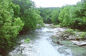
The Paint Rock River near Woodville, Alabama
|
|
| Country | United States |
| State | Alabama |
| Physical characteristics | |
| Main source | 34°53′53″N 86°10′14″W / 34.89814°N 86.17053°W |
| River mouth | 34°28′34″N 86°28′04″W / 34.47620°N 86.46776°W |
| Length | 58.7 mi (94.5 km) |
The Paint Rock River is a river in northern Alabama, United States. It is about 58.7 miles (94.5 kilometers) long. This river is a tributary of the Tennessee River. A tributary is a smaller river or stream that flows into a larger one.
About the Paint Rock River
The Paint Rock River is an important waterway in Alabama. It helps drain water from a large area. This area includes parts of northern Alabama and even some of south-central Tennessee.
Where the River Begins
The Paint Rock River starts in the northeastern part of Jackson County. It is formed when two smaller streams, Estill Fork and Hurricane Creek, join together. This joining point is called a confluence.
The River's Journey
After it starts, the river generally flows south. It passes by the town of Paint Rock. In its early sections, the river travels through a deep valley. This valley is carved into the Cumberland Plateau. The Cumberland Plateau is a large, flat-topped mountain area.
River Boundaries
As the river continues its journey, it helps mark a boundary. In its lower sections, the Paint Rock River forms part of the border. This border is between Madison County and Marshall County.
 | George Robert Carruthers |
 | Patricia Bath |
 | Jan Ernst Matzeliger |
 | Alexander Miles |

