
Palmyra, Virginia facts for kids
Quick facts for kids
Palmyra, Virginia
|
|
|---|---|

Fluvanna County administrative and legal buildings in Palmyra
|
|
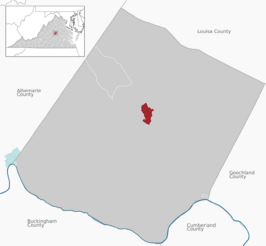 Location of Palmyra CDP within Fluvanna County
|
|

Palmyra, Virginia
Location in Virginia
|
|
| Country | United States |
| State | Virginia |
| County | Fluvanna |
| Area | |
| • Total | 1.42 sq mi (3.69 km2) |
| • Land | 1.42 sq mi (3.67 km2) |
| • Water | 0.01 sq mi (0.03 km2) |
| Elevation | 299 ft (91 m) |
| Population
(2010)
|
|
| • Total | 104 |
| • Density | 74/sq mi (28.4/km2) |
| Time zone | UTC−5 (Eastern (EST)) |
| • Summer (DST) | UTC−4 (EDT) |
| ZIP code |
22963
|
| FIPS code | 51-60392 |
| GNIS feature ID | 1498526 |
Palmyra is a small community in Virginia, United States. It's known as the county seat of Fluvanna County. This means it's where the main government offices for the county are located.
In 2010, about 104 people lived here. Palmyra is located on the eastern side of the Rivanna River. You can find it along U.S. Route 15. The ZIP code for Palmyra and the areas around it is 22963.
Several historic places in Palmyra are listed on the National Register of Historic Places. These include the Fluvanna County Courthouse Historic District, Glen Burnie, Pleasant Grove, and Seay's Chapel Methodist Church.
History of Palmyra

Before it was called Palmyra, this area belonged to the Timberlake family. In 1814, Reverend Walker Timberlake started a business here called "Palmyra Mills."
The village of Palmyra officially began in 1828. It became the main town, or county seat, for Fluvanna County. The historic courthouse was built soon after, between 1830 and 1831.
By 1835, Palmyra was growing. It had fourteen homes, a church, and three factories. There were also many other businesses. In the mid-1800s, Palmyra was an important stop. It was on the stagecoach route between Richmond and Staunton.
Later, a train line called the Virginia Air Line Railway ran through Palmyra. This railway operated from 1908 to 1975. The train connected Palmyra to other towns like Strathmore, Cohasset, Carysbrook, Troy, and on to Gordonsville or Charlottesville.
In 1930, a big fire destroyed many buildings on Main Street. Because of the Great Depression, a smaller version of Palmyra was rebuilt after the fire.
Geography and Location
Palmyra is in the middle of Fluvanna County. It sits on a hillside that rises to the northeast. Below it flows the Rivanna River.
U.S. Route 15 goes right through the community. This road crosses the Rivanna River at the south end of town. If you go north on US 15, you'll reach Gordonsville in about 20 miles. Going south for about 51 miles will take you to Farmville.
Virginia State Route 53 meets US 15 just south of the Rivanna River. This route leads northwest about 20 miles to Charlottesville.
The Palmyra community covers about 3.7 square kilometers (1.4 square miles). A very small part of this area, about 0.03 square kilometers (0.01 square miles), is water.
Climate
Palmyra has a climate with clear changes in seasons. It also gets rain or snow fairly evenly throughout the year. This type of weather is called a "Humid Subtropical Climate". This means it has hot, humid summers and mild winters.
| Climate data for Palmyra, Virginia | |||||||||||||
|---|---|---|---|---|---|---|---|---|---|---|---|---|---|
| Month | Jan | Feb | Mar | Apr | May | Jun | Jul | Aug | Sep | Oct | Nov | Dec | Year |
| Mean daily maximum °F (°C) | 47 (8) |
49 (9) |
58 (14) |
69 (21) |
75 (24) |
83 (28) |
86 (30) |
86 (30) |
79 (26) |
69 (21) |
59 (15) |
49 (9) |
67 (19) |
| Mean daily minimum °F (°C) | 25 (−4) |
26 (−3) |
32 (0) |
41 (5) |
50 (10) |
60 (16) |
64 (18) |
63 (17) |
56 (13) |
43 (6) |
34 (1) |
27 (−3) |
43 (6) |
| Average precipitation inches (mm) | 2.9 (74) |
2.8 (71) |
3.6 (91) |
2.9 (74) |
3.7 (94) |
3.5 (89) |
4.1 (100) |
4 (100) |
3.4 (86) |
3.7 (94) |
3.1 (79) |
3 (76) |
40.7 (1,030) |
| Source: Weatherbase | |||||||||||||
Famous People from Palmyra
- Chris Adler: A musician from the band Lamb of God.
- Willie Adler: Also a musician from the band Lamb of God.
- Chris Daughtry: A musician famous from American Idol and his band Daughtry. He graduated from Fluvanna County High School in 1998. His parents still live nearby.
- Texas Jack Omohundro (1846-1880): A famous frontier scout, actor, and cowboy. He was born on the Pleasure Hill farm in Palmyra.
See also
 In Spanish: Palmyra (Virginia) para niños
