Pambamarca Fortress Complex facts for kids

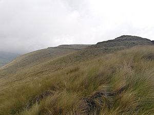
Quitoloma forstress.
|
|
| Location | Ecuador |
|---|---|
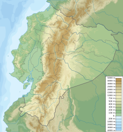
| Coordinates | 00°03′56″N 78°13′14″W / 0.06556°N 78.22056°W |
| Type | Fort and Settlement |
| History | |
| Founded | c. 1490s CE |
| Site notes | |
| Condition | In ruins |
The Pambamarca Fortress Complex is a group of old pukaras (hilltop forts) and other buildings made by the Inca Empire. These forts were built in the late 1400s. The Incas built them to help conquer the people of the Cayambe area. This area is in the Andes mountains of what is now northern Ecuador. The Pambamarca forts are near the town of Cayambe Canton in Pichincha Province. They are about 32 kilometres (20 mi) northeast of Quito.
In 1998, Pambamarca was suggested to be a UNESCO World Heritage Site.
Contents
Who Fought at Pambamarca?
The People of Caranqui Country
In the 1400s, people in the Andes mountains of northern Ecuador lived in several chiefdoms. These groups were similar in language and culture. But they often fought with each other. The main chiefdoms were the Caranqui, Cayambe, Otavalo, and Cochasquí.
The name "Pais Caranqui" (Caranqui country) is often used for all these chiefdoms. The Cayambe people were the main group defending against the Incas at Pambamarca. Experts think that between 100,000 and 150,000 people lived in these chiefdoms before the Incas arrived.
The Inca Empire
Around the 1460s, the future Inca emperor Topa Inca Yupanqui (who ruled from about 1471 to 1493) may have started the Inca conquest of Ecuador. He faced strong resistance. But he managed to reach Quito during his rule.
His son, Huayna Capac (who ruled from 1493 to 1525), spent almost his entire reign finishing the conquest of northern Ecuador. The first big challenge for the Incas was the Cayambe defense at Pambamarca.
The battles at Pambamarca likely lasted several years. The Incas finally won, possibly around 1505. After this, the Incas continued their conquest of northern Ecuador. They won their final victory over the Caranqui at Yawarkucha (Blood Lake). This last battle might have happened as late as 1520.
In the 1530s, the Incas themselves were conquered by the Spanish. The fierce fighting in this region is clear. Out of 184 known Inca pukaras, 106 are in northern Ecuador. This is a small area compared to the entire Inca Empire, which stretched 4,000 kilometres (2,500 mi) from north to south.
Exploring the Pambamarca Forts
The Pambamarca Fortress Complex has 14 Inca pukaras and other related buildings. They are spread out over an 8 kilometres (5.0 mi) arc on the northern slopes of the Pambamarca Volcano. These forts are located at high elevations, from 3,300 metres (10,800 ft) to 3,780 metres (12,400 ft).
About 4 kilometres (2.5 mi) northeast of the Inca forts are the Cayambe's own defenses. These include two pukaras that protected the Pisque River valley. They also guarded the Cayambe capital, which is still called Cayambe. Between these two sets of forts, there is one pukara whose origin is not fully known.
Quitoloma Fortress: A Key Site
The most famous and one of the largest forts is Quitoloma. Its name means "hill of Quito." It is the southernmost of the Pambamarca forts. It sits at an elevation of 3,780 metres (12,400 ft) on top of a small hill.
Quitoloma is about 700 metres (2,300 ft) long and 400 metres (1,300 ft) wide. The highest part of the site has an ushnu. This was a terraced platform used for important religious ceremonies. Around the ushnu are the remains of more than 100 buildings. These buildings were used as homes, storage places (qollqas), and administrative offices.
The living area was surrounded by three strong walls. Each wall was about 3 metres (9.8 ft) high. There were gates in the walls, protected by towers, ditches, and other defenses. Quitoloma was likely an important center for the Incas. It helped them fight the war against the Pais Caranqui. It also protected the city of Quito and the sacred site of El Quinche.
Archaeologists have found weapons and many stones inside the walls. These stones were used with slings and bolas, which were the Incas' main long-range weapons. An Inca road ran from Quito, passed by Quitoloma, and continued east towards the lowlands of the Amazon basin.
See also
 In Spanish: Fortalezas de Pambamarca para niños
 | John T. Biggers |
 | Thomas Blackshear |
 | Mark Bradford |
 | Beverly Buchanan |


